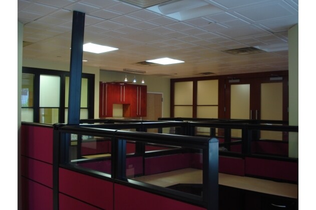
Property Record
16218 71St Ave, Fresh Meadows, NY 11365


NEARBY LISTINGS FOR SALE OR LEASE
-
-
-
-
-
No Photo
-
-
-
-
-
-
-
-
-
-
-
-
-
-
-
-
-
-
-
-
-
-
-
-
-
-
View all Fresh Meadows listings for sale on LoopNet.com
Property Detail
16218 71St Ave
06801-0047
Pomonok Crest
Apartment
Queens
X
New York
3604970231F
47
2024
0.10 AC
2025
Pomonok
122704
Long Island (New York)
13,900 SF
New York-Jersey City-White Plains, NY-NJ
DEMOGRAPHICS near 16218 71St Ave
1 mile
3 mile
5 mile
2024 Total Population
75,842
742,571
1,673,234
2029 Population
71,698
700,368
1,557,099
Pop Growth 2024-2029
(5.46%)
(5.68%)
(6.94%)
Average Age
40
42
42
2024 Total Households
25,556
262,034
561,861
HH Growth 2024-2029
(5.62%)
(5.78%)
(7.09%)
Median Household Inc
$70,913
$69,595
$72,780
Avg Household Size
2.70
2.70
2.80
2024 Avg HH Vehicles
1.00
1.00
1.00
Median Home Value
$713,342
$667,136
$671,552
Median Year Built
1955
1954
1952
Nearby Places
Map Layers
Map Styles
 Street
 Aerial
Transit
 Traffic
 Biking
Places
Listings with unknown addresses are not visible on the map
- Restaurants
- Banks
- Shops
- Fitness
- Groceries
PUBLIC TRANSPORTATION
COMMUTER RAIL
Jamaica Station (Babylon Branch - Long Island Rail Road, Far Rockaway Branch - Long Island Rail Road, Hempstead Branch - Long Island Rail Road, Long Beach Branch - Long Island Rail Road, Montauk Branch - Long Island Rail Road, Oyster Bay Branch - Long Island Rail Road, Port Jefferson Branch - Long Island Rail Road, Ronkonkoma Branch - Long Island Rail Road, West Hempstead Branch - Long Island Rail Road)
Drive
Walk
Distance
Jamaica Station (Babylon Branch - Long Island Rail Road, Far Rockaway Branch - Long Island Rail Road, Hempstead Branch - Long Island Rail Road, Long Beach Branch - Long Island Rail Road, Montauk Branch - Long Island Rail Road, Oyster Bay Branch - Long Island Rail Road, Port Jefferson Branch - Long Island Rail Road, Ronkonkoma Branch - Long Island Rail Road, West Hempstead Branch - Long Island Rail Road)
8 min
2.5 mi
Kew Gardens Station (Babylon Branch - Long Island Rail Road, Hempstead Branch - Long Island Rail Road, Long Beach Branch - Long Island Rail Road, Port Jefferson Branch - Long Island Rail Road)
Drive
Walk
Distance
Kew Gardens Station (Babylon Branch - Long Island Rail Road, Hempstead Branch - Long Island Rail Road, Long Beach Branch - Long Island Rail Road, Port Jefferson Branch - Long Island Rail Road)
8 min
2.8 mi
AIRPORT
LaGuardia
Drive
Walk
Distance
LaGuardia
13 min
5.9 mi
John F Kennedy International
Drive
Walk
Distance
John F Kennedy International
15 min
8.1 mi
Newark Liberty International
Drive
Walk
Distance
Newark Liberty International
41 min
25.3 mi
Freight Ports
NY - Red Hook Container Terminal
Drive
Walk
Distance
NY - Red Hook Container Terminal
25 min
14.0 mi
Nearby Properties
Address
Land Use
TOTAL SIZE
Lot Size
Zoning
Address
Land Use
TOTAL SIZE
Lot Size
Zoning
4,528,000 SF
94.27 AC
R4
Address
Land Use
TOTAL SIZE
Lot Size
Zoning
2,078,606 SF
58.93 AC
R4
Address
Land Use
TOTAL SIZE
Lot Size
Zoning
1,258,350 SF
410.24 AC
PARK
Address
Land Use
TOTAL SIZE
Lot Size
Zoning
1,069,367 SF
14.65 AC
R4
Address
Land Use
TOTAL SIZE
Lot Size
Zoning
1,292,074 SF
C4-2F
Address
Land Use
TOTAL SIZE
Lot Size
Zoning
1,516,458 SF
5.97 AC
R7-1
Address
Land Use
TOTAL SIZE
Lot Size
Zoning
8.28 AC
R7-1
Address
Land Use
TOTAL SIZE
Lot Size
Zoning
8.28 AC
R7-1
Address
Land Use
TOTAL SIZE
Lot Size
Zoning
8.28 AC
R7-1
Address
Land Use
TOTAL SIZE
Lot Size
Zoning
532,011 SF
2.48 AC
R6
Address
Land Use
TOTAL SIZE
Lot Size
Zoning
15,000 SF
255.27 AC
PARK
Address
Land Use
TOTAL SIZE
Lot Size
Zoning
13,500 SF
104 AC
PARK
Address
Land Use
TOTAL SIZE
Lot Size
Zoning
554,300 SF
20.72 AC
R3-2
Address
Land Use
TOTAL SIZE
Lot Size
Zoning
554,300 SF
20.72 AC
R3-2
Address
Land Use
TOTAL SIZE
Lot Size
Zoning
947 SF
101.82 AC
PARK
Address
Land Use
TOTAL SIZE
Lot Size
Zoning
126.85 AC
PARK
Address
Land Use
TOTAL SIZE
Lot Size
Zoning
4,800 SF
80.10 AC
PARK
Address
Land Use
TOTAL SIZE
Lot Size
Zoning
749,142 SF
16.48 AC
R6
Address
Land Use
TOTAL SIZE
Lot Size
Zoning
749,142 SF
16.48 AC
R6
Address
Land Use
TOTAL SIZE
Lot Size
Zoning
749,142 SF
16.48 AC
R6
Address
Land Use
TOTAL SIZE
Lot Size
Zoning
749,142 SF
16.48 AC
R6
Address
Land Use
TOTAL SIZE
Lot Size
Zoning
749,142 SF
16.48 AC
R6
Address
Land Use
TOTAL SIZE
Lot Size
Zoning
749,142 SF
16.48 AC
R6
Address
Land Use
TOTAL SIZE
Lot Size
Zoning
749,142 SF
16.48 AC
R6
Address
Land Use
TOTAL SIZE
Lot Size
Zoning
1,186,778 SF
31.45 AC
R4
Address
Land Use
TOTAL SIZE
Lot Size
Zoning
575,600 SF
2.35 AC
C4-5X
Address
Land Use
TOTAL SIZE
Lot Size
Zoning
575,600 SF
2.35 AC
C4-5X
Address
Land Use
TOTAL SIZE
Lot Size
Zoning
575,600 SF
2.35 AC
C4-5X
Address
Land Use
TOTAL SIZE
Lot Size
Zoning
575,600 SF
2.35 AC
C4-5X
Address
Land Use
TOTAL SIZE
Lot Size
Zoning
575,600 SF
2.35 AC
C4-5X
The World's #1 Commercial Real Estate Marketplace
Connect with us
© 2026 CoStar Group
The information above has been obtained from sources believed reliable. While we do not doubt its accuracy we have not verified it and make no guarantee, warranty or representation about it. It is your responsibility to independently confirm its accuracy and completeness. Any projections, opinions, assumptions, or estimates used are for example only and do not represent the current or future performance of the property. The value of this transaction to you depends on tax and other factors which should be evaluated by your tax, financial, and legal advisors. You and your advisors should conduct a careful, independent investigation of the property to determine to your satisfaction the suitability of the property for your needs.