Property Record
16219 Leal Rd, San Antonio, TX 78221
NEARBY LISTINGS FOR SALE OR LEASE
Property Detail
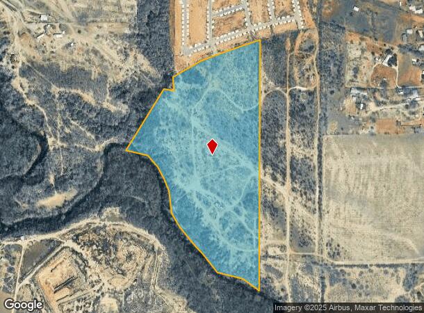
16219 Leal Rd
San Antonio-New Braunfels, TX
Conv A/S Code
04006-005-0660
CB 4006 P-66 ABS 3 (INCLUDES LOTS FROM PLAT 980/260) 2022-REMAINS PER SPLIT PER DEED 20210257873 (90.132 ACRES CONVEYED) OUT OF PID 156403/156402. EXE 9-14-2021. VERIFY IMPTS. SEE SURVEY MAP ATTACHED
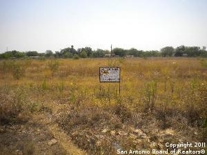
Privatepreserveopenspacevacantlandforestlandconservation
Bexar
A
Texas
48029C0590G
66
2024
45.46 AC
2025
South
151700
San Antonio
DEMOGRAPHICS near 16219 Leal Rd
1 Mile
3 Mile
5 Mile
2024 Total Population
906
6,879
24,999
2029 Population
970
7,466
27,458
Pop Growth 2024-2029
+ 7.06%
+ 8.53%
+ 9.84%
Average Age
34
35
34
2024 Total Households
291
2,154
7,742
HH Growth 2024-2029
+ 7.22%
+ 8.68%
+ 9.97%
Median Household Inc
$47,019
$55,631
$63,818
Avg Household Size
3.10
3.10
3.20
2024 Avg HH Vehicles
2.00
2.00
2.00
Median Home Value
$97,944
$168,241
$185,464
Median Year Built
1998
2002
2006
Nearby Places
Map Layers
Map Styles
 Street
 Aerial
- Restaurants
- Banks
- Shops
- Fitness
- Groceries
PUBLIC TRANSPORTATION
AIRPORT
San Antonio International
DRIVE
WALK
Distance
San Antonio International
35 min
20.8 mi
Freight Ports
Port of Corpus Christi
DRIVE
WALK
Distance
Port of Corpus Christi
139 min
131.5 mi
Nearby Properties
Address
Land Use
TOTAL SIZE
Lot Size
Zoning
Address
Land Use
TOTAL SIZE
Lot Size
Zoning
913,999 SF
417.09 AC
Address
Land Use
TOTAL SIZE
Lot Size
Zoning
1,456 SF
90.13 AC
Address
Land Use
TOTAL SIZE
Lot Size
Zoning
2,053 SF
31.86 AC
Address
Land Use
TOTAL SIZE
Lot Size
Zoning
1,056 SF
304.42 AC
Address
Land Use
TOTAL SIZE
Lot Size
Zoning
1,106 SF
101.32 AC
Address
Land Use
TOTAL SIZE
Lot Size
Zoning
136.35 AC
Address
Land Use
TOTAL SIZE
Lot Size
Zoning
80.42 AC
Address
Land Use
TOTAL SIZE
Lot Size
Zoning
1,216 SF
500 AC
Address
Land Use
TOTAL SIZE
Lot Size
Zoning
153.39 AC
Address
Land Use
TOTAL SIZE
Lot Size
Zoning
185.13 AC
Address
Land Use
TOTAL SIZE
Lot Size
Zoning
181.82 AC
Address
Land Use
TOTAL SIZE
Lot Size
Zoning
29,400 SF
1.38 AC
Address
Land Use
TOTAL SIZE
Lot Size
Zoning
25,872 SF
9.11 AC
Address
Land Use
TOTAL SIZE
Lot Size
Zoning
3,401 SF
4.41 AC
Address
Land Use
TOTAL SIZE
Lot Size
Zoning
784 SF
20.19 AC
Address
Land Use
TOTAL SIZE
Lot Size
Zoning
2,770 SF
27.53 AC
Address
Land Use
TOTAL SIZE
Lot Size
Zoning
5,742 SF
2.52 AC
Address
Land Use
TOTAL SIZE
Lot Size
Zoning
1,200 SF
120.55 AC
Address
Land Use
TOTAL SIZE
Lot Size
Zoning
8,296 SF
10 AC
Address
Land Use
TOTAL SIZE
Lot Size
Zoning
55.04 AC
Address
Land Use
TOTAL SIZE
Lot Size
Zoning
Address
Land Use
TOTAL SIZE
Lot Size
Zoning
23,132 SF
7.14 AC
Address
Land Use
TOTAL SIZE
Lot Size
Zoning
322,050 SF
7.87 AC
Address
Land Use
TOTAL SIZE
Lot Size
Zoning
9,020 SF
1.73 AC
Address
Land Use
TOTAL SIZE
Lot Size
Zoning
26,038 SF
4.83 AC
Address
Land Use
TOTAL SIZE
Lot Size
Zoning
54.72 AC
Address
Land Use
TOTAL SIZE
Lot Size
Zoning
86.41 AC
Address
Land Use
TOTAL SIZE
Lot Size
Zoning
14,597 SF
5.99 AC
Address
Land Use
TOTAL SIZE
Lot Size
Zoning
91.54 AC
The World's #1 Commercial Real Estate Marketplace
Connect with us
© 2026 CoStar Group
The information above has been obtained from sources believed reliable. While we do not doubt its accuracy we have not verified it and make no guarantee, warranty or representation about it. It is your responsibility to independently confirm its accuracy and completeness. Any projections, opinions, assumptions, or estimates used are for example only and do not represent the current or future performance of the property. The value of this transaction to you depends on tax and other factors which should be evaluated by your tax, financial, and legal advisors. You and your advisors should conduct a careful, independent investigation of the property to determine to your satisfaction the suitability of the property for your needs.