Property Record
16228 Flight Path Dr, Brooksville, FL 34604
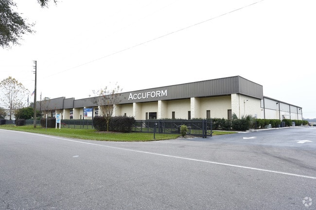

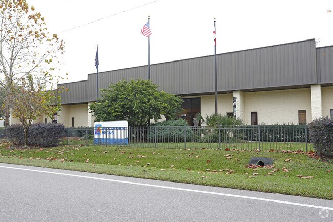
Property Detail
16228 Flight Path Dr
Tampa-St. Petersburg-Clearwater, FL
HERNANDO COUNTY AIRPORT INDUSTRIAL PARK UNIT 1 LOTS 25 & 26 ALONG WITH A 65X389 FT MOL STRIP DESC IN ORB 1564 PG 1433
R13-223-18-2393-0000-0250
Hernando
Structuresonleasedland
Florida
AE The base floodplain where base flood elevations are provided. AE Zones are now used on new format FIRMs instead of A1-A30 Zones.
25,26
0
4.77 AC
2025
Hernando County
040911
Tampa/St Petersburg
65,270 SF
NEARBY LISTINGS FOR SALE OR LEASE
DEMOGRAPHICS near 16228 Flight Path Dr
1 mile
3 mile
5 mile
2025 Total Population
1,019
27,478
74,199
2030 Population
1,112
30,238
81,908
Pop Growth 2025-2030
+ 9.13%
+ 10.04%
+ 10.39%
Average Age
44
43
43
2025 Total Households
313
10,118
28,221
HH Growth 2025-2030
+ 10.54%
+ 10.25%
+ 10.48%
Median Household Inc
$117,968
$80,724
$77,517
Avg Household Size
2.50
2.60
2.50
2025 Avg HH Vehicles
2.00
2.00
2.00
Median Home Value
$349,609
$345,584
$328,003
Median Year Built
2004
2002
1999
Nearby Places
Map Layers
Map Styles
 Street
 Aerial
Transit
 Traffic
 Biking
Places
Listings with unknown addresses are not visible on the map
- Restaurants
- Banks
- Shops
- Fitness
- Groceries
PUBLIC TRANSPORTATION
AIRPORT
Tampa International
Drive
Walk
Distance
Tampa International
56 min
43.5 mi
Freight Ports
Port of Tampa Bay
Drive
Walk
Distance
Port of Tampa Bay
69 min
43.8 mi
SALE & LEASE HISTORY
LISTING DATE
SALE/LEASE

Nov 27, 2017
For Sale
Nearby Properties
Address
Land Use
TOTAL SIZE
Lot Size
Zoning
Address
Land Use
TOTAL SIZE
Lot Size
Zoning
439,730 SF
29.90 AC
Address
Land Use
TOTAL SIZE
Lot Size
Zoning
490,353 SF
99.20 AC
Address
Land Use
TOTAL SIZE
Lot Size
Zoning
258,640 SF
18.03 AC
Address
Land Use
TOTAL SIZE
Lot Size
Zoning
410,643 SF
22.80 AC
Address
Land Use
TOTAL SIZE
Lot Size
Zoning
261,484 SF
39.80 AC
Address
Land Use
TOTAL SIZE
Lot Size
Zoning
180,156 SF
10.10 AC
Address
Land Use
TOTAL SIZE
Lot Size
Zoning
238,304 SF
342.80 AC
Address
Land Use
TOTAL SIZE
Lot Size
Zoning
324,411 SF
Address
Land Use
TOTAL SIZE
Lot Size
Zoning
182,471 SF
Address
Land Use
TOTAL SIZE
Lot Size
Zoning
178,400 SF
13.80 AC
Address
Land Use
TOTAL SIZE
Lot Size
Zoning
180,788 SF
37.40 AC
Address
Land Use
TOTAL SIZE
Lot Size
Zoning
208,434 SF
60.98 AC
Address
Land Use
TOTAL SIZE
Lot Size
Zoning
167,867 SF
25.40 AC
Address
Land Use
TOTAL SIZE
Lot Size
Zoning
3,446 SF
636.90 AC
Address
Land Use
TOTAL SIZE
Lot Size
Zoning
129,070 SF
5.80 AC
Address
Land Use
TOTAL SIZE
Lot Size
Zoning
116,287 SF
4.90 AC
Address
Land Use
TOTAL SIZE
Lot Size
Zoning
142,511 SF
12.50 AC
Address
Land Use
TOTAL SIZE
Lot Size
Zoning
90,952 SF
43.56 AC
Address
Land Use
TOTAL SIZE
Lot Size
Zoning
165 AC
Address
Land Use
TOTAL SIZE
Lot Size
Zoning
89,971 SF
Address
Land Use
TOTAL SIZE
Lot Size
Zoning
68,724 SF
Address
Land Use
TOTAL SIZE
Lot Size
Zoning
73,832 SF
27.88 AC
Address
Land Use
TOTAL SIZE
Lot Size
Zoning
143,865 SF
20 AC
Address
Land Use
TOTAL SIZE
Lot Size
Zoning
48,326 SF
15.80 AC
Address
Land Use
TOTAL SIZE
Lot Size
Zoning
118,089 SF
40 AC
Address
Land Use
TOTAL SIZE
Lot Size
Zoning
69,927 SF
69.26 AC
Address
Land Use
TOTAL SIZE
Lot Size
Zoning
160 AC
Address
Land Use
TOTAL SIZE
Lot Size
Zoning
59,518 SF
7.10 AC
Address
Land Use
TOTAL SIZE
Lot Size
Zoning
98,801 SF
Address
Land Use
TOTAL SIZE
Lot Size
Zoning
60,116 SF
3.99 AC
The World's #1 Commercial Real Estate Marketplace
Connect with us
© 2026 CoStar Group
The information above has been obtained from sources believed reliable. While we do not doubt its accuracy we have not verified it and make no guarantee, warranty or representation about it. It is your responsibility to independently confirm its accuracy and completeness. Any projections, opinions, assumptions, or estimates used are for example only and do not represent the current or future performance of the property. The value of this transaction to you depends on tax and other factors which should be evaluated by your tax, financial, and legal advisors. You and your advisors should conduct a careful, independent investigation of the property to determine to your satisfaction the suitability of the property for your needs.