Property Record
16229 N Oracle Rd, Tucson, AZ 85739


NEARBY LISTINGS FOR SALE OR LEASE
-
-
View all Tucson listings for sale on LoopNet.com
Property Detail
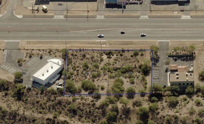
16229 N Oracle Rd
Tucson, AZ
Vista Las Catalinas No 1
222-18-0260
VISTA LAS CATALINAS NO 1 /LOT 9 BLK A/
Residentialacreage
Pima
X
Arizona
04019C0495L
9
2023
0.47 AC
2025
North Tucson/Oro Valley
004727
Tucson
DEMOGRAPHICS near 16229 N Oracle Rd
1 Mile
3 Mile
5 Mile
2024 Total Population
2,651
16,296
31,652
2029 Population
2,840
18,165
35,603
Pop Growth 2024-2029
+ 7.13%
+ 11.47%
+ 12.48%
Average Age
46
56
58
2024 Total Households
1,074
7,545
14,784
HH Growth 2024-2029
+ 7.26%
+ 11.76%
+ 13.12%
Median Household Inc
$53,524
$74,730
$89,027
Avg Household Size
2.40
2.10
2.10
2024 Avg HH Vehicles
2.00
2.00
2.00
Median Home Value
$251,843
$356,576
$391,383
Median Year Built
1993
1997
1998
Nearby Places
Map Layers
Map Styles
 Street
 Aerial
- Restaurants
- Banks
- Shops
- Fitness
- Groceries
PUBLIC TRANSPORTATION
AIRPORT
Tucson International
DRIVE
WALK
Distance
Tucson International
50 min
29.2 mi
SALE & LEASE HISTORY
LISTING DATE
SALE/LEASE

Sep 14, 2017
For Sale
Nearby Properties
Address
Land Use
TOTAL SIZE
Lot Size
Zoning
Address
Land Use
TOTAL SIZE
Lot Size
Zoning
130,127 SF
175.94 AC
SP
Address
Land Use
TOTAL SIZE
Lot Size
Zoning
22,734 SF
4.16 AC
CB1
Address
Land Use
TOTAL SIZE
Lot Size
Zoning
175,084 SF
45.61 AC
GR1
Address
Land Use
TOTAL SIZE
Lot Size
Zoning
66,253 SF
7.07 AC
CB1
Address
Land Use
TOTAL SIZE
Lot Size
Zoning
38,076 SF
8.86 AC
GR1
Address
Land Use
TOTAL SIZE
Lot Size
Zoning
21,734 SF
4.68 AC
Address
Land Use
TOTAL SIZE
Lot Size
Zoning
Address
Land Use
TOTAL SIZE
Lot Size
Zoning
576 SF
3.99 AC
GR1
Address
Land Use
TOTAL SIZE
Lot Size
Zoning
4,560 SF
3 AC
GR1
Address
Land Use
TOTAL SIZE
Lot Size
Zoning
1,750 SF
1.14 AC
GR1
Address
Land Use
TOTAL SIZE
Lot Size
Zoning
14,506 SF
3.95 AC
PAD
Address
Land Use
TOTAL SIZE
Lot Size
Zoning
24,033 SF
5.06 AC
GR1
Address
Land Use
TOTAL SIZE
Lot Size
Zoning
27,221 SF
3.84 AC
PAD
Address
Land Use
TOTAL SIZE
Lot Size
Zoning
18,964 SF
10.18 AC
RH
Address
Land Use
TOTAL SIZE
Lot Size
Zoning
16.46 AC
CB1
Address
Land Use
TOTAL SIZE
Lot Size
Zoning
4,994 SF
0.36 AC
CB2
Address
Land Use
TOTAL SIZE
Lot Size
Zoning
2,664 SF
1.10 AC
CB2
Address
Land Use
TOTAL SIZE
Lot Size
Zoning
576 SF
5 AC
RH
Address
Land Use
TOTAL SIZE
Lot Size
Zoning
320 AC
RH
Address
Land Use
TOTAL SIZE
Lot Size
Zoning
19,598 SF
3.25 AC
CB2
Address
Land Use
TOTAL SIZE
Lot Size
Zoning
52,500 SF
3.25 AC
CB2
Address
Land Use
TOTAL SIZE
Lot Size
Zoning
1,152 SF
2.32 AC
GR1
Address
Land Use
TOTAL SIZE
Lot Size
Zoning
2,542 SF
9.09 AC
Address
Land Use
TOTAL SIZE
Lot Size
Zoning
9,100 SF
1.09 AC
Address
Land Use
TOTAL SIZE
Lot Size
Zoning
20,304 SF
1.76 AC
CB2
Address
Land Use
TOTAL SIZE
Lot Size
Zoning
10.30 AC
CB1
Address
Land Use
TOTAL SIZE
Lot Size
Zoning
22,260 SF
1.70 AC
PAD
Address
Land Use
TOTAL SIZE
Lot Size
Zoning
105 SF
3.32 AC
GR1
Address
Land Use
TOTAL SIZE
Lot Size
Zoning
3,137 SF
1.12 AC
CB1
Address
Land Use
TOTAL SIZE
Lot Size
Zoning
17,002 SF
1.73 AC
CB1
The World's #1 Commercial Real Estate Marketplace
Connect with us
© 2025 CoStar Group
The information above has been obtained from sources believed reliable. While we do not doubt its accuracy we have not verified it and make no guarantee, warranty or representation about it. It is your responsibility to independently confirm its accuracy and completeness. Any projections, opinions, assumptions, or estimates used are for example only and do not represent the current or future performance of the property. The value of this transaction to you depends on tax and other factors which should be evaluated by your tax, financial, and legal advisors. You and your advisors should conduct a careful, independent investigation of the property to determine to your satisfaction the suitability of the property for your needs.