Property Record
16237 Avenue 296, Visalia, CA 93292


NEARBY LISTINGS FOR SALE OR LEASE
-
-
View all Visalia listings for sale on LoopNet.com
Property Detail
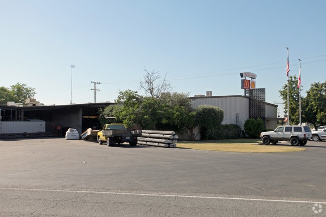
16237 Avenue 296
103-080-071-000
Broder Colony
Lightindustrial
PARCEL 2 PAR MAP 3968 PM40-72
X
Tulare
06107C0954E
California
2024
3.90 AC
2025
Farmersvle/Exeter/Lindsay
001400
Visalia/Porterville
42,347 SF
Visalia-Porterville, CA
DEMOGRAPHICS near 16237 Avenue 296
1 Mile
3 Mile
5 Mile
2024 Total Population
1,976
27,547
85,130
2029 Population
2,020
28,450
88,067
Pop Growth 2024-2029
+ 2.23%
+ 3.28%
+ 3.45%
Average Age
33
35
36
2024 Total Households
548
8,113
26,949
HH Growth 2024-2029
+ 2.37%
+ 3.24%
+ 3.41%
Median Household Inc
$79,430
$68,310
$60,968
Avg Household Size
3.60
3.40
3.10
2024 Avg HH Vehicles
2.00
2.00
2.00
Median Home Value
$292,281
$273,716
$270,454
Median Year Built
2000
1989
1984
Nearby Places
Map Layers
Map Styles
 Street
 Aerial
- Restaurants
- Banks
- Shops
- Fitness
- Groceries
PUBLIC TRANSPORTATION
AIRPORT
Fresno Yosemite International
DRIVE
WALK
Distance
Fresno Yosemite International
61 min
49.2 mi
Nearby Properties
Address
Land Use
TOTAL SIZE
Lot Size
Zoning
Address
Land Use
TOTAL SIZE
Lot Size
Zoning
12.40 AC
Address
Land Use
TOTAL SIZE
Lot Size
Zoning
7,311 SF
2.31 AC
Address
Land Use
TOTAL SIZE
Lot Size
Zoning
345,600 SF
20.65 AC
M1
Address
Land Use
TOTAL SIZE
Lot Size
Zoning
3.45 AC
RM
Address
Land Use
TOTAL SIZE
Lot Size
Zoning
5,427 SF
1.95 AC
CSO
Address
Land Use
TOTAL SIZE
Lot Size
Zoning
57,025 SF
3.22 AC
GC
Address
Land Use
TOTAL SIZE
Lot Size
Zoning
27,950 SF
7.06 AC
QP
Address
Land Use
TOTAL SIZE
Lot Size
Zoning
6,800 SF
2.08 AC
Address
Land Use
TOTAL SIZE
Lot Size
Zoning
71.25 AC
Address
Land Use
TOTAL SIZE
Lot Size
Zoning
103,140 SF
5.75 AC
R-M-3
Address
Land Use
TOTAL SIZE
Lot Size
Zoning
2,836 SF
7.28 AC
PD-C-3-SC
Address
Land Use
TOTAL SIZE
Lot Size
Zoning
31,487 SF
4.87 AC
CG
Address
Land Use
TOTAL SIZE
Lot Size
Zoning
13.66 AC
AE20
Address
Land Use
TOTAL SIZE
Lot Size
Zoning
3.22 AC
RM2
Address
Land Use
TOTAL SIZE
Lot Size
Zoning
1,250 SF
6.93 AC
AE-20
Address
Land Use
TOTAL SIZE
Lot Size
Zoning
13,780 SF
1.26 AC
RM2
Address
Land Use
TOTAL SIZE
Lot Size
Zoning
40,755 SF
3.77 AC
CSO
Address
Land Use
TOTAL SIZE
Lot Size
Zoning
2.29 AC
QP
Address
Land Use
TOTAL SIZE
Lot Size
Zoning
780 SF
1.97 AC
CSO
Address
Land Use
TOTAL SIZE
Lot Size
Zoning
8.38 AC
Address
Land Use
TOTAL SIZE
Lot Size
Zoning
3.49 AC
QP
Address
Land Use
TOTAL SIZE
Lot Size
Zoning
3,746 SF
0.70 AC
CN
Address
Land Use
TOTAL SIZE
Lot Size
Zoning
12,770 SF
1.62 AC
CS
Address
Land Use
TOTAL SIZE
Lot Size
Zoning
3,216 SF
0.44 AC
HC
Address
Land Use
TOTAL SIZE
Lot Size
Zoning
8,928 SF
6.15 AC
AE-20
Address
Land Use
TOTAL SIZE
Lot Size
Zoning
56,060 SF
3.64 AC
Address
Land Use
TOTAL SIZE
Lot Size
Zoning
17,156 SF
0.72 AC
PF
Address
Land Use
TOTAL SIZE
Lot Size
Zoning
0.75 AC
PA
The World's #1 Commercial Real Estate Marketplace
Connect with us
© 2025 CoStar Group
The information above has been obtained from sources believed reliable. While we do not doubt its accuracy we have not verified it and make no guarantee, warranty or representation about it. It is your responsibility to independently confirm its accuracy and completeness. Any projections, opinions, assumptions, or estimates used are for example only and do not represent the current or future performance of the property. The value of this transaction to you depends on tax and other factors which should be evaluated by your tax, financial, and legal advisors. You and your advisors should conduct a careful, independent investigation of the property to determine to your satisfaction the suitability of the property for your needs.