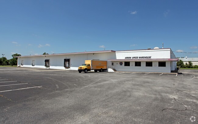
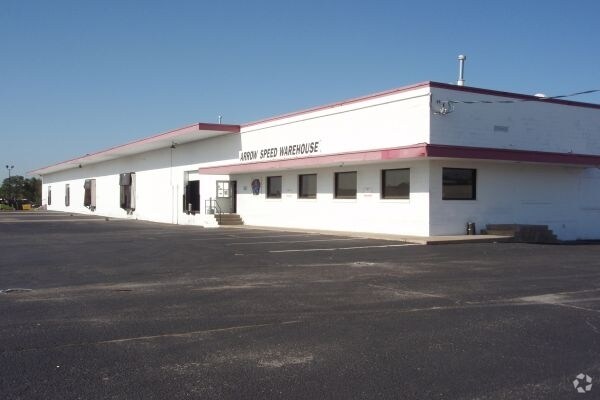
Property Record
1624 E 71St St E, Tulsa, OK 74136

NEARBY LISTINGS FOR SALE OR LEASE
Property Detail
1624 E 71St St E
90326-03-26-23330
Unplatted
Warehouse
PRT SE SW BEG 563.92N SECR W/2 SE SW TH W145 N236.77 W78 N416.80 E219.30 S226.72 E197.40 S330.08 E1.12 S95.15 W195 POB SEC 26 20 13 4.799ACS
X
Tulsa
40143C0242L
Oklahoma
2025
4.80 AC
2025
Northeast Tulsa
011300
Tulsa
46,200 SF
Tulsa, OK
DEMOGRAPHICS near 1624 E 71St St E
1 mile
3 mile
5 mile
2024 Total Population
8,731
53,499
147,570
2029 Population
9,070
55,612
153,528
Pop Growth 2024-2029
+ 3.88%
+ 3.95%
+ 4.04%
Average Age
33
36
36
2024 Total Households
2,887
20,187
58,157
HH Growth 2024-2029
+ 3.95%
+ 3.99%
+ 4.15%
Median Household Inc
$39,258
$41,572
$44,406
Avg Household Size
2.90
2.50
2.40
2024 Avg HH Vehicles
2.00
2.00
2.00
Median Home Value
$62,802
$80,669
$121,160
Median Year Built
1955
1956
1959
Nearby Places
Map Layers
Map Styles
 Street
 Aerial
Transit
 Traffic
 Biking
Places
Listings with unknown addresses are not visible on the map
- Restaurants
- Banks
- Shops
- Fitness
- Groceries
PUBLIC TRANSPORTATION
AIRPORT
Tulsa International
Drive
Walk
Distance
Tulsa International
9 min
4.2 mi
Nearby Properties
Address
Land Use
TOTAL SIZE
Lot Size
Zoning
Address
Land Use
TOTAL SIZE
Lot Size
Zoning
609,418 SF
177.77 AC
IM
Address
Land Use
TOTAL SIZE
Lot Size
Zoning
353.75 AC
IL
Address
Land Use
TOTAL SIZE
Lot Size
Zoning
94,115 SF
15.18 AC
IM
Address
Land Use
TOTAL SIZE
Lot Size
Zoning
1 SF
207.77 AC
IM
Address
Land Use
TOTAL SIZE
Lot Size
Zoning
228.59 AC
IL
Address
Land Use
TOTAL SIZE
Lot Size
Zoning
195,492 SF
17.11 AC
RM1
Address
Land Use
TOTAL SIZE
Lot Size
Zoning
77,346 SF
8.59 AC
RS3
Address
Land Use
TOTAL SIZE
Lot Size
Zoning
42,665 SF
493.63 AC
RS3
Address
Land Use
TOTAL SIZE
Lot Size
Zoning
118,824 SF
38.79 AC
IM
Address
Land Use
TOTAL SIZE
Lot Size
Zoning
110.77 AC
IL
Address
Land Use
TOTAL SIZE
Lot Size
Zoning
103,248 SF
8.87 AC
IL
Address
Land Use
TOTAL SIZE
Lot Size
Zoning
36,962 SF
1.23 AC
CH
Address
Land Use
TOTAL SIZE
Lot Size
Zoning
97.68 AC
CH
Address
Land Use
TOTAL SIZE
Lot Size
Zoning
29,584 SF
2.99 AC
IM
Address
Land Use
TOTAL SIZE
Lot Size
Zoning
41,874 SF
35.70 AC
RS3
Address
Land Use
TOTAL SIZE
Lot Size
Zoning
124,648 SF
21.23 AC
IL
Address
Land Use
TOTAL SIZE
Lot Size
Zoning
62,352 SF
4.88 AC
CS
Address
Land Use
TOTAL SIZE
Lot Size
Zoning
139.39 AC
IM
Address
Land Use
TOTAL SIZE
Lot Size
Zoning
117,204 SF
9.79 AC
IM
Address
Land Use
TOTAL SIZE
Lot Size
Zoning
34,356 SF
35.67 AC
RS3
Address
Land Use
TOTAL SIZE
Lot Size
Zoning
35,474 SF
6.11 AC
CM
Address
Land Use
TOTAL SIZE
Lot Size
Zoning
35,406 SF
1.51 AC
CH
Address
Land Use
TOTAL SIZE
Lot Size
Zoning
60,690 SF
3.69 AC
RS3
Address
Land Use
TOTAL SIZE
Lot Size
Zoning
66,324 SF
12.85 AC
CS
Address
Land Use
TOTAL SIZE
Lot Size
Zoning
187,351 SF
218.26 AC
IL
Address
Land Use
TOTAL SIZE
Lot Size
Zoning
185,649 SF
56.23 AC
IL
Address
Land Use
TOTAL SIZE
Lot Size
Zoning
101,090 SF
1.70 AC
RS2
Address
Land Use
TOTAL SIZE
Lot Size
Zoning
55,425 SF
2.96 AC
IL
Address
Land Use
TOTAL SIZE
Lot Size
Zoning
513.99 AC
RS3
The World's #1 Commercial Real Estate Marketplace
Connect with us
© 2026 CoStar Group
The information above has been obtained from sources believed reliable. While we do not doubt its accuracy we have not verified it and make no guarantee, warranty or representation about it. It is your responsibility to independently confirm its accuracy and completeness. Any projections, opinions, assumptions, or estimates used are for example only and do not represent the current or future performance of the property. The value of this transaction to you depends on tax and other factors which should be evaluated by your tax, financial, and legal advisors. You and your advisors should conduct a careful, independent investigation of the property to determine to your satisfaction the suitability of the property for your needs.