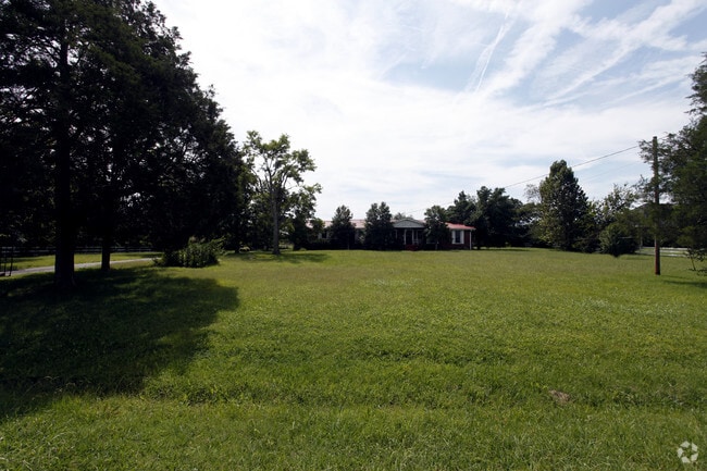
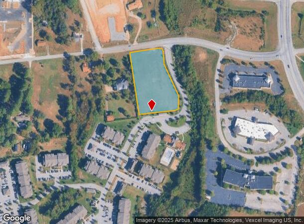
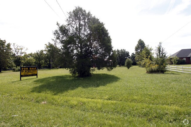
Property Record
1625 Franklin Rd, Lebanon, TN 37090
NEARBY LISTINGS FOR SALE OR LEASE
Property Detail
1625 Franklin Rd
Nashville-Davidson--Murfreesboro--Franklin, TN
Revere At Bartons Run
081-120.11
REVERE AT BARTONS RUN PB 28 PG 603 LOT 2
Residentialacreage
Wilson
X
Tennessee
47189C0190E
2
2024
2.19 AC
2024
Wilson County
030800
Nashville
DEMOGRAPHICS near 1625 Franklin Rd
1 Mile
3 Mile
5 Mile
2024 Total Population
2,809
20,256
50,905
2029 Population
3,341
23,983
60,668
Pop Growth 2024-2029
+ 18.94%
+ 18.40%
+ 19.18%
Average Age
40
40
40
2024 Total Households
1,144
7,971
19,732
HH Growth 2024-2029
+ 18.62%
+ 18.33%
+ 19.17%
Median Household Inc
$54,750
$55,040
$60,978
Avg Household Size
2.40
2.40
2.50
2024 Avg HH Vehicles
2.00
2.00
2.00
Median Home Value
$316,594
$287,614
$310,678
Median Year Built
2008
1991
1996
Nearby Places
- Restaurants
- Banks
- Shops
- Fitness
- Groceries
PUBLIC TRANSPORTATION
COMMUTER RAIL
Lebanon (East Corridor Line - Tennessee Regional Transportation Authority Music City Star (Music City Star))
DRIVE
WALK
Distance
Lebanon (East Corridor Line - Tennessee Regional Transportation Authority Music City Star (Music City Star))
8 min
4.4 mi
Hamilton Springs Station (WEGO STAR - WeGo Public Transit)
DRIVE
WALK
Distance
Hamilton Springs Station (WEGO STAR - WeGo Public Transit)
13 min
6.4 mi
AIRPORT
Nashville International
DRIVE
WALK
Distance
Nashville International
27 min
22.8 mi
Freight Ports
Port of Mobile
DRIVE
WALK
Distance
Port of Mobile
510 min
468.8 mi
Nearby Properties
Address
Land Use
TOTAL SIZE
Lot Size
Zoning
Address
Land Use
TOTAL SIZE
Lot Size
Zoning
265,283 SF
25 AC
Address
Land Use
TOTAL SIZE
Lot Size
Zoning
395,312 SF
42.08 AC
Address
Land Use
TOTAL SIZE
Lot Size
Zoning
465,181 SF
29.13 AC
Address
Land Use
TOTAL SIZE
Lot Size
Zoning
438,956 SF
35.78 AC
Address
Land Use
TOTAL SIZE
Lot Size
Zoning
405,286 SF
70.72 AC
Address
Land Use
TOTAL SIZE
Lot Size
Zoning
412,125 SF
36.44 AC
Address
Land Use
TOTAL SIZE
Lot Size
Zoning
309,940 SF
34 AC
Address
Land Use
TOTAL SIZE
Lot Size
Zoning
29,168 SF
304.39 AC
Address
Land Use
TOTAL SIZE
Lot Size
Zoning
530,720 SF
36.46 AC
Address
Land Use
TOTAL SIZE
Lot Size
Zoning
194,597 SF
20.20 AC
Address
Land Use
TOTAL SIZE
Lot Size
Zoning
74,767 SF
5.89 AC
B4
Address
Land Use
TOTAL SIZE
Lot Size
Zoning
383,150 SF
35.03 AC
Address
Land Use
TOTAL SIZE
Lot Size
Zoning
199,465 SF
23.89 AC
Address
Land Use
TOTAL SIZE
Lot Size
Zoning
222,400 SF
12.68 AC
Address
Land Use
TOTAL SIZE
Lot Size
Zoning
118,152 SF
5.72 AC
Address
Land Use
TOTAL SIZE
Lot Size
Zoning
41,168 SF
10.10 AC
Address
Land Use
TOTAL SIZE
Lot Size
Zoning
143,151 SF
15.31 AC
Address
Land Use
TOTAL SIZE
Lot Size
Zoning
342,800 SF
20.51 AC
M3
Address
Land Use
TOTAL SIZE
Lot Size
Zoning
104,219 SF
14.52 AC
Address
Land Use
TOTAL SIZE
Lot Size
Zoning
37,400 SF
3.42 AC
Address
Land Use
TOTAL SIZE
Lot Size
Zoning
154,212 SF
19.02 AC
Address
Land Use
TOTAL SIZE
Lot Size
Zoning
3,864 SF
31.30 AC
Address
Land Use
TOTAL SIZE
Lot Size
Zoning
231,867 SF
17.03 AC
M3
Address
Land Use
TOTAL SIZE
Lot Size
Zoning
46,742 SF
10.25 AC
Address
Land Use
TOTAL SIZE
Lot Size
Zoning
68,037 SF
2.89 AC
Address
Land Use
TOTAL SIZE
Lot Size
Zoning
124,632 SF
129 AC
Address
Land Use
TOTAL SIZE
Lot Size
Zoning
50,313 SF
3.47 AC
Address
Land Use
TOTAL SIZE
Lot Size
Zoning
113,072 SF
12.42 AC
Address
Land Use
TOTAL SIZE
Lot Size
Zoning
37,191 SF
13.62 AC
CG
Address
Land Use
TOTAL SIZE
Lot Size
Zoning
151,904 SF
16.50 AC
The World's #1 Commercial Real Estate Marketplace
Connect with us
© 2025 CoStar Group
The information above has been obtained from sources believed reliable. While we do not doubt its accuracy we have not verified it and make no guarantee, warranty or representation about it. It is your responsibility to independently confirm its accuracy and completeness. Any projections, opinions, assumptions, or estimates used are for example only and do not represent the current or future performance of the property. The value of this transaction to you depends on tax and other factors which should be evaluated by your tax, financial, and legal advisors. You and your advisors should conduct a careful, independent investigation of the property to determine to your satisfaction the suitability of the property for your needs.