Property Record
1625 Lashelle Way, Colorado Springs, CO 80906


NEARBY LISTINGS FOR SALE OR LEASE
-
-
View all Colorado Springs listings for sale on LoopNet.com
Property Detail
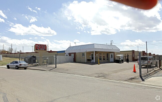
1625 Lashelle Way
Colorado Springs, CO
Stratmoor-Academy Subdivision
65054-14-005
LOT 1 BLK 1 STRATMOOR-ACADEMY SUB EX THAT PART AS FOLS, COM AT SE COR OF SEC 5-15-66, TH S 89<0555 W ON S LN 591.50 FT FOR POB, CONT ON LAST MENT COURSE 145.0 FT, NWLY ON A CUR TO R, SD CUR HAVING A RAD OF 2814.90 FT A C/A OF 5<4628 AN ARC DIST OF 28
Warehouse
El Paso
X
Colorado
08041C0743G
1
2024
3.15 AC
2025
Southwest
003303
Colorado Springs
54,620 SF
DEMOGRAPHICS near 1625 Lashelle Way
1 Mile
3 Mile
5 Mile
2024 Total Population
10,986
70,740
173,228
2029 Population
11,522
73,929
181,306
Pop Growth 2024-2029
+ 4.88%
+ 4.51%
+ 4.66%
Average Age
32
34
35
2024 Total Households
4,390
24,390
64,065
HH Growth 2024-2029
+ 5.24%
+ 4.87%
+ 5.07%
Median Household Inc
$59,414
$64,903
$61,086
Avg Household Size
2.50
2.50
2.50
2024 Avg HH Vehicles
2.00
2.00
2.00
Median Home Value
$337,277
$353,443
$323,376
Median Year Built
1988
1984
1982
Nearby Places
Map Layers
Map Styles
 Street
 Aerial
- Restaurants
- Banks
- Shops
- Fitness
- Groceries
PUBLIC TRANSPORTATION
AIRPORT
City of Colorado Springs Municipal
DRIVE
WALK
Distance
City of Colorado Springs Municipal
22 min
11.0 mi
Nearby Properties
Address
Land Use
TOTAL SIZE
Lot Size
Zoning
Address
Land Use
TOTAL SIZE
Lot Size
Zoning
309,046 SF
28.95 AC
PF SS
Address
Land Use
TOTAL SIZE
Lot Size
Zoning
215,464 SF
11.59 AC
R-5
Address
Land Use
TOTAL SIZE
Lot Size
Zoning
152,977 SF
39.50 AC
MX-M MX-M/
Address
Land Use
TOTAL SIZE
Lot Size
Zoning
215,377 SF
11.24 AC
R-5/CR
Address
Land Use
TOTAL SIZE
Lot Size
Zoning
99,829 SF
15.39 AC
R-E CU UV
Address
Land Use
TOTAL SIZE
Lot Size
Zoning
107,146 SF
16.72 AC
R-1 6 CU
Address
Land Use
TOTAL SIZE
Lot Size
Zoning
124,107 SF
104.60 AC
MX-N CU
Address
Land Use
TOTAL SIZE
Lot Size
Zoning
166,182 SF
26.35 AC
BP/CR
Address
Land Use
TOTAL SIZE
Lot Size
Zoning
24,293 SF
10.61 AC
C5
Address
Land Use
TOTAL SIZE
Lot Size
Zoning
34,984 SF
14.31 AC
A-5
Address
Land Use
TOTAL SIZE
Lot Size
Zoning
46,190 SF
4.02 AC
PDZ
Address
Land Use
TOTAL SIZE
Lot Size
Zoning
38,365 SF
3.37 AC
MX-M
Address
Land Use
TOTAL SIZE
Lot Size
Zoning
107,610 SF
5.69 AC
R-E
Address
Land Use
TOTAL SIZE
Lot Size
Zoning
261,184 SF
17.39 AC
MX-M CU
Address
Land Use
TOTAL SIZE
Lot Size
Zoning
28,769 SF
3.92 AC
MX-M
Address
Land Use
TOTAL SIZE
Lot Size
Zoning
22,596 SF
3.93 AC
R-5 UV AO
Address
Land Use
TOTAL SIZE
Lot Size
Zoning
60,730 SF
4.26 AC
BP
Address
Land Use
TOTAL SIZE
Lot Size
Zoning
50,992 SF
10.27 AC
PDZ AO
Address
Land Use
TOTAL SIZE
Lot Size
Zoning
92,000 SF
9.56 AC
MX-M UV AO
Address
Land Use
TOTAL SIZE
Lot Size
Zoning
66,640 SF
6.87 AC
MX-M CU AO
Address
Land Use
TOTAL SIZE
Lot Size
Zoning
30,860 SF
1.71 AC
MX-M CU
Address
Land Use
TOTAL SIZE
Lot Size
Zoning
340,865 SF
13.70 AC
RM-30 RS-6
Address
Land Use
TOTAL SIZE
Lot Size
Zoning
250,137 SF
9.62 AC
MX-M
Address
Land Use
TOTAL SIZE
Lot Size
Zoning
25,919 SF
0.02 AC
Address
Land Use
TOTAL SIZE
Lot Size
Zoning
328,069 SF
16.85 AC
MX-M
Address
Land Use
TOTAL SIZE
Lot Size
Zoning
148,414 SF
24.09 AC
MX-M UV
Address
Land Use
TOTAL SIZE
Lot Size
Zoning
434,130 SF
31.14 AC
BP
Address
Land Use
TOTAL SIZE
Lot Size
Zoning
215,716 SF
10.58 AC
R-5/CR
Address
Land Use
TOTAL SIZE
Lot Size
Zoning
9,448 SF
212.16 AC
A-5
Address
Land Use
TOTAL SIZE
Lot Size
Zoning
163,073 SF
14.57 AC
PUD
The World's #1 Commercial Real Estate Marketplace
Connect with us
© 2026 CoStar Group
The information above has been obtained from sources believed reliable. While we do not doubt its accuracy we have not verified it and make no guarantee, warranty or representation about it. It is your responsibility to independently confirm its accuracy and completeness. Any projections, opinions, assumptions, or estimates used are for example only and do not represent the current or future performance of the property. The value of this transaction to you depends on tax and other factors which should be evaluated by your tax, financial, and legal advisors. You and your advisors should conduct a careful, independent investigation of the property to determine to your satisfaction the suitability of the property for your needs.