Property Record
1627 N 34Th St, Superior, WI 54880
NEARBY LISTINGS FOR SALE OR LEASE
Property Detail
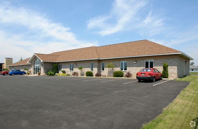
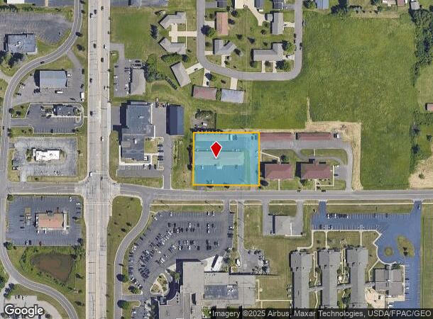
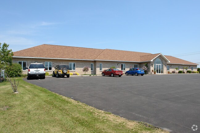
1627 N 34Th St
07-807-03011-07
THE WEST 250 FT OF THAT PART OF THE S1/2 OF S1/2 OF NE 1/4 DESCRIBED IN VOL 517-169. 1.148 AC M/L
Commercialnec
Douglas
X
Wisconsin
27137C3880E
1.15 AC
2024
Superior
2024
Duluth
020600
Duluth, MN-WI
DEMOGRAPHICS near 1627 N 34Th St
1 Mile
3 Mile
5 Mile
2024 Total Population
3,883
23,635
39,792
2029 Population
3,834
23,349
39,235
Pop Growth 2024-2029
(1.26%)
(1.21%)
(1.40%)
Average Age
41
40
40
2024 Total Households
1,706
10,396
17,644
HH Growth 2024-2029
(1.41%)
(1.27%)
(1.47%)
Median Household Inc
$49,452
$52,209
$51,370
Avg Household Size
2.10
2.10
2.10
2024 Avg HH Vehicles
2.00
2.00
2.00
Median Home Value
$167,800
$151,189
$150,646
Median Year Built
1963
1956
1949
Nearby Places
Map Layers
Map Styles
 Street
 Aerial
- Restaurants
- Banks
- Shops
- Fitness
- Groceries
PUBLIC TRANSPORTATION
AIRPORT
Duluth International
DRIVE
WALK
Distance
Duluth International
30 min
14.8 mi
SALE & LEASE HISTORY
LISTING DATE
SALE/LEASE

Sep 25, 2016
For Lease
Nearby Properties
Address
Land Use
TOTAL SIZE
Lot Size
Zoning
Address
Land Use
TOTAL SIZE
Lot Size
Zoning
175 AC
W1
Address
Land Use
TOTAL SIZE
Lot Size
Zoning
50.82 AC
M2
Address
Land Use
TOTAL SIZE
Lot Size
Zoning
2.81 AC
PDD
Address
Land Use
TOTAL SIZE
Lot Size
Zoning
1.45 AC
C3
Address
Land Use
TOTAL SIZE
Lot Size
Zoning
135.91 AC
M2
Address
Land Use
TOTAL SIZE
Lot Size
Zoning
1.36 AC
C2
Address
Land Use
TOTAL SIZE
Lot Size
Zoning
21.96 AC
Address
Land Use
TOTAL SIZE
Lot Size
Zoning
4.17 AC
C2
Address
Land Use
TOTAL SIZE
Lot Size
Zoning
28.37 AC
W1
Address
Land Use
TOTAL SIZE
Lot Size
Zoning
2.47 AC
C2
Address
Land Use
TOTAL SIZE
Lot Size
Zoning
6.94 AC
Address
Land Use
TOTAL SIZE
Lot Size
Zoning
27.99 AC
C2
Address
Land Use
TOTAL SIZE
Lot Size
Zoning
52.06 AC
M2
Address
Land Use
TOTAL SIZE
Lot Size
Zoning
2 AC
R3
Address
Land Use
TOTAL SIZE
Lot Size
Zoning
6.01 AC
M2
Address
Land Use
TOTAL SIZE
Lot Size
Zoning
0.68 AC
R3
Address
Land Use
TOTAL SIZE
Lot Size
Zoning
2.44 AC
C2
Address
Land Use
TOTAL SIZE
Lot Size
Zoning
20.01 AC
Address
Land Use
TOTAL SIZE
Lot Size
Zoning
1.34 AC
Address
Land Use
TOTAL SIZE
Lot Size
Zoning
3.42 AC
R3
Address
Land Use
TOTAL SIZE
Lot Size
Zoning
7.05 AC
M2
Address
Land Use
TOTAL SIZE
Lot Size
Zoning
4.47 AC
Address
Land Use
TOTAL SIZE
Lot Size
Zoning
9.84 AC
C2
Address
Land Use
TOTAL SIZE
Lot Size
Zoning
24.54 AC
W1
Address
Land Use
TOTAL SIZE
Lot Size
Zoning
11.43 AC
R3
Address
Land Use
TOTAL SIZE
Lot Size
Zoning
1.97 AC
PDD
Address
Land Use
TOTAL SIZE
Lot Size
Zoning
Address
Land Use
TOTAL SIZE
Lot Size
Zoning
1.41 AC
C4
Address
Land Use
TOTAL SIZE
Lot Size
Zoning
3.54 AC
W1
Address
Land Use
TOTAL SIZE
Lot Size
Zoning
7.50 AC
R3
The World's #1 Commercial Real Estate Marketplace
Connect with us
© 2025 CoStar Group
The information above has been obtained from sources believed reliable. While we do not doubt its accuracy we have not verified it and make no guarantee, warranty or representation about it. It is your responsibility to independently confirm its accuracy and completeness. Any projections, opinions, assumptions, or estimates used are for example only and do not represent the current or future performance of the property. The value of this transaction to you depends on tax and other factors which should be evaluated by your tax, financial, and legal advisors. You and your advisors should conduct a careful, independent investigation of the property to determine to your satisfaction the suitability of the property for your needs.