Property Record
1628 Pelham Rd S, Jacksonville, AL 36265
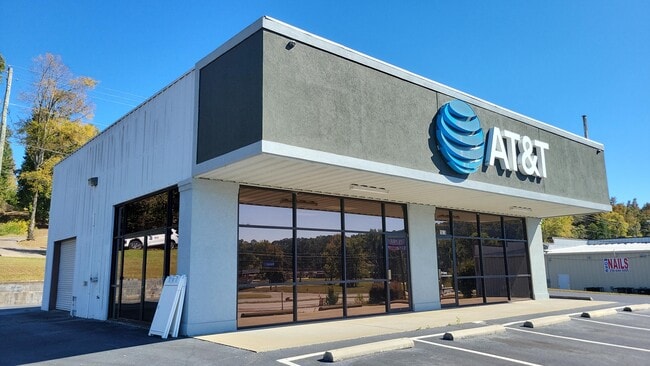

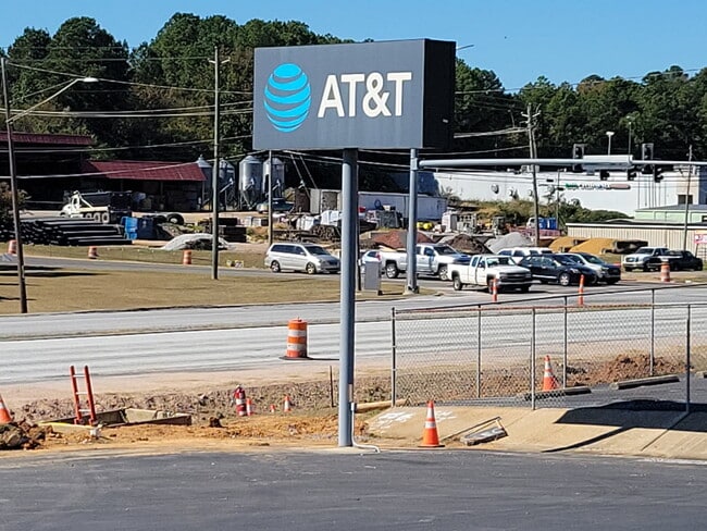
This Property Is For Sale
NEARBY LISTINGS FOR SALE OR LEASE
Property Detail
1628 Pelham Rd S
Anniston-Oxford, AL
Shipman Subdivision
12-07-26-0-002-043.011
SEC 26 T14S R08E SHIPMAN SUB PT LT 1 BEG 150 N OF SW COR LT 1 TH E 168.35 N 160.09 W 181.24 S 155.53 TO POB JACKSONVILLE AL
Storebuilding
Calhoun
X
Alabama
01015C0167E
1
2025
0.66 AC
2025
Gadsden/Anniston Area
002105
Other Market Areas
1,920 SF
DEMOGRAPHICS near 1628 Pelham Rd S
1 Mile
3 Mile
5 Mile
2024 Total Population
2,904
17,214
25,236
2029 Population
2,842
17,326
25,337
Pop Growth 2024-2029
(2.13%)
+ 0.65%
+ 0.40%
Average Age
38
34
36
2024 Total Households
1,232
6,013
9,223
HH Growth 2024-2029
(2.19%)
+ 0.72%
+ 0.47%
Median Household Inc
$45,542
$43,140
$48,310
Avg Household Size
2.30
2.20
2.30
2024 Avg HH Vehicles
2.00
2.00
2.00
Median Home Value
$174,520
$181,386
$181,575
Median Year Built
1989
1987
1984
Nearby Places
Map Layers
Map Styles
 Street
 Aerial
- Restaurants
- Banks
- Shops
- Fitness
- Groceries
Nearby Properties
Address
Land Use
TOTAL SIZE
Lot Size
Zoning
Address
Land Use
TOTAL SIZE
Lot Size
Zoning
2,784 SF
17 AC
Address
Land Use
TOTAL SIZE
Lot Size
Zoning
7,875 SF
9 AC
Address
Land Use
TOTAL SIZE
Lot Size
Zoning
20,074 SF
12 AC
Address
Land Use
TOTAL SIZE
Lot Size
Zoning
17,232 SF
14 AC
Address
Land Use
TOTAL SIZE
Lot Size
Zoning
163,080 SF
17 AC
Address
Land Use
TOTAL SIZE
Lot Size
Zoning
11,400 SF
8 AC
Address
Land Use
TOTAL SIZE
Lot Size
Zoning
50,524 SF
3.73 AC
Address
Land Use
TOTAL SIZE
Lot Size
Zoning
2,400 SF
19 AC
Address
Land Use
TOTAL SIZE
Lot Size
Zoning
34,354 SF
29 AC
Address
Land Use
TOTAL SIZE
Lot Size
Zoning
23,512 SF
4.60 AC
Address
Land Use
TOTAL SIZE
Lot Size
Zoning
3,360 SF
10.80 AC
Address
Land Use
TOTAL SIZE
Lot Size
Zoning
1,800 SF
18.95 AC
Address
Land Use
TOTAL SIZE
Lot Size
Zoning
56,080 SF
5.15 AC
Address
Land Use
TOTAL SIZE
Lot Size
Zoning
11,762 SF
12 AC
Address
Land Use
TOTAL SIZE
Lot Size
Zoning
33,413 SF
4.50 AC
Address
Land Use
TOTAL SIZE
Lot Size
Zoning
25,993 SF
6.05 AC
Address
Land Use
TOTAL SIZE
Lot Size
Zoning
4,750 SF
3.09 AC
Address
Land Use
TOTAL SIZE
Lot Size
Zoning
Address
Land Use
TOTAL SIZE
Lot Size
Zoning
20,703 SF
2.60 AC
Address
Land Use
TOTAL SIZE
Lot Size
Zoning
26,654 SF
10 AC
Address
Land Use
TOTAL SIZE
Lot Size
Zoning
3,504 SF
6.74 AC
Address
Land Use
TOTAL SIZE
Lot Size
Zoning
3,207 SF
9.50 AC
Address
Land Use
TOTAL SIZE
Lot Size
Zoning
Address
Land Use
TOTAL SIZE
Lot Size
Zoning
1,717 SF
1.12 AC
Address
Land Use
TOTAL SIZE
Lot Size
Zoning
2,912 SF
2.10 AC
Address
Land Use
TOTAL SIZE
Lot Size
Zoning
19.22 AC
Address
Land Use
TOTAL SIZE
Lot Size
Zoning
39,828 SF
3.60 AC
Address
Land Use
TOTAL SIZE
Lot Size
Zoning
1,800 SF
6.40 AC
Address
Land Use
TOTAL SIZE
Lot Size
Zoning
3,811 SF
1.82 AC
Address
Land Use
TOTAL SIZE
Lot Size
Zoning
44.80 AC
The World's #1 Commercial Real Estate Marketplace
Connect with us
© 2026 CoStar Group
The information above has been obtained from sources believed reliable. While we do not doubt its accuracy we have not verified it and make no guarantee, warranty or representation about it. It is your responsibility to independently confirm its accuracy and completeness. Any projections, opinions, assumptions, or estimates used are for example only and do not represent the current or future performance of the property. The value of this transaction to you depends on tax and other factors which should be evaluated by your tax, financial, and legal advisors. You and your advisors should conduct a careful, independent investigation of the property to determine to your satisfaction the suitability of the property for your needs.