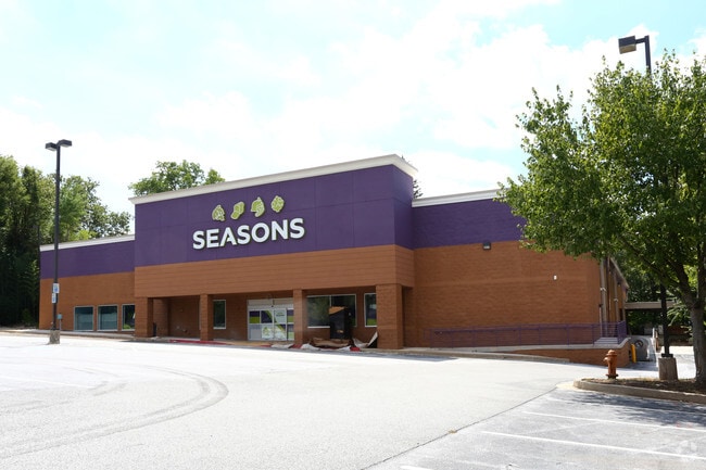
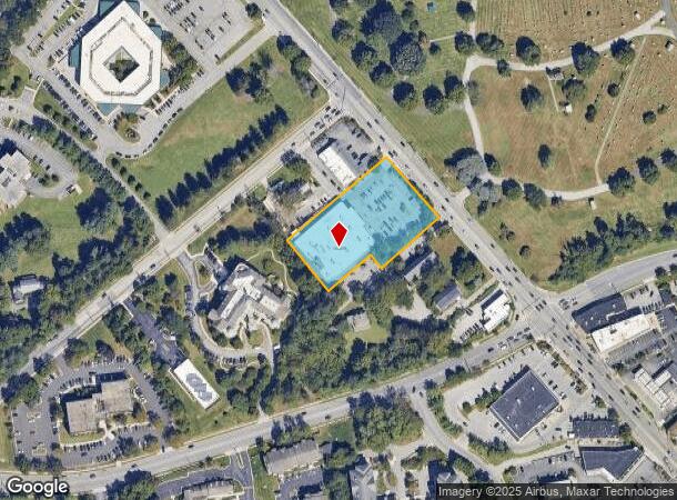
Property Record
1628 Reisterstown Rd, Pikesville, MD 21208
NEARBY LISTINGS FOR SALE OR LEASE
Property Detail
1628 Reisterstown Rd
03-2200016475
1.653 AC
Storebuilding
Baltimore
X
Maryland
2400100240G
1.65 AC
2024
Reisterstown Rd Corridor
2025
Baltimore
403401
Baltimore-Columbia-Towson, MD
26,100 SF
DEMOGRAPHICS near 1628 Reisterstown Rd
1 Mile
3 Mile
5 Mile
2024 Total Population
8,571
100,244
252,327
2029 Population
8,477
97,675
246,499
Pop Growth 2024-2029
(1.10%)
(2.56%)
(2.31%)
Average Age
50
42
41
2024 Total Households
4,144
40,001
101,018
HH Growth 2024-2029
(1.18%)
(2.64%)
(2.46%)
Median Household Inc
$82,980
$76,244
$71,671
Avg Household Size
1.90
2.40
2.40
2024 Avg HH Vehicles
1.00
2.00
2.00
Median Home Value
$302,811
$289,510
$276,811
Median Year Built
1977
1968
1968
Nearby Places
Map Layers
Map Styles
 Street
 Aerial
- Restaurants
- Banks
- Shops
- Fitness
- Groceries
PUBLIC TRANSPORTATION
COMMUTER RAIL
West Baltimore (PENN - WASHINGTON - Maryland Area Regional Commuter Trains (The MARC), Penn Line - Maryland Area Regional Commuter Trains (The MARC))
DRIVE
WALK
Distance
West Baltimore (PENN - WASHINGTON - Maryland Area Regional Commuter Trains (The MARC), Penn Line - Maryland Area Regional Commuter Trains (The MARC))
23 min
8.1 mi
AIRPORT
Baltimore/Washington International Thurgood Marshall
DRIVE
WALK
Distance
Baltimore/Washington International Thurgood Marshall
28 min
17.0 mi
Freight Ports
Port of Baltimore
DRIVE
WALK
Distance
Port of Baltimore
28 min
17.5 mi
Nearby Properties
Address
Land Use
TOTAL SIZE
Lot Size
Zoning
Address
Land Use
TOTAL SIZE
Lot Size
Zoning
941,727 SF
36.89 AC
TOD-3
Address
Land Use
TOTAL SIZE
Lot Size
Zoning
630,367 SF
470.44 AC
DR1
Address
Land Use
TOTAL SIZE
Lot Size
Zoning
34.99 AC
R-5
Address
Land Use
TOTAL SIZE
Lot Size
Zoning
173,057 SF
17.22 AC
Address
Land Use
TOTAL SIZE
Lot Size
Zoning
Address
Land Use
TOTAL SIZE
Lot Size
Zoning
99,153 SF
9.41 AC
OR2
Address
Land Use
TOTAL SIZE
Lot Size
Zoning
Address
Land Use
TOTAL SIZE
Lot Size
Zoning
14.41 AC
Address
Land Use
TOTAL SIZE
Lot Size
Zoning
7.05 AC
BM
Address
Land Use
TOTAL SIZE
Lot Size
Zoning
186,708 SF
10.92 AC
DR3.5
Address
Land Use
TOTAL SIZE
Lot Size
Zoning
6.14 AC
02
Address
Land Use
TOTAL SIZE
Lot Size
Zoning
145,800 SF
44 SF
Address
Land Use
TOTAL SIZE
Lot Size
Zoning
140,286 SF
11.71 AC
BR
Address
Land Use
TOTAL SIZE
Lot Size
Zoning
190,243 SF
3.28 AC
R-9
Address
Land Use
TOTAL SIZE
Lot Size
Zoning
201.09 AC
Address
Land Use
TOTAL SIZE
Lot Size
Zoning
13.68 AC
DR16
Address
Land Use
TOTAL SIZE
Lot Size
Zoning
8.76 AC
RAE1
Address
Land Use
TOTAL SIZE
Lot Size
Zoning
162,386 SF
30.68 AC
DR5.5
Address
Land Use
TOTAL SIZE
Lot Size
Zoning
279,000 SF
21.85 AC
BM
Address
Land Use
TOTAL SIZE
Lot Size
Zoning
12.69 AC
DR16
Address
Land Use
TOTAL SIZE
Lot Size
Zoning
29.54 AC
BM
Address
Land Use
TOTAL SIZE
Lot Size
Zoning
180,274 SF
46 AC
DR5.5
Address
Land Use
TOTAL SIZE
Lot Size
Zoning
144,137 SF
28.32 AC
Address
Land Use
TOTAL SIZE
Lot Size
Zoning
55,502 SF
1.29 AC
OR1
Address
Land Use
TOTAL SIZE
Lot Size
Zoning
2,993 SF
11.36 AC
BL
Address
Land Use
TOTAL SIZE
Lot Size
Zoning
9,573 SF
10.52 AC
BM
Address
Land Use
TOTAL SIZE
Lot Size
Zoning
15.21 AC
DR16
Address
Land Use
TOTAL SIZE
Lot Size
Zoning
338,824 SF
5.13 AC
Address
Land Use
TOTAL SIZE
Lot Size
Zoning
15,221 SF
16.82 AC
DR16
Address
Land Use
TOTAL SIZE
Lot Size
Zoning
125,946 SF
32.20 AC
DR3.5
The World's #1 Commercial Real Estate Marketplace
Connect with us
© 2025 CoStar Group
The information above has been obtained from sources believed reliable. While we do not doubt its accuracy we have not verified it and make no guarantee, warranty or representation about it. It is your responsibility to independently confirm its accuracy and completeness. Any projections, opinions, assumptions, or estimates used are for example only and do not represent the current or future performance of the property. The value of this transaction to you depends on tax and other factors which should be evaluated by your tax, financial, and legal advisors. You and your advisors should conduct a careful, independent investigation of the property to determine to your satisfaction the suitability of the property for your needs.