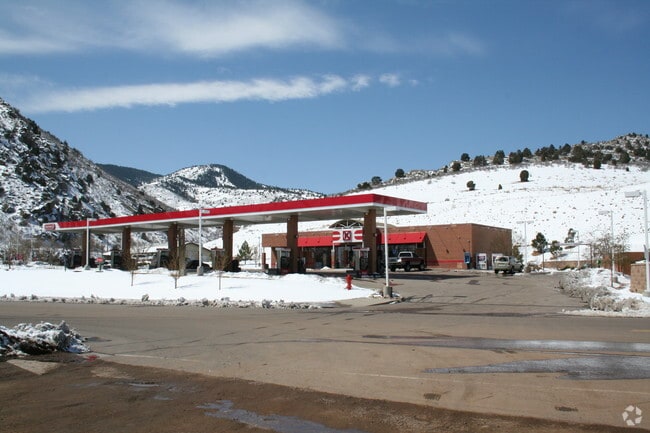
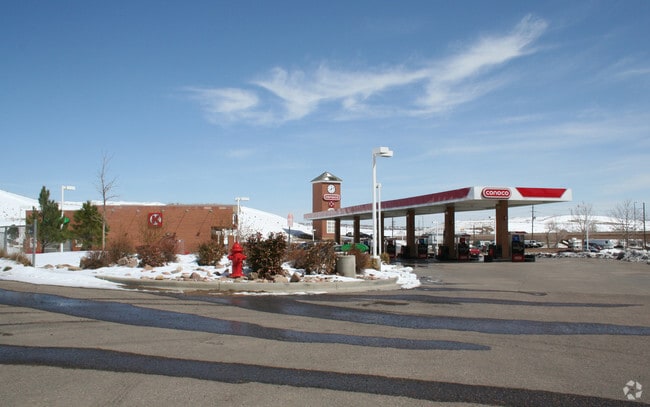
Property Record
16283 Morrison Rd, Morrison, CO 80465

Save to a Folder
{{folder.Name}}
{{folder.ListingIds.length}} Properties
{{folder.ListingIds.length}} Property
Create a New Folder
Property Detail
16283 Morrison Rd
Denver-Aurora-Centennial, CO
SECTION 36 TOWNSHIP 04 RANGE 70 QTR SW SUBDIVISIONCD 164300 SUBDIVISIONNAME CONOCO AT C-470 & MORRISON ROAD FLG #1 BLOCK 001 LOT 0001 SIZE: 48122 TRACT 00B VALUE: 1.105
40-363-02-001
JEFFERSON
Commercialnec
Colorado
B and X Area of moderate flood hazard, usually the area between the limits of the 100-year and 500-year floods.
1
2025
1.11 AC
2025
West
011724
Denver
4,551 SF
NEARBY LISTINGS FOR SALE OR LEASE
DEMOGRAPHICS near 16283 Morrison Rd
1 mile
3 mile
5 mile
2025 Total Population
1,360
22,147
105,072
2030 Population
1,358
21,978
104,138
Pop Growth 2025-2030
(0.15%)
(0.76%)
(0.89%)
Average Age
43
43
42
2025 Total Households
509
8,349
42,456
HH Growth 2025-2030
(0.79%)
(0.89%)
(0.95%)
Median Household Inc
$201,953
$160,198
$115,278
Avg Household Size
2.60
2.60
2.40
2025 Avg HH Vehicles
2.00
2.00
2.00
Median Home Value
$990,043
$776,581
$699,771
Median Year Built
2010
1990
1983
Nearby Places
Map Layers
Map Styles
 Street
 Aerial
Layers
 Traffic
 Biking
Places
Listings with unknown addresses are not visible on the map
- Restaurants
- Banks
- Shops
- Fitness
- Groceries
PUBLIC TRANSPORTATION
AIRPORT
Denver International
Drive
Walk
Distance
Denver International
51 min
40.5 mi
Nearby Properties
Address
Land Use
TOTAL SIZE
Lot Size
Zoning
Address
Land Use
TOTAL SIZE
Lot Size
Zoning
5,075 SF
1,955.14 AC
A2
Address
Land Use
TOTAL SIZE
Lot Size
Zoning
294,876 SF
12.25 AC
Address
Land Use
TOTAL SIZE
Lot Size
Zoning
70,614 SF
4.78 AC
CDOLI
Address
Land Use
TOTAL SIZE
Lot Size
Zoning
266.38 AC
A2
Address
Land Use
TOTAL SIZE
Lot Size
Zoning
33.55 AC
Address
Land Use
TOTAL SIZE
Lot Size
Zoning
33,467 SF
2.51 AC
CDOLI
Address
Land Use
TOTAL SIZE
Lot Size
Zoning
72,694 SF
13.85 AC
Address
Land Use
TOTAL SIZE
Lot Size
Zoning
108,566 SF
9.84 AC
C1
Address
Land Use
TOTAL SIZE
Lot Size
Zoning
50,892 SF
63.59 AC
OS-C
Address
Land Use
TOTAL SIZE
Lot Size
Zoning
50,148 SF
3.55 AC
Address
Land Use
TOTAL SIZE
Lot Size
Zoning
1,959.26 AC
A2
Address
Land Use
TOTAL SIZE
Lot Size
Zoning
367.86 AC
A2
Address
Land Use
TOTAL SIZE
Lot Size
Zoning
115.60 AC
A1
Address
Land Use
TOTAL SIZE
Lot Size
Zoning
49,576 SF
3.42 AC
Address
Land Use
TOTAL SIZE
Lot Size
Zoning
98,174 SF
13.17 AC
Address
Land Use
TOTAL SIZE
Lot Size
Zoning
9,942 SF
276.11 AC
CO
Address
Land Use
TOTAL SIZE
Lot Size
Zoning
66.51 AC
PD
Address
Land Use
TOTAL SIZE
Lot Size
Zoning
98.53 AC
A2
Address
Land Use
TOTAL SIZE
Lot Size
Zoning
16,192 SF
4.07 AC
Address
Land Use
TOTAL SIZE
Lot Size
Zoning
16,660 SF
243.22 AC
A2
Address
Land Use
TOTAL SIZE
Lot Size
Zoning
46,020 SF
9.31 AC
Address
Land Use
TOTAL SIZE
Lot Size
Zoning
3,910 SF
1,103.44 AC
A2
Address
Land Use
TOTAL SIZE
Lot Size
Zoning
44,599 SF
2.84 AC
Address
Land Use
TOTAL SIZE
Lot Size
Zoning
14,028 SF
360 AC
CO
Address
Land Use
TOTAL SIZE
Lot Size
Zoning
44,845 SF
13.76 AC
PD
Address
Land Use
TOTAL SIZE
Lot Size
Zoning
17,840 SF
1.64 AC
PD
Address
Land Use
TOTAL SIZE
Lot Size
Zoning
36,440 SF
106.80 AC
PD
Address
Land Use
TOTAL SIZE
Lot Size
Zoning
16,836 SF
1.31 AC
Address
Land Use
TOTAL SIZE
Lot Size
Zoning
28,917 SF
20.33 AC
A2
Address
Land Use
TOTAL SIZE
Lot Size
Zoning
12,827 SF
2.97 AC
C1
The World's #1 Commercial Real Estate Marketplace
Connect with us
© 2026 CoStar Group
The information above has been obtained from sources believed reliable. While we do not doubt its accuracy we have not verified it and make no guarantee, warranty or representation about it. It is your responsibility to independently confirm its accuracy and completeness. Any projections, opinions, assumptions, or estimates used are for example only and do not represent the current or future performance of the property. The value of this transaction to you depends on tax and other factors which should be evaluated by your tax, financial, and legal advisors. You and your advisors should conduct a careful, independent investigation of the property to determine to your satisfaction the suitability of the property for your needs.