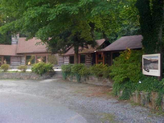
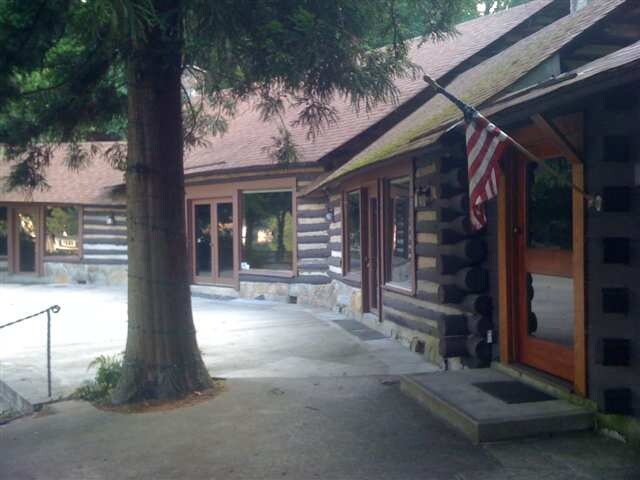
Property Record
1629 E Butter St, Landrum, SC 29356
NEARBY LISTINGS FOR SALE OR LEASE
Property Detail
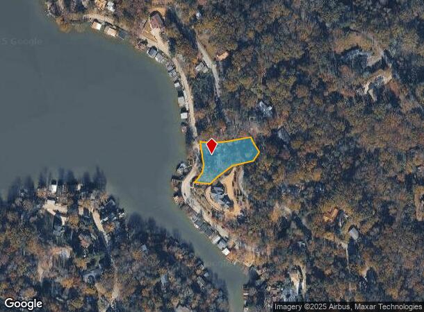
1629 E Butter St
Greenville-Anderson-Greer, SC
Lake Lanier
0624.01-04-018.00
Greenville
Sfr
South Carolina
X
0.81 AC
45083C0005D
Travelers Rest
4,508 SF
Greenville/Spartanburg
DEMOGRAPHICS near 1629 E Butter St
1 Mile
3 Mile
5 Mile
2024 Total Population
1,223
6,623
14,287
2029 Population
1,369
7,408
15,888
Pop Growth 2024-2029
+ 11.94%
+ 11.85%
+ 11.21%
Average Age
52
50
49
2024 Total Households
575
3,085
6,429
HH Growth 2024-2029
+ 11.83%
+ 11.80%
+ 11.26%
Median Household Inc
$63,937
$56,652
$55,018
Avg Household Size
2.10
2.10
2.20
2024 Avg HH Vehicles
2.00
2.00
2.00
Median Home Value
$358,546
$290,466
$260,352
Median Year Built
1983
1979
1980
Nearby Places
Map Layers
Map Styles
 Street
 Aerial
- Restaurants
- Banks
- Shops
- Fitness
- Groceries
PUBLIC TRANSPORTATION
AIRPORT
Greenville Spartanburg International
DRIVE
WALK
Distance
Greenville Spartanburg International
43 min
24.7 mi
Asheville Regional
DRIVE
WALK
Distance
Asheville Regional
47 min
32.5 mi
SALE & LEASE HISTORY
LISTING DATE
SALE/LEASE

Sep 24, 2016
For Sale
Oct 13, 2016
For Sale
Apr 03, 2017
For Sale
Nearby Properties
Address
Land Use
TOTAL SIZE
Lot Size
Zoning
Address
Land Use
TOTAL SIZE
Lot Size
Zoning
13 AC
M
Address
Land Use
TOTAL SIZE
Lot Size
Zoning
166.74 AC
RE5
Address
Land Use
TOTAL SIZE
Lot Size
Zoning
8,095 SF
0.53 AC
M
Address
Land Use
TOTAL SIZE
Lot Size
Zoning
6,735 SF
8.20 AC
M
Address
Land Use
TOTAL SIZE
Lot Size
Zoning
15,450 SF
3 AC
M
Address
Land Use
TOTAL SIZE
Lot Size
Zoning
2,796 SF
7.95 AC
M
Address
Land Use
TOTAL SIZE
Lot Size
Zoning
8,986 SF
1.15 AC
M
Address
Land Use
TOTAL SIZE
Lot Size
Zoning
7,204 SF
5.25 AC
M
Address
Land Use
TOTAL SIZE
Lot Size
Zoning
6,688 SF
1.25 AC
M
Address
Land Use
TOTAL SIZE
Lot Size
Zoning
28.12 AC
M
Address
Land Use
TOTAL SIZE
Lot Size
Zoning
6,443 SF
0.72 AC
M
Address
Land Use
TOTAL SIZE
Lot Size
Zoning
4,432 SF
8.05 AC
M
Address
Land Use
TOTAL SIZE
Lot Size
Zoning
289.30 AC
UNZONED
Address
Land Use
TOTAL SIZE
Lot Size
Zoning
122.29 AC
MX
Address
Land Use
TOTAL SIZE
Lot Size
Zoning
10,000 SF
10.63 AC
M
Address
Land Use
TOTAL SIZE
Lot Size
Zoning
220 AC
MX
Address
Land Use
TOTAL SIZE
Lot Size
Zoning
2,334 SF
126.27 AC
M
Address
Land Use
TOTAL SIZE
Lot Size
Zoning
16,552 SF
2.15 AC
M
Address
Land Use
TOTAL SIZE
Lot Size
Zoning
5,360 SF
0.68 AC
M
Address
Land Use
TOTAL SIZE
Lot Size
Zoning
10,624 SF
2.39 AC
M
Address
Land Use
TOTAL SIZE
Lot Size
Zoning
3,500 SF
0.52 AC
M
Address
Land Use
TOTAL SIZE
Lot Size
Zoning
5,233 SF
1.13 AC
M
Address
Land Use
TOTAL SIZE
Lot Size
Zoning
13,236 SF
6.49 AC
M
Address
Land Use
TOTAL SIZE
Lot Size
Zoning
1,200 SF
5.70 AC
M
Address
Land Use
TOTAL SIZE
Lot Size
Zoning
6,262 SF
0.53 AC
M
Address
Land Use
TOTAL SIZE
Lot Size
Zoning
2,386 SF
5.05 AC
M
Address
Land Use
TOTAL SIZE
Lot Size
Zoning
21.61 AC
RE5
Address
Land Use
TOTAL SIZE
Lot Size
Zoning
20,012 SF
4.18 AC
M
Address
Land Use
TOTAL SIZE
Lot Size
Zoning
Address
Land Use
TOTAL SIZE
Lot Size
Zoning
2,598 SF
1.14 AC
M
The World's #1 Commercial Real Estate Marketplace
Connect with us
© 2026 CoStar Group
The information above has been obtained from sources believed reliable. While we do not doubt its accuracy we have not verified it and make no guarantee, warranty or representation about it. It is your responsibility to independently confirm its accuracy and completeness. Any projections, opinions, assumptions, or estimates used are for example only and do not represent the current or future performance of the property. The value of this transaction to you depends on tax and other factors which should be evaluated by your tax, financial, and legal advisors. You and your advisors should conduct a careful, independent investigation of the property to determine to your satisfaction the suitability of the property for your needs.