Property Record
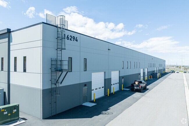
16294 S Bringhurst Blvd, Bluffdale, UT 84065


NEARBY LISTINGS FOR SALE OR LEASE
Property Detail
16294 S Bringhurst Blvd
Salt Lake City
Bringhurst Station Industrial Park
Salt Lake City, UT
LOT 106, BRINGHURST STATION INDUSTRIAL PARK
33-22-403-001-0000
Salt Lake
Multipleuses
Utah
2024
106
2025
2.39 AC
112827
Riverton
34,020 SF
DEMOGRAPHICS near 16294 S Bringhurst Blvd
1 Mile
3 Mile
5 Mile
2024 Total Population
1,381
32,263
140,758
2029 Population
1,446
35,383
154,046
Pop Growth 2024-2029
+ 4.71%
+ 9.67%
+ 9.44%
Average Age
28
29
31
2024 Total Households
404
9,149
39,844
HH Growth 2024-2029
+ 4.70%
+ 9.66%
+ 9.56%
Median Household Inc
$96,428
$108,234
$111,560
Avg Household Size
3.40
3.50
3.40
2024 Avg HH Vehicles
2.00
2.00
2.00
Median Home Value
$571,212
$586,522
$539,948
Median Year Built
2011
2010
2010
Nearby Places
Map Layers
Map Styles
 Street
 Aerial
- Restaurants
- Banks
- Shops
- Fitness
- Groceries
PUBLIC TRANSPORTATION
COMMUTER RAIL
Lehi Station (FrontRunner - Utah Transit Authority (UTA))
DRIVE
WALK
Distance
Lehi Station (FrontRunner - Utah Transit Authority (UTA))
10 min
6.1 mi
Draper Station (FrontRunner - Utah Transit Authority (UTA))
DRIVE
WALK
Distance
Draper Station (FrontRunner - Utah Transit Authority (UTA))
11 min
6.3 mi
AIRPORT
Salt Lake City International
DRIVE
WALK
Distance
Salt Lake City International
36 min
25.3 mi
Provo Municipal
DRIVE
WALK
Distance
Provo Municipal
34 min
25.6 mi
Freight Ports
Port of Stockton
DRIVE
WALK
Distance
Port of Stockton
731 min
707.3 mi
Nearby Properties
Address
Land Use
TOTAL SIZE
Lot Size
Zoning
Address
Land Use
TOTAL SIZE
Lot Size
Zoning
373,246 SF
30.09 AC
C-2
Address
Land Use
TOTAL SIZE
Lot Size
Zoning
702,133 SF
19.46 AC
Address
Land Use
TOTAL SIZE
Lot Size
Zoning
187,621 SF
3.64 AC
1103
Address
Land Use
TOTAL SIZE
Lot Size
Zoning
99,144 SF
6.23 AC
HC
Address
Land Use
TOTAL SIZE
Lot Size
Zoning
81,925 SF
10.13 AC
MU
Address
Land Use
TOTAL SIZE
Lot Size
Zoning
311,093 SF
39.70 AC
C-2
Address
Land Use
TOTAL SIZE
Lot Size
Zoning
53,777 SF
229.36 AC
SF-1
Address
Land Use
TOTAL SIZE
Lot Size
Zoning
247,594 SF
19.01 AC
Address
Land Use
TOTAL SIZE
Lot Size
Zoning
96,629 SF
14.43 AC
MU
Address
Land Use
TOTAL SIZE
Lot Size
Zoning
83,309 SF
4.75 AC
HC
Address
Land Use
TOTAL SIZE
Lot Size
Zoning
103,178 SF
33.52 AC
PF
Address
Land Use
TOTAL SIZE
Lot Size
Zoning
153,475 SF
3.37 AC
Address
Land Use
TOTAL SIZE
Lot Size
Zoning
32,825 SF
8.42 AC
MU
Address
Land Use
TOTAL SIZE
Lot Size
Zoning
171,841 SF
22.77 AC
Address
Land Use
TOTAL SIZE
Lot Size
Zoning
324,963 SF
10.03 AC
RMF
Address
Land Use
TOTAL SIZE
Lot Size
Zoning
92,428 SF
3.47 AC
1103
Address
Land Use
TOTAL SIZE
Lot Size
Zoning
128,345 SF
4.88 AC
Address
Land Use
TOTAL SIZE
Lot Size
Zoning
13,923 SF
57.11 AC
PF
Address
Land Use
TOTAL SIZE
Lot Size
Zoning
142,042 SF
6.99 AC
Address
Land Use
TOTAL SIZE
Lot Size
Zoning
274,419 SF
11.51 AC
Address
Land Use
TOTAL SIZE
Lot Size
Zoning
76,194 SF
7.16 AC
H-C
Address
Land Use
TOTAL SIZE
Lot Size
Zoning
126,946 SF
7.19 AC
Address
Land Use
TOTAL SIZE
Lot Size
Zoning
30,034 SF
7.27 AC
C-R
Address
Land Use
TOTAL SIZE
Lot Size
Zoning
127,744 SF
6 AC
Address
Land Use
TOTAL SIZE
Lot Size
Zoning
111,347 SF
9.77 AC
MU
Address
Land Use
TOTAL SIZE
Lot Size
Zoning
79,000 SF
4.38 AC
HC
Address
Land Use
TOTAL SIZE
Lot Size
Zoning
159,119 SF
8.47 AC
Address
Land Use
TOTAL SIZE
Lot Size
Zoning
107,728 SF
7.71 AC
Address
Land Use
TOTAL SIZE
Lot Size
Zoning
118,244 SF
7.23 AC
I-1
Address
Land Use
TOTAL SIZE
Lot Size
Zoning
110.88 AC
4144
The World's #1 Commercial Real Estate Marketplace
Connect with us
© 2025 CoStar Group
The information above has been obtained from sources believed reliable. While we do not doubt its accuracy we have not verified it and make no guarantee, warranty or representation about it. It is your responsibility to independently confirm its accuracy and completeness. Any projections, opinions, assumptions, or estimates used are for example only and do not represent the current or future performance of the property. The value of this transaction to you depends on tax and other factors which should be evaluated by your tax, financial, and legal advisors. You and your advisors should conduct a careful, independent investigation of the property to determine to your satisfaction the suitability of the property for your needs.