Property Record
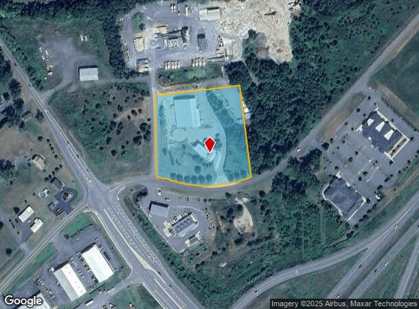
16299 Allied Way, Culpeper, VA 22701
NEARBY LISTINGS FOR SALE OR LEASE
-
-
View all Culpeper listings for sale on LoopNet.com
Property Detail
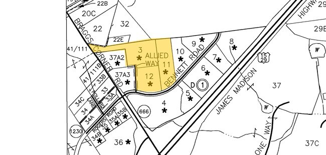
16299 Allied Way
Washington-Arlington-Alexandria, DC-VA-MD-WV
109
42-D-1-12
ALLIED COMMERCIAL PARK LOT 12 PF 2/520-522
Commercialnec
Culpeper
X
Virginia
51137C0025E
12
2024
3.79 AC
2025
Suburban Virginia Area
930300
Other Market Areas
4,132 SF
DEMOGRAPHICS near 16299 Allied Way
1 Mile
3 Mile
5 Mile
2024 Total Population
125
14,564
30,057
2029 Population
136
15,888
32,879
Pop Growth 2024-2029
+ 8.80%
+ 9.09%
+ 9.39%
Average Age
37
37
38
2024 Total Households
44
5,125
10,462
HH Growth 2024-2029
+ 9.09%
+ 9.33%
+ 9.59%
Median Household Inc
$74,999
$77,404
$82,809
Avg Household Size
2.70
2.70
2.80
2024 Avg HH Vehicles
2.00
2.00
2.00
Median Home Value
$414,286
$320,709
$331,160
Median Year Built
1996
1991
1993
Nearby Places
- Restaurants
- Banks
- Shops
- Fitness
- Groceries
PUBLIC TRANSPORTATION
COMMUTER RAIL
Culpeper Amtrak Station (Cardinal - Amtrak, Crescent - Amtrak, Northeast Regional - Amtrak)
DRIVE
WALK
Distance
Culpeper Amtrak Station (Cardinal - Amtrak, Crescent - Amtrak, Northeast Regional - Amtrak)
7 min
3.1 mi
Freight Ports
Virginia Port Authority - Richmond
DRIVE
WALK
Distance
Virginia Port Authority - Richmond
123 min
92.7 mi
Nearby Properties
Address
Land Use
TOTAL SIZE
Lot Size
Zoning
Address
Land Use
TOTAL SIZE
Lot Size
Zoning
377,903 SF
30.12 AC
LI
Address
Land Use
TOTAL SIZE
Lot Size
Zoning
386,833 SF
15.80 AC
R1
Address
Land Use
TOTAL SIZE
Lot Size
Zoning
165,275 SF
78.67 AC
R1
Address
Land Use
TOTAL SIZE
Lot Size
Zoning
25,802 SF
64.06 AC
A1
Address
Land Use
TOTAL SIZE
Lot Size
Zoning
147,265 SF
29.61 AC
M1
Address
Land Use
TOTAL SIZE
Lot Size
Zoning
220,403 SF
8.91 AC
R1
Address
Land Use
TOTAL SIZE
Lot Size
Zoning
58.15 AC
M2
Address
Land Use
TOTAL SIZE
Lot Size
Zoning
54.85 AC
LI
Address
Land Use
TOTAL SIZE
Lot Size
Zoning
41.97 AC
LI
Address
Land Use
TOTAL SIZE
Lot Size
Zoning
43,800 SF
13.28 AC
C3
Address
Land Use
TOTAL SIZE
Lot Size
Zoning
19,602 SF
10.32 AC
M1
Address
Land Use
TOTAL SIZE
Lot Size
Zoning
6,294 SF
33.37 AC
M2
Address
Land Use
TOTAL SIZE
Lot Size
Zoning
179,344 SF
17.34 AC
C3
Address
Land Use
TOTAL SIZE
Lot Size
Zoning
38,890 SF
32.91 AC
LIRA
Address
Land Use
TOTAL SIZE
Lot Size
Zoning
63,866 SF
8.99 AC
C3
Address
Land Use
TOTAL SIZE
Lot Size
Zoning
28.26 AC
LI
Address
Land Use
TOTAL SIZE
Lot Size
Zoning
201,634 SF
18.40 AC
M2
Address
Land Use
TOTAL SIZE
Lot Size
Zoning
69,372 SF
7.93 AC
C3
Address
Land Use
TOTAL SIZE
Lot Size
Zoning
68,613 SF
22.46 AC
M2
Address
Land Use
TOTAL SIZE
Lot Size
Zoning
13,474 SF
16.58 AC
PUD
Address
Land Use
TOTAL SIZE
Lot Size
Zoning
50,277 SF
50.97 AC
RA
Address
Land Use
TOTAL SIZE
Lot Size
Zoning
20.48 AC
LI
Address
Land Use
TOTAL SIZE
Lot Size
Zoning
10,720 SF
17.57 AC
R3
Address
Land Use
TOTAL SIZE
Lot Size
Zoning
143,552 SF
10.34 AC
R2
Address
Land Use
TOTAL SIZE
Lot Size
Zoning
165,854 SF
12.53 AC
R4
Address
Land Use
TOTAL SIZE
Lot Size
Zoning
59,210 SF
4.40 AC
R1R3
Address
Land Use
TOTAL SIZE
Lot Size
Zoning
127,058 SF
9.84 AC
C3
Address
Land Use
TOTAL SIZE
Lot Size
Zoning
111,844 SF
12.17 AC
C3
Address
Land Use
TOTAL SIZE
Lot Size
Zoning
282,110 SF
30.44 AC
M2
Address
Land Use
TOTAL SIZE
Lot Size
Zoning
5,408 SF
5 AC
C3
The World's #1 Commercial Real Estate Marketplace
Connect with us
© 2025 CoStar Group
The information above has been obtained from sources believed reliable. While we do not doubt its accuracy we have not verified it and make no guarantee, warranty or representation about it. It is your responsibility to independently confirm its accuracy and completeness. Any projections, opinions, assumptions, or estimates used are for example only and do not represent the current or future performance of the property. The value of this transaction to you depends on tax and other factors which should be evaluated by your tax, financial, and legal advisors. You and your advisors should conduct a careful, independent investigation of the property to determine to your satisfaction the suitability of the property for your needs.