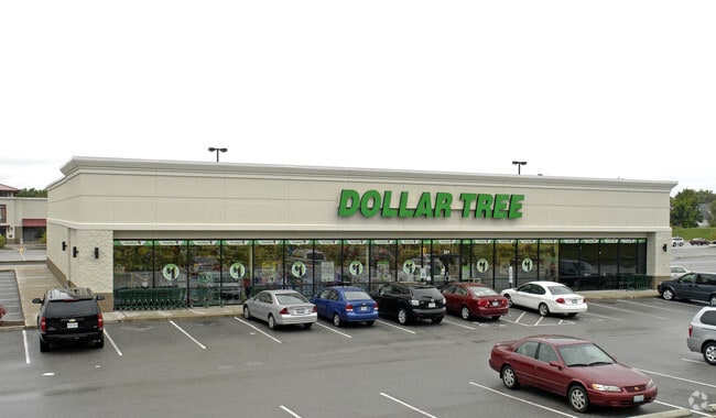
Property Record
Highway K, Ofallon, MO 63366

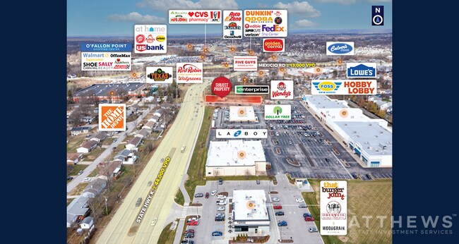

NEARBY LISTINGS FOR SALE OR LEASE
Property Detail
Highway K
St. Louis, MO-IL
Megan Crossing Bdry Adj Lot 3
2-0061-D005-00-0003.0000000
MEGAN CROSSING BDRY ADJ LOT 3 LOT 3
Commercialnec
St. Charles
X
Missouri
29183C0237G
3
2024
1.01 AC
2025
St Charles County
311802
St. Louis
10,304 SF
DEMOGRAPHICS near Highway K
1 Mile
3 Mile
5 Mile
2024 Total Population
11,197
87,784
168,296
2029 Population
11,843
92,553
178,156
Pop Growth 2024-2029
+ 5.77%
+ 5.43%
+ 5.86%
Average Age
39
40
40
2024 Total Households
4,223
32,450
62,762
HH Growth 2024-2029
+ 5.85%
+ 5.49%
+ 5.93%
Median Household Inc
$80,626
$96,403
$98,748
Avg Household Size
2.60
2.70
2.60
2024 Avg HH Vehicles
2.00
2.00
2.00
Median Home Value
$243,024
$272,536
$280,340
Median Year Built
1994
1995
1996
Nearby Places
Map Layers
Map Styles
 Street
 Aerial
- Restaurants
- Banks
- Shops
- Fitness
- Groceries
PUBLIC TRANSPORTATION
AIRPORT
St Louis Lambert International
DRIVE
WALK
Distance
St Louis Lambert International
36 min
23.0 mi
Freight Ports
Port of Shreveport
DRIVE
WALK
Distance
Port of Shreveport
692 min
592.3 mi
SALE & LEASE HISTORY
LISTING DATE
SALE/LEASE

Oct 08, 2019
For Sale
Jan 26, 2023
For Sale
Nearby Properties
Address
Land Use
TOTAL SIZE
Lot Size
Zoning
Address
Land Use
TOTAL SIZE
Lot Size
Zoning
163,438 SF
5.76 AC
Address
Land Use
TOTAL SIZE
Lot Size
Zoning
418,104 SF
38.83 AC
Address
Land Use
TOTAL SIZE
Lot Size
Zoning
71,908 SF
8.72 AC
Address
Land Use
TOTAL SIZE
Lot Size
Zoning
254,435 SF
16.57 AC
Address
Land Use
TOTAL SIZE
Lot Size
Zoning
342,840 SF
58.93 AC
AB6
Address
Land Use
TOTAL SIZE
Lot Size
Zoning
235,876 SF
11.35 AC
Address
Land Use
TOTAL SIZE
Lot Size
Zoning
261,357 SF
7.90 AC
Address
Land Use
TOTAL SIZE
Lot Size
Zoning
46,388 SF
10.76 AC
Address
Land Use
TOTAL SIZE
Lot Size
Zoning
75.10 AC
AC7
Address
Land Use
TOTAL SIZE
Lot Size
Zoning
399,520 SF
16.98 AC
AB3
Address
Land Use
TOTAL SIZE
Lot Size
Zoning
591,516 SF
28.79 AC
AB2
Address
Land Use
TOTAL SIZE
Lot Size
Zoning
32.19 AC
AA1
Address
Land Use
TOTAL SIZE
Lot Size
Zoning
36,438 SF
2.08 AC
AC4
Address
Land Use
TOTAL SIZE
Lot Size
Zoning
429,473 SF
82.18 AC
Address
Land Use
TOTAL SIZE
Lot Size
Zoning
167,090 SF
19.85 AC
Address
Land Use
TOTAL SIZE
Lot Size
Zoning
49,680 SF
2.22 AC
Address
Land Use
TOTAL SIZE
Lot Size
Zoning
251,169 SF
20.19 AC
Address
Land Use
TOTAL SIZE
Lot Size
Zoning
562,434 SF
40.73 AC
AB3
Address
Land Use
TOTAL SIZE
Lot Size
Zoning
210,095 SF
12.29 AC
AE9
Address
Land Use
TOTAL SIZE
Lot Size
Zoning
53,636 SF
Address
Land Use
TOTAL SIZE
Lot Size
Zoning
201,531 SF
22.28 AC
Address
Land Use
TOTAL SIZE
Lot Size
Zoning
48.76 AC
AF0
Address
Land Use
TOTAL SIZE
Lot Size
Zoning
109,400 SF
19.94 AC
Address
Land Use
TOTAL SIZE
Lot Size
Zoning
197,791 SF
18.58 AC
Address
Land Use
TOTAL SIZE
Lot Size
Zoning
261,016 SF
15.27 AC
Address
Land Use
TOTAL SIZE
Lot Size
Zoning
47.95 AC
AF0
Address
Land Use
TOTAL SIZE
Lot Size
Zoning
5,548 SF
68.46 AC
Address
Land Use
TOTAL SIZE
Lot Size
Zoning
129,472 SF
22 AC
AC2
Address
Land Use
TOTAL SIZE
Lot Size
Zoning
113,099 SF
12.12 AC
Address
Land Use
TOTAL SIZE
Lot Size
Zoning
147,526 SF
7.51 AC
AE8
The World's #1 Commercial Real Estate Marketplace
Connect with us
© 2025 CoStar Group
The information above has been obtained from sources believed reliable. While we do not doubt its accuracy we have not verified it and make no guarantee, warranty or representation about it. It is your responsibility to independently confirm its accuracy and completeness. Any projections, opinions, assumptions, or estimates used are for example only and do not represent the current or future performance of the property. The value of this transaction to you depends on tax and other factors which should be evaluated by your tax, financial, and legal advisors. You and your advisors should conduct a careful, independent investigation of the property to determine to your satisfaction the suitability of the property for your needs.