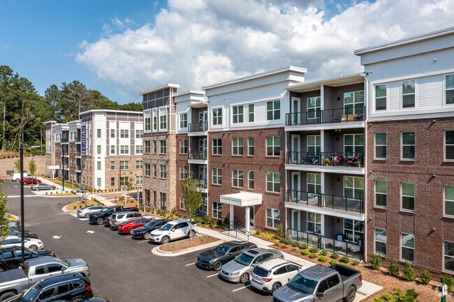
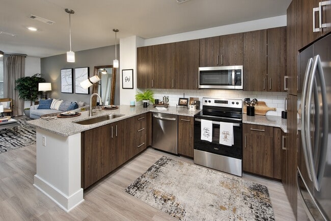
Property Record
1630 Peachtree Industrial Blvd, Suwanee, GA 30024

NEARBY LISTINGS FOR SALE OR LEASE
Property Detail
1630 Peachtree Industrial Blvd
Atlanta-Sandy Springs-Roswell, GA
Peachtree Ind Blvd
7-207-085
LONG DRIVE OFF MAIN ROAD TO GET TO PROPE NO COMFORTABLE AN LAND F/C 4/15- HOUSE IS RECESSED
Apartment
Gwinnett
AE
Georgia
13121C0111G
433
2023
8.74 AC
2025
Duluth
011648
Atlanta
232,176 SF
DEMOGRAPHICS near 1630 Peachtree Industrial Blvd
1 Mile
3 Mile
5 Mile
2024 Total Population
7,770
58,764
178,929
2029 Population
8,103
61,948
188,645
Pop Growth 2024-2029
+ 4.29%
+ 5.42%
+ 5.43%
Average Age
38
39
39
2024 Total Households
2,846
20,433
61,822
HH Growth 2024-2029
+ 4.53%
+ 5.53%
+ 5.42%
Median Household Inc
$102,816
$116,005
$100,699
Avg Household Size
2.70
2.80
2.90
2024 Avg HH Vehicles
2.00
2.00
2.00
Median Home Value
$375,073
$415,041
$400,839
Median Year Built
1997
2000
1997
Nearby Places
Map Layers
Map Styles
 Street
 Aerial
- Restaurants
- Banks
- Shops
- Fitness
- Groceries
PUBLIC TRANSPORTATION
AIRPORT
Hartsfield - Jackson Atlanta International
DRIVE
WALK
Distance
Hartsfield - Jackson Atlanta International
55 min
40.3 mi
Nearby Properties
Address
Land Use
TOTAL SIZE
Lot Size
Zoning
Address
Land Use
TOTAL SIZE
Lot Size
Zoning
482,658 SF
17.05 AC
MUR
Address
Land Use
TOTAL SIZE
Lot Size
Zoning
509,302 SF
55.13 AC
RM8
Address
Land Use
TOTAL SIZE
Lot Size
Zoning
534,578 SF
44.21 AC
RM8
Address
Land Use
TOTAL SIZE
Lot Size
Zoning
393,939 SF
42.21 AC
RM8
Address
Land Use
TOTAL SIZE
Lot Size
Zoning
404,176 SF
32.67 AC
M2
Address
Land Use
TOTAL SIZE
Lot Size
Zoning
393,913 SF
25.93 AC
RM13
Address
Land Use
TOTAL SIZE
Lot Size
Zoning
280,454 SF
19.97 AC
MUR
Address
Land Use
TOTAL SIZE
Lot Size
Zoning
359,241 SF
21.02 AC
PMUD
Address
Land Use
TOTAL SIZE
Lot Size
Zoning
471,807 SF
69.50 AC
R100
Address
Land Use
TOTAL SIZE
Lot Size
Zoning
379,183 SF
6.09 AC
PMUD
Address
Land Use
TOTAL SIZE
Lot Size
Zoning
334,841 SF
28.14 AC
RM13
Address
Land Use
TOTAL SIZE
Lot Size
Zoning
304,276 SF
14.90 AC
MUR
Address
Land Use
TOTAL SIZE
Lot Size
Zoning
372,904 SF
11.64 AC
PUD
Address
Land Use
TOTAL SIZE
Lot Size
Zoning
234,420 SF
10.35 AC
PMUD
Address
Land Use
TOTAL SIZE
Lot Size
Zoning
220,779 SF
7.32 AC
PMUD
Address
Land Use
TOTAL SIZE
Lot Size
Zoning
248,400 SF
13.92 AC
MUO
Address
Land Use
TOTAL SIZE
Lot Size
Zoning
385,167 SF
49.55 AC
M1
Address
Land Use
TOTAL SIZE
Lot Size
Zoning
503,650 SF
34.37 AC
M1
Address
Land Use
TOTAL SIZE
Lot Size
Zoning
332,011 SF
8.84 AC
PMUD
Address
Land Use
TOTAL SIZE
Lot Size
Zoning
326,904 SF
46.73 AC
OI
Address
Land Use
TOTAL SIZE
Lot Size
Zoning
553,941 SF
32.82 AC
M1
Address
Land Use
TOTAL SIZE
Lot Size
Zoning
184,890 SF
3 AC
PMUD
Address
Land Use
TOTAL SIZE
Lot Size
Zoning
185,524 SF
12.61 AC
M1
Address
Land Use
TOTAL SIZE
Lot Size
Zoning
160,021 SF
14.27 AC
PMUD
Address
Land Use
TOTAL SIZE
Lot Size
Zoning
201,040 SF
26.40 AC
R100
Address
Land Use
TOTAL SIZE
Lot Size
Zoning
235,807 SF
1.90 AC
M1
Address
Land Use
TOTAL SIZE
Lot Size
Zoning
175,613 SF
17.63 AC
M1
Address
Land Use
TOTAL SIZE
Lot Size
Zoning
143,457 SF
7.85 AC
OI
Address
Land Use
TOTAL SIZE
Lot Size
Zoning
96,165 SF
47.41 AC
PMUD
The World's #1 Commercial Real Estate Marketplace
Connect with us
© 2026 CoStar Group
The information above has been obtained from sources believed reliable. While we do not doubt its accuracy we have not verified it and make no guarantee, warranty or representation about it. It is your responsibility to independently confirm its accuracy and completeness. Any projections, opinions, assumptions, or estimates used are for example only and do not represent the current or future performance of the property. The value of this transaction to you depends on tax and other factors which should be evaluated by your tax, financial, and legal advisors. You and your advisors should conduct a careful, independent investigation of the property to determine to your satisfaction the suitability of the property for your needs.