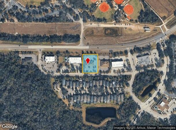
Property Record
16301 Fishhawk Blvd, Lithia, FL 33547

NEARBY LISTINGS FOR SALE OR LEASE
Property Detail
16301 Fishhawk Blvd
Tampa-St. Petersburg-Clearwater, FL
Fishhawk Ranch Tract 8
U-21-30-21-9IN-000000-00003.0
FISHHAWK RANCH TRACT 8 LOT 3 LESS THAT PART DESC AS FOLLOWS: COMM AT NE COR OF LOT 3 FOR POB RUN THN ALG ELY BDRY S 00 DEG 24 MIN 52 SEC W 221.01 FT TO SE COR THEREOF THN ALG S BDRY OF LOT 3 ALSO BEING N BDRY OF TRACT A (BAYBERRY GLEN DRIVE) RUN N 89
Medicalbuilding
Hillsborough
X
Florida
12057C0530H
3
2024
0.93 AC
2024
Eastern Outlying
013922
Tampa/St Petersburg
7,260 SF
DEMOGRAPHICS near 16301 Fishhawk Blvd
1 Mile
3 Mile
5 Mile
2024 Total Population
7,877
35,814
83,986
2029 Population
8,528
38,896
91,709
Pop Growth 2024-2029
+ 8.26%
+ 8.61%
+ 9.20%
Average Age
35
37
39
2024 Total Households
2,400
11,210
27,396
HH Growth 2024-2029
+ 8.54%
+ 8.87%
+ 9.42%
Median Household Inc
$136,049
$118,297
$109,268
Avg Household Size
3.30
3.10
3.00
2024 Avg HH Vehicles
2.00
2.00
2.00
Median Home Value
$497,221
$420,413
$366,813
Median Year Built
2008
2004
1999
Nearby Places
Map Layers
Map Styles
 Street
 Aerial
- Restaurants
- Banks
- Shops
- Fitness
- Groceries
PUBLIC TRANSPORTATION
AIRPORT
Tampa International
DRIVE
WALK
Distance
Tampa International
47 min
27.9 mi
St Pete-Clearwater International
DRIVE
WALK
Distance
St Pete-Clearwater International
64 min
37.9 mi
Freight Ports
Port of Tampa Bay
DRIVE
WALK
Distance
Port of Tampa Bay
35 min
18.7 mi
Nearby Properties
Address
Land Use
TOTAL SIZE
Lot Size
Zoning
Address
Land Use
TOTAL SIZE
Lot Size
Zoning
421,873 SF
93.26 AC
PD
Address
Land Use
TOTAL SIZE
Lot Size
Zoning
361,294 SF
10.30 AC
PD
Address
Land Use
TOTAL SIZE
Lot Size
Zoning
231,811 SF
26.54 AC
PD
Address
Land Use
TOTAL SIZE
Lot Size
Zoning
870 AC
AR
Address
Land Use
TOTAL SIZE
Lot Size
Zoning
25,210 SF
66.38 AC
AR
Address
Land Use
TOTAL SIZE
Lot Size
Zoning
96,158 SF
11.98 AC
PD
Address
Land Use
TOTAL SIZE
Lot Size
Zoning
233.81 AC
AR
Address
Land Use
TOTAL SIZE
Lot Size
Zoning
99,450 SF
13.65 AC
PD
Address
Land Use
TOTAL SIZE
Lot Size
Zoning
97,587 SF
24.06 AC
PD
Address
Land Use
TOTAL SIZE
Lot Size
Zoning
99,384 SF
14.72 AC
PD
Address
Land Use
TOTAL SIZE
Lot Size
Zoning
67,300 SF
10.03 AC
PD
Address
Land Use
TOTAL SIZE
Lot Size
Zoning
69,591 SF
38.33 AC
PD
Address
Land Use
TOTAL SIZE
Lot Size
Zoning
93,917 SF
30.89 AC
PD
Address
Land Use
TOTAL SIZE
Lot Size
Zoning
54,698 SF
8.28 AC
PD
Address
Land Use
TOTAL SIZE
Lot Size
Zoning
48,842 SF
6.18 AC
AS-1
Address
Land Use
TOTAL SIZE
Lot Size
Zoning
60,362 SF
6.47 AC
PD
Address
Land Use
TOTAL SIZE
Lot Size
Zoning
297.24 AC
PD
Address
Land Use
TOTAL SIZE
Lot Size
Zoning
48,315 SF
3.11 AC
PD
Address
Land Use
TOTAL SIZE
Lot Size
Zoning
34,982 SF
4.26 AC
PD
Address
Land Use
TOTAL SIZE
Lot Size
Zoning
25,854 SF
170.94 AC
PD
Address
Land Use
TOTAL SIZE
Lot Size
Zoning
21,271 SF
1.93 AC
PD
Address
Land Use
TOTAL SIZE
Lot Size
Zoning
23,527 SF
16.67 AC
AS-1
Address
Land Use
TOTAL SIZE
Lot Size
Zoning
30,135 SF
154.29 AC
AR
Address
Land Use
TOTAL SIZE
Lot Size
Zoning
408.10 AC
AR
Address
Land Use
TOTAL SIZE
Lot Size
Zoning
17,301 SF
3.72 AC
PD
Address
Land Use
TOTAL SIZE
Lot Size
Zoning
288.37 AC
PD
Address
Land Use
TOTAL SIZE
Lot Size
Zoning
285.69 AC
AR
Address
Land Use
TOTAL SIZE
Lot Size
Zoning
35,136 SF
0.78 AC
PD
Address
Land Use
TOTAL SIZE
Lot Size
Zoning
33,381 SF
197.92 AC
PD
Address
Land Use
TOTAL SIZE
Lot Size
Zoning
13,800 SF
3.55 AC
PD
The World's #1 Commercial Real Estate Marketplace
Connect with us
© 2026 CoStar Group
The information above has been obtained from sources believed reliable. While we do not doubt its accuracy we have not verified it and make no guarantee, warranty or representation about it. It is your responsibility to independently confirm its accuracy and completeness. Any projections, opinions, assumptions, or estimates used are for example only and do not represent the current or future performance of the property. The value of this transaction to you depends on tax and other factors which should be evaluated by your tax, financial, and legal advisors. You and your advisors should conduct a careful, independent investigation of the property to determine to your satisfaction the suitability of the property for your needs.