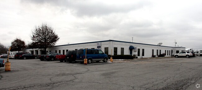
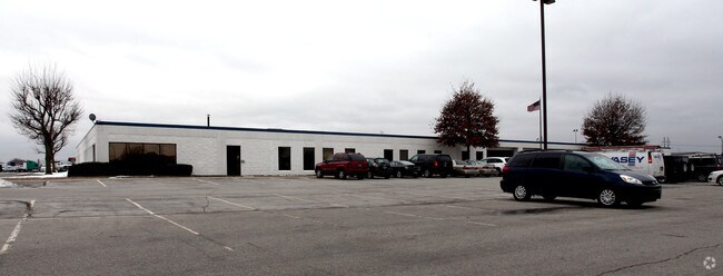
Property Record
1631 W Thompson Rd, Indianapolis, IN 46217
NEARBY LISTINGS FOR SALE OR LEASE
Property Detail
1631 W Thompson Rd
49-14-03-109-005.000-500
693.72FT TOBEG 20.99AC
Truckterminal
Marion
A
Indiana
18097C0229F
20.99 AC
2023
Bluff Road
2024
Indianapolis
380103
Indianapolis-Carmel-Anderson, IN
163,291 SF
DEMOGRAPHICS near 1631 W Thompson Rd
1 Mile
3 Mile
5 Mile
2024 Total Population
1,222
46,250
164,295
2029 Population
1,198
45,370
163,070
Pop Growth 2024-2029
(1.96%)
(1.90%)
(0.75%)
Average Age
34
36
37
2024 Total Households
392
17,766
62,269
HH Growth 2024-2029
(2.04%)
(1.98%)
(0.78%)
Median Household Inc
$109,187
$63,847
$60,008
Avg Household Size
3.10
2.50
2.50
2024 Avg HH Vehicles
2.00
2.00
2.00
Median Home Value
$165,744
$179,992
$168,894
Median Year Built
1952
1975
1969
Nearby Places
Map Layers
Map Styles
 Street
 Aerial
- Restaurants
- Banks
- Shops
- Fitness
- Groceries
PUBLIC TRANSPORTATION
COMMUTER RAIL
Indianapolis (Cardinal - Amtrak)
DRIVE
WALK
Distance
Indianapolis (Cardinal - Amtrak)
11 min
6.2 mi
AIRPORT
Indianapolis International
DRIVE
WALK
Distance
Indianapolis International
23 min
12.7 mi
Freight Ports
Port of Toledo
DRIVE
WALK
Distance
Port of Toledo
281 min
234.8 mi
Nearby Properties
Address
Land Use
TOTAL SIZE
Lot Size
Zoning
Address
Land Use
TOTAL SIZE
Lot Size
Zoning
5,470 SF
35.46 AC
Address
Land Use
TOTAL SIZE
Lot Size
Zoning
405,888 SF
19.56 AC
ZO01
Address
Land Use
TOTAL SIZE
Lot Size
Zoning
5,279 SF
18.07 AC
ZO01
Address
Land Use
TOTAL SIZE
Lot Size
Zoning
1,812 SF
11.08 AC
ZO01
Address
Land Use
TOTAL SIZE
Lot Size
Zoning
3,818 SF
15.24 AC
Address
Land Use
TOTAL SIZE
Lot Size
Zoning
5,779 SF
15.77 AC
Address
Land Use
TOTAL SIZE
Lot Size
Zoning
4,476 SF
12.18 AC
Address
Land Use
TOTAL SIZE
Lot Size
Zoning
1,925 SF
29.98 AC
Address
Land Use
TOTAL SIZE
Lot Size
Zoning
3,337 SF
21.53 AC
ZO01
Address
Land Use
TOTAL SIZE
Lot Size
Zoning
65,551 SF
12.84 AC
ZO01
Address
Land Use
TOTAL SIZE
Lot Size
Zoning
5,665 SF
25.25 AC
ZO01
Address
Land Use
TOTAL SIZE
Lot Size
Zoning
39,618 SF
8.17 AC
ZO01
Address
Land Use
TOTAL SIZE
Lot Size
Zoning
1,932 SF
19.63 AC
ZO01
Address
Land Use
TOTAL SIZE
Lot Size
Zoning
18,209 SF
38.23 AC
ZO01
Address
Land Use
TOTAL SIZE
Lot Size
Zoning
2,928 SF
17.76 AC
Address
Land Use
TOTAL SIZE
Lot Size
Zoning
220,708 SF
26.81 AC
ZO01
Address
Land Use
TOTAL SIZE
Lot Size
Zoning
1,372 SF
25.27 AC
Address
Land Use
TOTAL SIZE
Lot Size
Zoning
112,178 SF
23.51 AC
ZO01
Address
Land Use
TOTAL SIZE
Lot Size
Zoning
5,075 SF
8 AC
ZO01
Address
Land Use
TOTAL SIZE
Lot Size
Zoning
72,509 SF
11.07 AC
ZO01
Address
Land Use
TOTAL SIZE
Lot Size
Zoning
24,398 SF
4.12 AC
ZO01
Address
Land Use
TOTAL SIZE
Lot Size
Zoning
355,250 SF
42.64 AC
ZO01
Address
Land Use
TOTAL SIZE
Lot Size
Zoning
104,036 SF
9.27 AC
ZO01
Address
Land Use
TOTAL SIZE
Lot Size
Zoning
18,211 SF
16.44 AC
ZO01
Address
Land Use
TOTAL SIZE
Lot Size
Zoning
22,364 SF
92.67 AC
ZO01
Address
Land Use
TOTAL SIZE
Lot Size
Zoning
1,639 SF
11.26 AC
ZO01
Address
Land Use
TOTAL SIZE
Lot Size
Zoning
49,810 SF
6.40 AC
Address
Land Use
TOTAL SIZE
Lot Size
Zoning
93,650 SF
7.71 AC
ZO01
Address
Land Use
TOTAL SIZE
Lot Size
Zoning
13,339 SF
9.98 AC
ZO01
The World's #1 Commercial Real Estate Marketplace
Connect with us
© 2026 CoStar Group
The information above has been obtained from sources believed reliable. While we do not doubt its accuracy we have not verified it and make no guarantee, warranty or representation about it. It is your responsibility to independently confirm its accuracy and completeness. Any projections, opinions, assumptions, or estimates used are for example only and do not represent the current or future performance of the property. The value of this transaction to you depends on tax and other factors which should be evaluated by your tax, financial, and legal advisors. You and your advisors should conduct a careful, independent investigation of the property to determine to your satisfaction the suitability of the property for your needs.