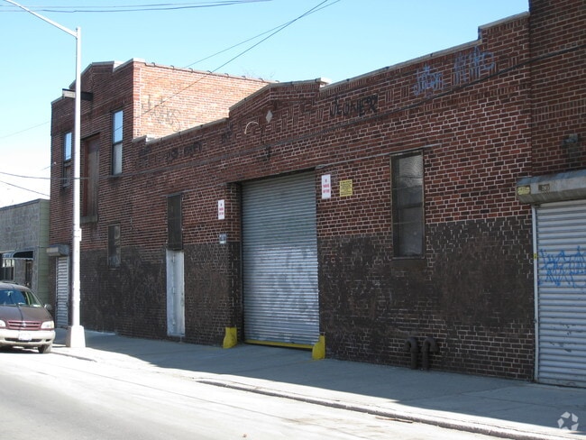
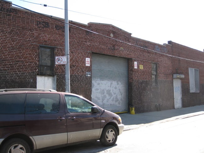
Property Record
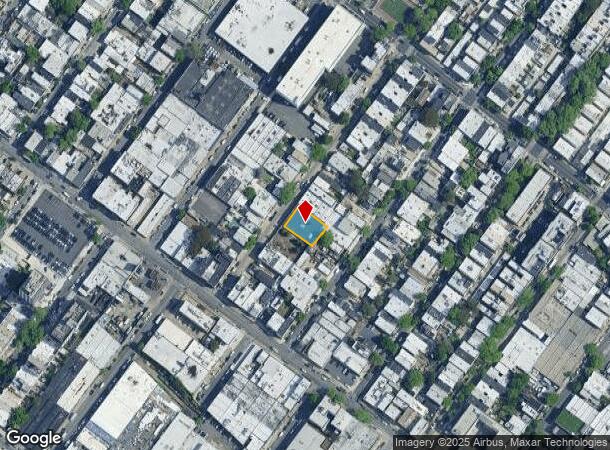
1632 George St, Ridgewood, NY 11385
NEARBY LISTINGS FOR SALE OR LEASE
Property Detail
1632 George St
03552-0023
Queens
Lightindustrial
New York
X
23
3604970209F
0.17 AC
2024
Central Queens
2025
Long Island (New York)
058500
New York-Jersey City-White Plains, NY-NJ
7,500 SF
DEMOGRAPHICS near 1632 George St
1 Mile
3 Mile
5 Mile
2024 Total Population
128,318
1,004,272
2,826,197
2029 Population
118,057
934,276
2,649,199
Pop Growth 2024-2029
(8.00%)
(6.97%)
(6.26%)
Average Age
37
38
39
2024 Total Households
45,134
356,566
1,077,515
HH Growth 2024-2029
(8.58%)
(7.44%)
(6.44%)
Median Household Inc
$69,531
$61,255
$73,109
Avg Household Size
2.70
2.70
2.50
2024 Avg HH Vehicles
1.00
1.00
1.00
Median Home Value
$878,055
$783,436
$748,122
Median Year Built
1947
1948
1949
Nearby Places
- Restaurants
- Banks
- Shops
- Fitness
- Groceries
PUBLIC TRANSPORTATION
TRANSIT/SUBWAY
Halsey Street (L Line) (L - New York MTA Subway (The Subway))
DRIVE
WALK
Distance
Halsey Street (L Line) (L - New York MTA Subway (The Subway))
0 min
2 min
0.1 mi
Myrtle-Wyckoff Avenues (L - New York MTA Subway (The Subway), M - New York MTA Subway (The Subway))
DRIVE
WALK
Distance
Myrtle-Wyckoff Avenues (L - New York MTA Subway (The Subway), M - New York MTA Subway (The Subway))
2 min
10 min
0.5 mi
Seneca Avenue (M - New York MTA Subway (The Subway))
DRIVE
WALK
Distance
Seneca Avenue (M - New York MTA Subway (The Subway))
2 min
11 min
0.6 mi
Forest Avenue (M - New York MTA Subway (The Subway))
DRIVE
WALK
Distance
Forest Avenue (M - New York MTA Subway (The Subway))
3 min
12 min
0.7 mi
Wilson Avenue (L - New York MTA Subway (The Subway))
DRIVE
WALK
Distance
Wilson Avenue (L - New York MTA Subway (The Subway))
4 min
16 min
0.8 mi
COMMUTER RAIL
East New York Station (Far Rockaway Branch - Long Island Rail Road, Long Beach Branch - Long Island Rail Road, West Hempstead Branch - Long Island Rail Road)
DRIVE
WALK
Distance
East New York Station (Far Rockaway Branch - Long Island Rail Road, Long Beach Branch - Long Island Rail Road, West Hempstead Branch - Long Island Rail Road)
5 min
2.2 mi
Nostrand Avenue Station (Far Rockaway Branch - Long Island Rail Road, Hempstead Branch - Long Island Rail Road, Long Beach Branch - Long Island Rail Road, West Hempstead Branch - Long Island Rail Road)
DRIVE
WALK
Distance
Nostrand Avenue Station (Far Rockaway Branch - Long Island Rail Road, Hempstead Branch - Long Island Rail Road, Long Beach Branch - Long Island Rail Road, West Hempstead Branch - Long Island Rail Road)
10 min
3.6 mi
AIRPORT
LaGuardia
DRIVE
WALK
Distance
LaGuardia
17 min
7.2 mi
John F Kennedy International
DRIVE
WALK
Distance
John F Kennedy International
18 min
10.6 mi
Newark Liberty International
DRIVE
WALK
Distance
Newark Liberty International
35 min
18.3 mi
Freight Ports
NY - Red Hook Container Terminal
DRIVE
WALK
Distance
NY - Red Hook Container Terminal
16 min
7.0 mi
Nearby Properties
Address
Land Use
TOTAL SIZE
Lot Size
Zoning
Address
Land Use
TOTAL SIZE
Lot Size
Zoning
2,812,739 SF
2.10 AC
C5-3
Address
Land Use
TOTAL SIZE
Lot Size
Zoning
54,170 SF
229.57 AC
PARK
Address
Land Use
TOTAL SIZE
Lot Size
Zoning
835,231 SF
11.32 AC
R6
Address
Land Use
TOTAL SIZE
Lot Size
Zoning
126.85 AC
PARK
Address
Land Use
TOTAL SIZE
Lot Size
Zoning
264,691 SF
5.17 AC
M1-2
Address
Land Use
TOTAL SIZE
Lot Size
Zoning
1,000 SF
210.07 AC
R3-2
Address
Land Use
TOTAL SIZE
Lot Size
Zoning
1,572,198 SF
22.06 AC
M1-2
Address
Land Use
TOTAL SIZE
Lot Size
Zoning
511,776 SF
2.33 AC
R6
Address
Land Use
TOTAL SIZE
Lot Size
Zoning
826,915 SF
8.83 AC
M3-1
Address
Land Use
TOTAL SIZE
Lot Size
Zoning
446,763 SF
12.52 AC
R6
Address
Land Use
TOTAL SIZE
Lot Size
Zoning
1,150,500 SF
15.17 AC
R6
Address
Land Use
TOTAL SIZE
Lot Size
Zoning
307,038 SF
7.84 AC
M1-1
Address
Land Use
TOTAL SIZE
Lot Size
Zoning
474,715 SF
1.72 AC
M14R8A
Address
Land Use
TOTAL SIZE
Lot Size
Zoning
458,778 SF
2.09 AC
R6
Address
Land Use
TOTAL SIZE
Lot Size
Zoning
490,600 SF
12.01 AC
M1-1
Address
Land Use
TOTAL SIZE
Lot Size
Zoning
257,660 SF
1.94 AC
R7A
Address
Land Use
TOTAL SIZE
Lot Size
Zoning
1,136,208 SF
30.25 AC
R5
Address
Land Use
TOTAL SIZE
Lot Size
Zoning
353,333 SF
1.99 AC
R6A
Address
Land Use
TOTAL SIZE
Lot Size
Zoning
780,000 SF
11.15 AC
R6
Address
Land Use
TOTAL SIZE
Lot Size
Zoning
88,700 SF
4.59 AC
M3-1
Address
Land Use
TOTAL SIZE
Lot Size
Zoning
821,016 SF
8.92 AC
R6
Address
Land Use
TOTAL SIZE
Lot Size
Zoning
220,627 SF
0.79 AC
C4-4
Address
Land Use
TOTAL SIZE
Lot Size
Zoning
388,023 SF
1.58 AC
R7A
Address
Land Use
TOTAL SIZE
Lot Size
Zoning
328,860 SF
3.15 AC
R6A
Address
Land Use
TOTAL SIZE
Lot Size
Zoning
574,055 SF
3.33 AC
M1-3
Address
Land Use
TOTAL SIZE
Lot Size
Zoning
328,792 SF
3.60 AC
R6
Address
Land Use
TOTAL SIZE
Lot Size
Zoning
102,000 SF
1.44 AC
PARK
Address
Land Use
TOTAL SIZE
Lot Size
Zoning
940,800 SF
11.55 AC
R5
Address
Land Use
TOTAL SIZE
Lot Size
Zoning
1,622,073 SF
10.69 AC
R6
Address
Land Use
TOTAL SIZE
Lot Size
Zoning
528,000 SF
6 AC
R5B
The World's #1 Commercial Real Estate Marketplace
Connect with us
© 2025 CoStar Group
The information above has been obtained from sources believed reliable. While we do not doubt its accuracy we have not verified it and make no guarantee, warranty or representation about it. It is your responsibility to independently confirm its accuracy and completeness. Any projections, opinions, assumptions, or estimates used are for example only and do not represent the current or future performance of the property. The value of this transaction to you depends on tax and other factors which should be evaluated by your tax, financial, and legal advisors. You and your advisors should conduct a careful, independent investigation of the property to determine to your satisfaction the suitability of the property for your needs.