Property Record
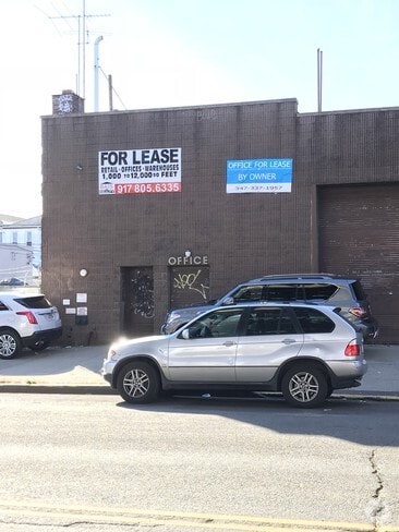
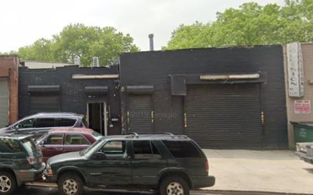
1632 Mcdonald Ave, Brooklyn, NY 11230

NEARBY LISTINGS FOR SALE OR LEASE
Property Detail
1632 Mcdonald Ave
06582-0028
ID2005022400518002
Warehouse
Kings
X
New York
3604970351F
23
2024
0.39 AC
2025
South Brooklyn
044000
Long Island (New York)
16,800 SF
New York-Jersey City-White Plains, NY-NJ
DEMOGRAPHICS near 1632 Mcdonald Ave
1 mile
3 mile
5 mile
2024 Total Population
140,900
1,029,946
1,713,112
2029 Population
131,757
957,663
1,597,178
Pop Growth 2024-2029
(6.49%)
(7.02%)
(6.77%)
Average Age
39
40
40
2024 Total Households
45,630
351,086
616,482
HH Growth 2024-2029
(6.98%)
(7.32%)
(7.05%)
Median Household Inc
$63,249
$63,302
$68,480
Avg Household Size
2.90
2.80
2.70
2024 Avg HH Vehicles
1.00
1.00
1.00
Median Home Value
$923,740
$794,167
$809,655
Median Year Built
1947
1948
1948
Nearby Places
Map Layers
Map Styles
 Street
 Aerial
Transit
 Traffic
 Biking
Places
Listings with unknown addresses are not visible on the map
- Restaurants
- Banks
- Shops
- Fitness
- Groceries
PUBLIC TRANSPORTATION
TRANSIT/SUBWAY
Avenue N (F - New York MTA Subway (The Subway))
Drive
Walk
Distance
Avenue N (F - New York MTA Subway (The Subway))
0 min
3 min
0.2 mi
Avenue P (F - New York MTA Subway (The Subway))
Drive
Walk
Distance
Avenue P (F - New York MTA Subway (The Subway))
1 min
6 min
0.3 mi
Bay Parkway (F Line) (F - New York MTA Subway (The Subway))
Drive
Walk
Distance
Bay Parkway (F Line) (F - New York MTA Subway (The Subway))
1 min
11 min
0.6 mi
Bay Parkway (N Line) (N - New York MTA Subway (The Subway))
Drive
Walk
Distance
Bay Parkway (N Line) (N - New York MTA Subway (The Subway))
3 min
12 min
0.6 mi
20 Avenue (N Line) (N - New York MTA Subway (The Subway))
Drive
Walk
Distance
20 Avenue (N Line) (N - New York MTA Subway (The Subway))
3 min
16 min
0.8 mi
COMMUTER RAIL
Nostrand Avenue Station (Far Rockaway Branch - Long Island Rail Road, Hempstead Branch - Long Island Rail Road, Long Beach Branch - Long Island Rail Road, West Hempstead Branch - Long Island Rail Road)
Drive
Walk
Distance
Nostrand Avenue Station (Far Rockaway Branch - Long Island Rail Road, Hempstead Branch - Long Island Rail Road, Long Beach Branch - Long Island Rail Road, West Hempstead Branch - Long Island Rail Road)
14 min
5.9 mi
Drive
Walk
Distance
13 min
5.9 mi
AIRPORT
John F Kennedy International
Drive
Walk
Distance
John F Kennedy International
24 min
14.1 mi
LaGuardia
Drive
Walk
Distance
LaGuardia
30 min
16.9 mi
Newark Liberty International
Drive
Walk
Distance
Newark Liberty International
34 min
20.4 mi
Freight Ports
NY - Red Hook Container Terminal
Drive
Walk
Distance
NY - Red Hook Container Terminal
10 min
5.8 mi
SALE & LEASE HISTORY
LISTING DATE
SALE/LEASE

Oct 30, 2017
For Lease
Jul 19, 2018
For Lease
Jan 04, 2019
For Lease
Feb 27, 2020
For Lease
Dec 07, 2017
For Lease
Nearby Properties
Address
Land Use
TOTAL SIZE
Lot Size
Zoning
Address
Land Use
TOTAL SIZE
Lot Size
Zoning
1,281,577 SF
20.78 AC
M3-1
Address
Land Use
TOTAL SIZE
Lot Size
Zoning
1,524,659 SF
170.96 AC
R4
Address
Land Use
TOTAL SIZE
Lot Size
Zoning
1,078,317 SF
10.45 AC
R4
Address
Land Use
TOTAL SIZE
Lot Size
Zoning
5,800 SF
20.10 AC
R6
Address
Land Use
TOTAL SIZE
Lot Size
Zoning
5,800 SF
20.10 AC
R6
Address
Land Use
TOTAL SIZE
Lot Size
Zoning
5,800 SF
20.10 AC
R6
Address
Land Use
TOTAL SIZE
Lot Size
Zoning
5,800 SF
20.10 AC
R6
Address
Land Use
TOTAL SIZE
Lot Size
Zoning
5,800 SF
20.10 AC
R6
Address
Land Use
TOTAL SIZE
Lot Size
Zoning
5,800 SF
20.10 AC
R6
Address
Land Use
TOTAL SIZE
Lot Size
Zoning
5,800 SF
20.10 AC
R6
Address
Land Use
TOTAL SIZE
Lot Size
Zoning
5,800 SF
20.10 AC
R6
Address
Land Use
TOTAL SIZE
Lot Size
Zoning
5,800 SF
20.10 AC
R6
Address
Land Use
TOTAL SIZE
Lot Size
Zoning
12.39 AC
R6
Address
Land Use
TOTAL SIZE
Lot Size
Zoning
965,600 SF
6.65 AC
R5
Address
Land Use
TOTAL SIZE
Lot Size
Zoning
1,073,920 SF
16.53 AC
R6
Address
Land Use
TOTAL SIZE
Lot Size
Zoning
335,800 SF
1.51 AC
R6
Address
Land Use
TOTAL SIZE
Lot Size
Zoning
54.78 AC
PARK
Address
Land Use
TOTAL SIZE
Lot Size
Zoning
785,450 SF
14.22 AC
R6
Address
Land Use
TOTAL SIZE
Lot Size
Zoning
1,800,000 SF
12.39 AC
R6
Address
Land Use
TOTAL SIZE
Lot Size
Zoning
1,736,700 SF
20.10 AC
R6
Address
Land Use
TOTAL SIZE
Lot Size
Zoning
753,367 SF
5.11 AC
R6
Address
Land Use
TOTAL SIZE
Lot Size
Zoning
623,806 SF
4.68 AC
R6
Address
Land Use
TOTAL SIZE
Lot Size
Zoning
623,806 SF
4.68 AC
R6
Address
Land Use
TOTAL SIZE
Lot Size
Zoning
623,806 SF
4.68 AC
R6
Address
Land Use
TOTAL SIZE
Lot Size
Zoning
623,806 SF
4.68 AC
R6
Address
Land Use
TOTAL SIZE
Lot Size
Zoning
623,806 SF
4.68 AC
R6
Address
Land Use
TOTAL SIZE
Lot Size
Zoning
623,806 SF
4.68 AC
R6
Address
Land Use
TOTAL SIZE
Lot Size
Zoning
623,806 SF
4.68 AC
R6
Address
Land Use
TOTAL SIZE
Lot Size
Zoning
623,806 SF
4.68 AC
R6
Address
Land Use
TOTAL SIZE
Lot Size
Zoning
623,806 SF
4.68 AC
R6
The World's #1 Commercial Real Estate Marketplace
Connect with us
© 2026 CoStar Group
The information above has been obtained from sources believed reliable. While we do not doubt its accuracy we have not verified it and make no guarantee, warranty or representation about it. It is your responsibility to independently confirm its accuracy and completeness. Any projections, opinions, assumptions, or estimates used are for example only and do not represent the current or future performance of the property. The value of this transaction to you depends on tax and other factors which should be evaluated by your tax, financial, and legal advisors. You and your advisors should conduct a careful, independent investigation of the property to determine to your satisfaction the suitability of the property for your needs.