Property Record
16325 E 11 Mile Rd, Roseville, MI 48066
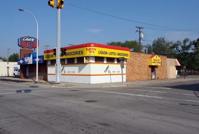
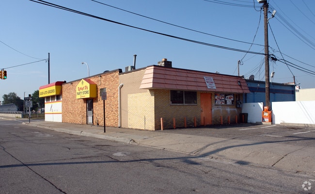
This Property Is For Sale
NEARBY LISTINGS FOR SALE OR LEASE
Property Detail
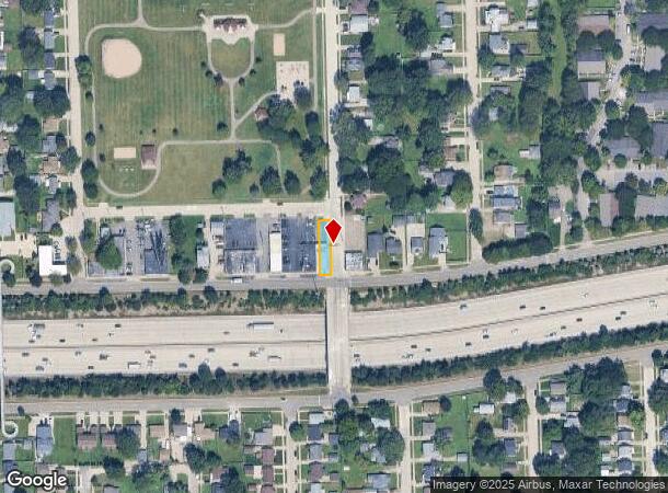
16325 E 11 Mile Rd
Detroit-Warren-Dearborn, MI
Treppas Felician Gardens Sub
08-14-18-455-029
TREPPA'S FELICIAN GARDENS SUB LOT 1 EXC S 69 FT FOR HWY & LOT 39 EXC W 5 FT
Supermarket
Macomb
X
Michigan
26163C0130F
1,39
2024
0.10 AC
2025
Macomb East
256000
Detroit
2,190 SF
DEMOGRAPHICS near 16325 E 11 Mile Rd
1 Mile
3 Mile
5 Mile
2024 Total Population
16,502
140,269
341,121
2029 Population
16,332
138,448
337,402
Pop Growth 2024-2029
(1.03%)
(1.30%)
(1.09%)
Average Age
39
40
40
2024 Total Households
6,827
57,694
138,833
HH Growth 2024-2029
(1.10%)
(1.32%)
(1.19%)
Median Household Inc
$52,113
$57,318
$56,560
Avg Household Size
2.40
2.40
2.40
2024 Avg HH Vehicles
2.00
2.00
2.00
Median Home Value
$123,607
$139,338
$147,145
Median Year Built
1958
1959
1959
Nearby Places
- Restaurants
- Banks
- Shops
- Fitness
- Groceries
PUBLIC TRANSPORTATION
AIRPORT
Windsor International
DRIVE
WALK
Distance
Windsor International
48 min
29.4 mi
Detroit Metro Wayne County
DRIVE
WALK
Distance
Detroit Metro Wayne County
52 min
36.8 mi
Freight Ports
Port of Toledo
DRIVE
WALK
Distance
Port of Toledo
98 min
77.6 mi
Nearby Properties
Address
Land Use
TOTAL SIZE
Lot Size
Zoning
Address
Land Use
TOTAL SIZE
Lot Size
Zoning
260,164 SF
Address
Land Use
TOTAL SIZE
Lot Size
Zoning
238,144 SF
12.15 AC
MZ
Address
Land Use
TOTAL SIZE
Lot Size
Zoning
661,151 SF
37.28 AC
MZ
Address
Land Use
TOTAL SIZE
Lot Size
Zoning
323,858 SF
20.66 AC
R-3
Address
Land Use
TOTAL SIZE
Lot Size
Zoning
303,770 SF
23.62 AC
R-3
Address
Land Use
TOTAL SIZE
Lot Size
Zoning
283,685 SF
19.90 AC
R-3
Address
Land Use
TOTAL SIZE
Lot Size
Zoning
31.84 AC
RH
Address
Land Use
TOTAL SIZE
Lot Size
Zoning
362,350 SF
22.39 AC
M-2
Address
Land Use
TOTAL SIZE
Lot Size
Zoning
162,597 SF
17.94 AC
C-2
Address
Land Use
TOTAL SIZE
Lot Size
Zoning
217,369 SF
20.15 AC
B-2
Address
Land Use
TOTAL SIZE
Lot Size
Zoning
204,620 SF
13.73 AC
R-3
Address
Land Use
TOTAL SIZE
Lot Size
Zoning
218,819 SF
15 AC
R-3
Address
Land Use
TOTAL SIZE
Lot Size
Zoning
102,598 SF
Address
Land Use
TOTAL SIZE
Lot Size
Zoning
376,278 SF
19.85 AC
RM-1
Address
Land Use
TOTAL SIZE
Lot Size
Zoning
179,653 SF
11.56 AC
B-2
Address
Land Use
TOTAL SIZE
Lot Size
Zoning
181,076 SF
8.16 AC
R-3
Address
Land Use
TOTAL SIZE
Lot Size
Zoning
103,069 SF
11.41 AC
B-3
Address
Land Use
TOTAL SIZE
Lot Size
Zoning
109,494 SF
7.54 AC
O
Address
Land Use
TOTAL SIZE
Lot Size
Zoning
92,800 SF
6.71 AC
R-3
Address
Land Use
TOTAL SIZE
Lot Size
Zoning
41,065 SF
4.30 AC
B-3
Address
Land Use
TOTAL SIZE
Lot Size
Zoning
105,354 SF
2.33 AC
B-3
Address
Land Use
TOTAL SIZE
Lot Size
Zoning
160,600 SF
9.62 AC
R-3
Address
Land Use
TOTAL SIZE
Lot Size
Zoning
228,269 SF
10.37 AC
I-2
Address
Land Use
TOTAL SIZE
Lot Size
Zoning
167,589 SF
16.80 AC
B-3
Address
Land Use
TOTAL SIZE
Lot Size
Zoning
168,058 SF
19.75 AC
IC
Address
Land Use
TOTAL SIZE
Lot Size
Zoning
193,020 SF
13.62 AC
RM-1
Address
Land Use
TOTAL SIZE
Lot Size
Zoning
13.49 AC
MZ
Address
Land Use
TOTAL SIZE
Lot Size
Zoning
119,898 SF
14.65 AC
B-2
Address
Land Use
TOTAL SIZE
Lot Size
Zoning
70,292 SF
3.45 AC
IC
Address
Land Use
TOTAL SIZE
Lot Size
Zoning
133,611 SF
11.74 AC
B-3
The World's #1 Commercial Real Estate Marketplace
Connect with us
© 2025 CoStar Group
The information above has been obtained from sources believed reliable. While we do not doubt its accuracy we have not verified it and make no guarantee, warranty or representation about it. It is your responsibility to independently confirm its accuracy and completeness. Any projections, opinions, assumptions, or estimates used are for example only and do not represent the current or future performance of the property. The value of this transaction to you depends on tax and other factors which should be evaluated by your tax, financial, and legal advisors. You and your advisors should conduct a careful, independent investigation of the property to determine to your satisfaction the suitability of the property for your needs.