Property Record
16327 Highway 14, Sterling, CO 80751


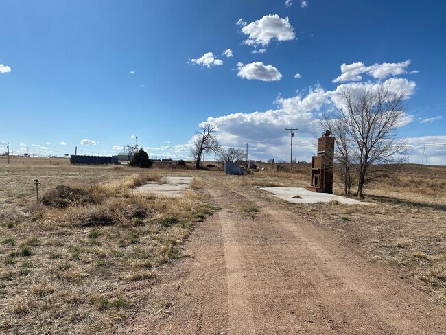
Property Detail
16327 Highway 14
Sterling, CO
A TRACT IN SE4SW4 OF SEC 26 DESC AS FOLLOWS: TPOB IS A PT ON S LINE AND 3085.7' WLY OF THE SE COR OF SEC 26; TH ANG R 87D28',
651000
LOGAN
Realpropertynec
Colorado
A Areas with a 1% annual chance of flooding and a 26% chance of flooding over the life of a 30-year mortgage.
89d
2025
10 AC
2025
Colorado East Area
966101
Other Market Areas
2,240 SF
NEARBY LISTINGS FOR SALE OR LEASE
-
-
View all Sterling listings for sale on LoopNet.com
DEMOGRAPHICS near 16327 Highway 14
1 mile
3 mile
5 mile
2025 Total Population
346
7,789
14,404
2030 Population
344
7,705
14,265
Pop Growth 2025-2030
(0.58%)
(1.08%)
(0.97%)
Average Age
44
42
41
2025 Total Households
140
3,296
6,012
HH Growth 2025-2030
(0.71%)
(1.67%)
(1.40%)
Median Household Inc
$100,357
$54,305
$55,144
Avg Household Size
2.40
2.30
2.20
2025 Avg HH Vehicles
3.00
2.00
2.00
Median Home Value
$364,999
$244,803
$243,978
Median Year Built
1973
1965
1962
Nearby Places
Map Layers
Map Styles
 Street
 Aerial
Transit
 Traffic
 Biking
Places
Listings with unknown addresses are not visible on the map
- Restaurants
- Banks
- Shops
- Fitness
- Groceries
SALE & LEASE HISTORY
LISTING DATE
SALE/LEASE

Mar 27, 2020
For Sale
Nearby Properties
Address
Land Use
TOTAL SIZE
Lot Size
Zoning
Address
Land Use
TOTAL SIZE
Lot Size
Zoning
50,355 SF
4.22 AC
Address
Land Use
TOTAL SIZE
Lot Size
Zoning
93,227 SF
29.25 AC
Address
Land Use
TOTAL SIZE
Lot Size
Zoning
135,095 SF
35.79 AC
Address
Land Use
TOTAL SIZE
Lot Size
Zoning
45,162 SF
8.62 AC
Address
Land Use
TOTAL SIZE
Lot Size
Zoning
18,379 SF
2.50 AC
Address
Land Use
TOTAL SIZE
Lot Size
Zoning
55,203 SF
242 AC
Address
Land Use
TOTAL SIZE
Lot Size
Zoning
20,672 SF
4.17 AC
Address
Land Use
TOTAL SIZE
Lot Size
Zoning
36,586 SF
10 AC
Address
Land Use
TOTAL SIZE
Lot Size
Zoning
19,880 SF
3 AC
Address
Land Use
TOTAL SIZE
Lot Size
Zoning
12,818 SF
4 AC
Address
Land Use
TOTAL SIZE
Lot Size
Zoning
179,474 SF
22.61 AC
Address
Land Use
TOTAL SIZE
Lot Size
Zoning
19,124 SF
2.16 AC
Address
Land Use
TOTAL SIZE
Lot Size
Zoning
19,900 SF
10.50 AC
Address
Land Use
TOTAL SIZE
Lot Size
Zoning
14,324 SF
5 AC
Address
Land Use
TOTAL SIZE
Lot Size
Zoning
4,608 SF
1.09 AC
Address
Land Use
TOTAL SIZE
Lot Size
Zoning
68,184 SF
10.11 AC
Address
Land Use
TOTAL SIZE
Lot Size
Zoning
11,334 SF
1.71 AC
Address
Land Use
TOTAL SIZE
Lot Size
Zoning
9,562 SF
1.66 AC
Address
Land Use
TOTAL SIZE
Lot Size
Zoning
9,384 SF
2 AC
Address
Land Use
TOTAL SIZE
Lot Size
Zoning
12,852 SF
3.08 AC
Address
Land Use
TOTAL SIZE
Lot Size
Zoning
26,293 SF
4.17 AC
Address
Land Use
TOTAL SIZE
Lot Size
Zoning
25,098 SF
5.51 AC
Address
Land Use
TOTAL SIZE
Lot Size
Zoning
6,555 SF
0.76 AC
Address
Land Use
TOTAL SIZE
Lot Size
Zoning
14,093 SF
1.74 AC
Address
Land Use
TOTAL SIZE
Lot Size
Zoning
17,580 SF
0.94 AC
Address
Land Use
TOTAL SIZE
Lot Size
Zoning
10,766 SF
1.66 AC
Address
Land Use
TOTAL SIZE
Lot Size
Zoning
13,455 SF
2.48 AC
Address
Land Use
TOTAL SIZE
Lot Size
Zoning
6,000 SF
0.45 AC
Address
Land Use
TOTAL SIZE
Lot Size
Zoning
8,000 SF
6.02 AC
The World's #1 Commercial Real Estate Marketplace
Connect with us
© 2026 CoStar Group
The information above has been obtained from sources believed reliable. While we do not doubt its accuracy we have not verified it and make no guarantee, warranty or representation about it. It is your responsibility to independently confirm its accuracy and completeness. Any projections, opinions, assumptions, or estimates used are for example only and do not represent the current or future performance of the property. The value of this transaction to you depends on tax and other factors which should be evaluated by your tax, financial, and legal advisors. You and your advisors should conduct a careful, independent investigation of the property to determine to your satisfaction the suitability of the property for your needs.