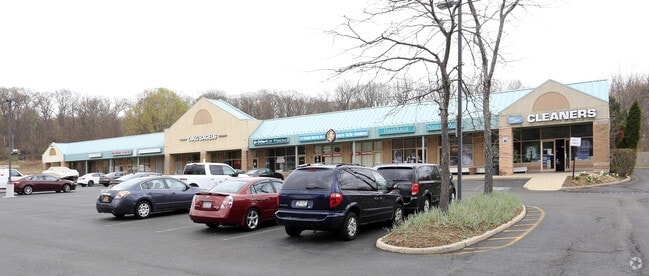
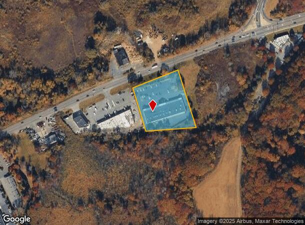
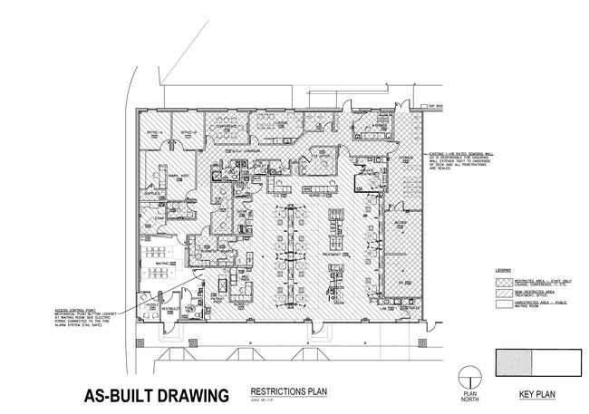
Property Record
1633 Route 202, Pomona, NY 10970

Current Lease Availabilities
NEARBY LISTINGS FOR SALE OR LEASE
Property Detail
1633 Route 202
392689-033-006-0001-008-000-0000
Rockland
Regionalshoppingcenterormallwithanchorstore
New York
X
8.000
36087C0091G
2.06 AC
2023
Ramapo
2024
Northern New Jersey
011509
New York-Jersey City-White Plains, NY-NJ
18,240 SF
DEMOGRAPHICS near 1633 Route 202
1 Mile
3 Mile
5 Mile
2024 Total Population
6,920
43,296
171,655
2029 Population
6,946
43,350
170,698
Pop Growth 2024-2029
+ 0.38%
+ 0.12%
(0.56%)
Average Age
39
37
35
2024 Total Households
2,487
12,621
47,633
HH Growth 2024-2029
+ 0.24%
+ 0.11%
(0.55%)
Median Household Inc
$101,461
$114,718
$94,158
Avg Household Size
2.70
3.30
3.40
2024 Avg HH Vehicles
2.00
2.00
2.00
Median Home Value
$294,999
$548,639
$508,654
Median Year Built
1976
1975
1973
Nearby Places
- Restaurants
- Banks
- Shops
- Fitness
- Groceries
PUBLIC TRANSPORTATION
COMMUTER RAIL
Spring Valley (Pascack Valley Line - NJ Transit Commuter Rail (NJ Transit))
DRIVE
WALK
Distance
Spring Valley (Pascack Valley Line - NJ Transit Commuter Rail (NJ Transit))
10 min
6.3 mi
Nanuet (Pascack Valley Line - NJ Transit Commuter Rail (NJ Transit))
DRIVE
WALK
Distance
Nanuet (Pascack Valley Line - NJ Transit Commuter Rail (NJ Transit))
13 min
7.8 mi
AIRPORT
Westchester County
DRIVE
WALK
Distance
Westchester County
40 min
29.0 mi
New York Stewart International
DRIVE
WALK
Distance
New York Stewart International
47 min
31.5 mi
LaGuardia
DRIVE
WALK
Distance
LaGuardia
55 min
37.5 mi
Freight Ports
NY - Red Hook Container Terminal
DRIVE
WALK
Distance
NY - Red Hook Container Terminal
65 min
44.7 mi
Nearby Properties
Address
Land Use
TOTAL SIZE
Lot Size
Zoning
Address
Land Use
TOTAL SIZE
Lot Size
Zoning
620,500 SF
63.50 AC
925
Address
Land Use
TOTAL SIZE
Lot Size
Zoning
196,017 SF
12.08 AC
962
Address
Land Use
TOTAL SIZE
Lot Size
Zoning
104,303 SF
71.26 AC
RR-50
Address
Land Use
TOTAL SIZE
Lot Size
Zoning
174,000 SF
20.60 AC
915
Address
Land Use
TOTAL SIZE
Lot Size
Zoning
31,056 SF
14.70 AC
940
Address
Land Use
TOTAL SIZE
Lot Size
Zoning
129,170 SF
29.99 AC
911
Address
Land Use
TOTAL SIZE
Lot Size
Zoning
113,413 SF
17.77 AC
962
Address
Land Use
TOTAL SIZE
Lot Size
Zoning
4.80 AC
361
Address
Land Use
TOTAL SIZE
Lot Size
Zoning
173,180 SF
40.10 AC
964
Address
Land Use
TOTAL SIZE
Lot Size
Zoning
8.40 AC
303
Address
Land Use
TOTAL SIZE
Lot Size
Zoning
72,930 SF
18.10 AC
02 - SINGL
Address
Land Use
TOTAL SIZE
Lot Size
Zoning
26,847 SF
131.60 AC
925
Address
Land Use
TOTAL SIZE
Lot Size
Zoning
118,089 SF
9.60 AC
915
Address
Land Use
TOTAL SIZE
Lot Size
Zoning
34,938 SF
0.43 AC
962
Address
Land Use
TOTAL SIZE
Lot Size
Zoning
175,948 SF
11.13 AC
Address
Land Use
TOTAL SIZE
Lot Size
Zoning
362.10 AC
911
Address
Land Use
TOTAL SIZE
Lot Size
Zoning
261 AC
911
Address
Land Use
TOTAL SIZE
Lot Size
Zoning
60,803 SF
6.70 AC
02 - SINGL
Address
Land Use
TOTAL SIZE
Lot Size
Zoning
29.60 AC
915
Address
Land Use
TOTAL SIZE
Lot Size
Zoning
56,546 SF
24.61 AC
RR-80
Address
Land Use
TOTAL SIZE
Lot Size
Zoning
23,088 SF
3.50 AC
915
Address
Land Use
TOTAL SIZE
Lot Size
Zoning
207 AC
940
Address
Land Use
TOTAL SIZE
Lot Size
Zoning
6,073 SF
136.80 AC
911
Address
Land Use
TOTAL SIZE
Lot Size
Zoning
3,764 SF
70.06 AC
02 - SINGL
Address
Land Use
TOTAL SIZE
Lot Size
Zoning
154.09 AC
911
Address
Land Use
TOTAL SIZE
Lot Size
Zoning
850 AC
911
Address
Land Use
TOTAL SIZE
Lot Size
Zoning
23,050 SF
29.75 AC
911
Address
Land Use
TOTAL SIZE
Lot Size
Zoning
152,070 SF
25.12 AC
1R50
Address
Land Use
TOTAL SIZE
Lot Size
Zoning
35.80 AC
911
Address
Land Use
TOTAL SIZE
Lot Size
Zoning
12,512 SF
7.59 AC
915
The World's #1 Commercial Real Estate Marketplace
Connect with us
© 2025 CoStar Group
The information above has been obtained from sources believed reliable. While we do not doubt its accuracy we have not verified it and make no guarantee, warranty or representation about it. It is your responsibility to independently confirm its accuracy and completeness. Any projections, opinions, assumptions, or estimates used are for example only and do not represent the current or future performance of the property. The value of this transaction to you depends on tax and other factors which should be evaluated by your tax, financial, and legal advisors. You and your advisors should conduct a careful, independent investigation of the property to determine to your satisfaction the suitability of the property for your needs.