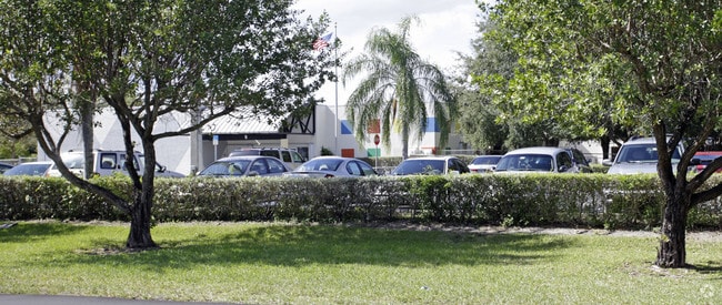
Property Record
16330 Sw 147Th Ave, Miami, FL 33187

NEARBY LISTINGS FOR SALE OR LEASE
Property Detail
16330 Sw 147Th Ave
30-5928-000-0022
28 55 39 339332 SQ FT SW1/4 OF NE1/4 OF SE1/4 LESS E 272.5 FT OF N1/2 LOT SIZE IRREGULAR OR 13239-3506 0387 2
Warehouse
Miami/Dade
X
Florida
12086C0581L
7.79 AC
2023
Southwest Dade
2023
South Florida
019700
Miami-Miami Beach-Kendall, FL
6,220 SF
DEMOGRAPHICS near 16330 Sw 147Th Ave
1 Mile
3 Mile
5 Mile
2024 Total Population
19,882
72,222
231,537
2029 Population
19,161
70,277
225,056
Pop Growth 2024-2029
(3.63%)
(2.69%)
(2.80%)
Average Age
41
40
41
2024 Total Households
5,654
21,153
72,417
HH Growth 2024-2029
(4.10%)
(3.17%)
(3.23%)
Median Household Inc
$94,121
$83,944
$70,763
Avg Household Size
3.40
3.20
3.00
2024 Avg HH Vehicles
2.00
2.00
2.00
Median Home Value
$395,745
$386,209
$365,756
Median Year Built
1993
1995
1989
Nearby Places
Map Layers
Map Styles
 Street
 Aerial
- Restaurants
- Banks
- Shops
- Fitness
- Groceries
PUBLIC TRANSPORTATION
AIRPORT
Miami International
DRIVE
WALK
Distance
Miami International
35 min
19.3 mi
Freight Ports
Port of Miami
DRIVE
WALK
Distance
Port of Miami
44 min
26.4 mi
Nearby Properties
Address
Land Use
TOTAL SIZE
Lot Size
Zoning
Address
Land Use
TOTAL SIZE
Lot Size
Zoning
498,210 SF
17.39 AC
9400
Address
Land Use
TOTAL SIZE
Lot Size
Zoning
528,142 SF
28.26 AC
3800
Address
Land Use
TOTAL SIZE
Lot Size
Zoning
59,587 SF
260 AC
9000
Address
Land Use
TOTAL SIZE
Lot Size
Zoning
189,564 SF
723.43 AC
9000
Address
Land Use
TOTAL SIZE
Lot Size
Zoning
686,394 SF
669.92 AC
8000
Address
Land Use
TOTAL SIZE
Lot Size
Zoning
445,437 SF
13 AC
3900
Address
Land Use
TOTAL SIZE
Lot Size
Zoning
428,066 SF
12.69 AC
3900
Address
Land Use
TOTAL SIZE
Lot Size
Zoning
546,903 SF
49.47 AC
7700
Address
Land Use
TOTAL SIZE
Lot Size
Zoning
257,796 SF
8.12 AC
3800
Address
Land Use
TOTAL SIZE
Lot Size
Zoning
269,546 SF
21.99 AC
6200
Address
Land Use
TOTAL SIZE
Lot Size
Zoning
287,950 SF
9.81 AC
4100
Address
Land Use
TOTAL SIZE
Lot Size
Zoning
396,198 SF
17.10 AC
3700
Address
Land Use
TOTAL SIZE
Lot Size
Zoning
266,199 SF
8.74 AC
3900
Address
Land Use
TOTAL SIZE
Lot Size
Zoning
196,490 SF
13.50 AC
0102
Address
Land Use
TOTAL SIZE
Lot Size
Zoning
1 SF
304.88 AC
9000
Address
Land Use
TOTAL SIZE
Lot Size
Zoning
254,848 SF
14.41 AC
7100
Address
Land Use
TOTAL SIZE
Lot Size
Zoning
172,645 SF
15.49 AC
3800
Address
Land Use
TOTAL SIZE
Lot Size
Zoning
240,744 SF
32.07 AC
9000
Address
Land Use
TOTAL SIZE
Lot Size
Zoning
187,494 SF
10.41 AC
7700
Address
Land Use
TOTAL SIZE
Lot Size
Zoning
111,400 SF
8.52 AC
7700
Address
Land Use
TOTAL SIZE
Lot Size
Zoning
189,990 SF
4.14 AC
7100
Address
Land Use
TOTAL SIZE
Lot Size
Zoning
113,720 SF
9.70 AC
6200
Address
Land Use
TOTAL SIZE
Lot Size
Zoning
172,517 SF
15.47 AC
6400
Address
Land Use
TOTAL SIZE
Lot Size
Zoning
39,208 SF
13.64 AC
6200
Address
Land Use
TOTAL SIZE
Lot Size
Zoning
119,575 SF
2.19 AC
7700
Address
Land Use
TOTAL SIZE
Lot Size
Zoning
158,037 SF
14.07 AC
6200
Address
Land Use
TOTAL SIZE
Lot Size
Zoning
98,943 SF
8.32 AC
6200
Address
Land Use
TOTAL SIZE
Lot Size
Zoning
92,509 SF
10.37 AC
6400
Address
Land Use
TOTAL SIZE
Lot Size
Zoning
1 SF
221.02 AC
9000
The World's #1 Commercial Real Estate Marketplace
Connect with us
© 2026 CoStar Group
The information above has been obtained from sources believed reliable. While we do not doubt its accuracy we have not verified it and make no guarantee, warranty or representation about it. It is your responsibility to independently confirm its accuracy and completeness. Any projections, opinions, assumptions, or estimates used are for example only and do not represent the current or future performance of the property. The value of this transaction to you depends on tax and other factors which should be evaluated by your tax, financial, and legal advisors. You and your advisors should conduct a careful, independent investigation of the property to determine to your satisfaction the suitability of the property for your needs.