Property Record
1635 Amigo St, Henderson, NV 89044


NEARBY LISTINGS FOR SALE OR LEASE
Property Detail
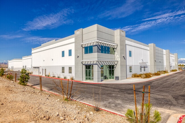
1635 Amigo St
Las Vegas
Henderson 10-Acre Industrial
Las Vegas-Henderson-Paradise, NV
HENDERSON 10-ACRE INDUSTRIAL PLAT BOOK 166 PAGE 19 LOT 1
191-10-111-001
Clark
Foodprocessing
Nevada
2024
1
2025
9.49 AC
005720
SE LV/Henderson
152,962 SF
DEMOGRAPHICS near 1635 Amigo St
1 Mile
3 Mile
5 Mile
2024 Total Population
6,317
101,760
234,700
2029 Population
7,165
111,345
254,775
Pop Growth 2024-2029
+ 13.42%
+ 9.42%
+ 8.55%
Average Age
37
40
42
2024 Total Households
2,189
38,908
93,035
HH Growth 2024-2029
+ 13.93%
+ 9.30%
+ 8.41%
Median Household Inc
$95,720
$83,890
$85,910
Avg Household Size
2.80
2.60
2.50
2024 Avg HH Vehicles
2.00
2.00
2.00
Median Home Value
$405,094
$435,628
$436,914
Median Year Built
2010
2006
2004
Nearby Places
Map Layers
Map Styles
 Street
 Aerial
- Restaurants
- Banks
- Shops
- Fitness
- Groceries
PUBLIC TRANSPORTATION
AIRPORT
Harry Reid International
DRIVE
WALK
Distance
Harry Reid International
17 min
10.7 mi
Boulder City Municipal
DRIVE
WALK
Distance
Boulder City Municipal
33 min
22.6 mi
Freight Ports
Port of Long Beach
DRIVE
WALK
Distance
Port of Long Beach
303 min
271.2 mi
SALE & LEASE HISTORY
LISTING DATE
SALE/LEASE

Jun 07, 2021
For Lease
Nearby Properties
Address
Land Use
TOTAL SIZE
Lot Size
Zoning
Address
Land Use
TOTAL SIZE
Lot Size
Zoning
696,660 SF
72.72 AC
Address
Land Use
TOTAL SIZE
Lot Size
Zoning
882 SF
39.43 AC
Address
Land Use
TOTAL SIZE
Lot Size
Zoning
14,422 SF
30.79 AC
Address
Land Use
TOTAL SIZE
Lot Size
Zoning
197,134 SF
24.59 AC
Address
Land Use
TOTAL SIZE
Lot Size
Zoning
614,616 SF
55.59 AC
Address
Land Use
TOTAL SIZE
Lot Size
Zoning
1,365 SF
22.68 AC
Address
Land Use
TOTAL SIZE
Lot Size
Zoning
5,227 SF
16.79 AC
Address
Land Use
TOTAL SIZE
Lot Size
Zoning
1,184,001 SF
57.02 AC
IP
Address
Land Use
TOTAL SIZE
Lot Size
Zoning
5,975 SF
18.81 AC
Address
Land Use
TOTAL SIZE
Lot Size
Zoning
4,312 SF
19.42 AC
C:R-4
Address
Land Use
TOTAL SIZE
Lot Size
Zoning
5,271 SF
22.88 AC
Address
Land Use
TOTAL SIZE
Lot Size
Zoning
614,520 SF
28.81 AC
Address
Land Use
TOTAL SIZE
Lot Size
Zoning
438,778 SF
19.30 AC
C:R-4
Address
Land Use
TOTAL SIZE
Lot Size
Zoning
3,528 SF
18.15 AC
RH36
Address
Land Use
TOTAL SIZE
Lot Size
Zoning
325,458 SF
15.23 AC
Address
Land Use
TOTAL SIZE
Lot Size
Zoning
7,370 SF
18.03 AC
Address
Land Use
TOTAL SIZE
Lot Size
Zoning
4,924 SF
16.14 AC
C:R-3
Address
Land Use
TOTAL SIZE
Lot Size
Zoning
6,043 SF
15.86 AC
Address
Land Use
TOTAL SIZE
Lot Size
Zoning
161,090 SF
355.75 AC
Address
Land Use
TOTAL SIZE
Lot Size
Zoning
36.85 AC
PS
Address
Land Use
TOTAL SIZE
Lot Size
Zoning
Address
Land Use
TOTAL SIZE
Lot Size
Zoning
3,990 SF
24.88 AC
RM16
Address
Land Use
TOTAL SIZE
Lot Size
Zoning
Address
Land Use
TOTAL SIZE
Lot Size
Zoning
220,694 SF
44.74 AC
Address
Land Use
TOTAL SIZE
Lot Size
Zoning
22,009 SF
11.53 AC
Address
Land Use
TOTAL SIZE
Lot Size
Zoning
481,860 SF
27.18 AC
Address
Land Use
TOTAL SIZE
Lot Size
Zoning
Address
Land Use
TOTAL SIZE
Lot Size
Zoning
22,180 SF
5.89 AC
The World's #1 Commercial Real Estate Marketplace
Connect with us
© 2025 CoStar Group
The information above has been obtained from sources believed reliable. While we do not doubt its accuracy we have not verified it and make no guarantee, warranty or representation about it. It is your responsibility to independently confirm its accuracy and completeness. Any projections, opinions, assumptions, or estimates used are for example only and do not represent the current or future performance of the property. The value of this transaction to you depends on tax and other factors which should be evaluated by your tax, financial, and legal advisors. You and your advisors should conduct a careful, independent investigation of the property to determine to your satisfaction the suitability of the property for your needs.