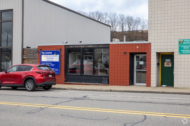
Property Record
1635 E Railroad St, Carnegie, PA 15106

Property Detail
1635 E Railroad St
Pittsburgh, PA
T F MC CABE PLAN PT 22 SEC D LOT 30X120 E RAILR OAD ST 1 STY C B BLDG & OFF #1635
0101-C-00049-0000-00
ALLEGHENY
Bartavern
Pennsylvania
C and X Area of minimal flood hazard, usually depicted on FIRMs as above the 500-year flood level.
49
2024
0.08 AC
2025
Parkway West Corridor
471000
Pittsburgh
NEARBY LISTINGS FOR SALE OR LEASE
DEMOGRAPHICS near 1635 E Railroad St
1 mile
3 mile
5 mile
2025 Total Population
12,544
83,067
206,044
2030 Population
12,345
81,184
202,382
Pop Growth 2025-2030
(1.59%)
(2.27%)
(1.78%)
Average Age
45
44
43
2025 Total Households
5,932
37,023
91,506
HH Growth 2025-2030
(1.74%)
(2.35%)
(1.83%)
Median Household Inc
$71,391
$93,792
$88,343
Avg Household Size
2.00
2.20
2.20
2025 Avg HH Vehicles
1.00
2.00
2.00
Median Home Value
$210,173
$267,953
$249,075
Median Year Built
1955
1955
1955
Nearby Places
Map Layers
Map Styles
 Street
 Aerial
Transit
 Traffic
 Biking
Places
Listings with unknown addresses are not visible on the map
- Restaurants
- Banks
- Shops
- Fitness
- Groceries
PUBLIC TRANSPORTATION
COMMUTER RAIL
Drive
Walk
Distance
14 min
7.5 mi
AIRPORT
Pittsburgh International
Drive
Walk
Distance
Pittsburgh International
25 min
13.7 mi
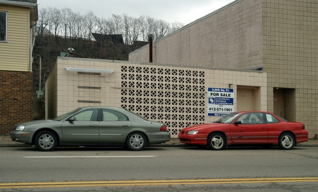
SALE & LEASE HISTORY
LISTING DATE
SALE/LEASE

Dec 12, 2025
For Lease
Nearby Properties
Address
Land Use
TOTAL SIZE
Lot Size
Zoning
Address
Land Use
TOTAL SIZE
Lot Size
Zoning
Address
Land Use
TOTAL SIZE
Lot Size
Zoning
62.76 AC
Address
Land Use
TOTAL SIZE
Lot Size
Zoning
28.59 AC
Address
Land Use
TOTAL SIZE
Lot Size
Zoning
15.88 AC
Address
Land Use
TOTAL SIZE
Lot Size
Zoning
16.08 AC
Address
Land Use
TOTAL SIZE
Lot Size
Zoning
14.32 AC
Address
Land Use
TOTAL SIZE
Lot Size
Zoning
5.24 AC
Address
Land Use
TOTAL SIZE
Lot Size
Zoning
21.38 AC
Address
Land Use
TOTAL SIZE
Lot Size
Zoning
Address
Land Use
TOTAL SIZE
Lot Size
Zoning
12.68 AC
Address
Land Use
TOTAL SIZE
Lot Size
Zoning
17.50 AC
Address
Land Use
TOTAL SIZE
Lot Size
Zoning
Address
Land Use
TOTAL SIZE
Lot Size
Zoning
16.01 AC
Address
Land Use
TOTAL SIZE
Lot Size
Zoning
Address
Land Use
TOTAL SIZE
Lot Size
Zoning
Address
Land Use
TOTAL SIZE
Lot Size
Zoning
36.95 AC
Address
Land Use
TOTAL SIZE
Lot Size
Zoning
17.04 AC
Address
Land Use
TOTAL SIZE
Lot Size
Zoning
15.26 AC
Address
Land Use
TOTAL SIZE
Lot Size
Zoning
37.96 AC
Address
Land Use
TOTAL SIZE
Lot Size
Zoning
16.70 AC
Address
Land Use
TOTAL SIZE
Lot Size
Zoning
1,272 SF
40.99 AC
Address
Land Use
TOTAL SIZE
Lot Size
Zoning
Address
Land Use
TOTAL SIZE
Lot Size
Zoning
Address
Land Use
TOTAL SIZE
Lot Size
Zoning
8.62 AC
Address
Land Use
TOTAL SIZE
Lot Size
Zoning
12.34 AC
Address
Land Use
TOTAL SIZE
Lot Size
Zoning
Address
Land Use
TOTAL SIZE
Lot Size
Zoning
13.32 AC
Address
Land Use
TOTAL SIZE
Lot Size
Zoning
Address
Land Use
TOTAL SIZE
Lot Size
Zoning
Address
Land Use
TOTAL SIZE
Lot Size
Zoning
The World's #1 Commercial Real Estate Marketplace
Connect with us
© 2026 CoStar Group
The information above has been obtained from sources believed reliable. While we do not doubt its accuracy we have not verified it and make no guarantee, warranty or representation about it. It is your responsibility to independently confirm its accuracy and completeness. Any projections, opinions, assumptions, or estimates used are for example only and do not represent the current or future performance of the property. The value of this transaction to you depends on tax and other factors which should be evaluated by your tax, financial, and legal advisors. You and your advisors should conduct a careful, independent investigation of the property to determine to your satisfaction the suitability of the property for your needs.