Property Record
1635 N Maple Rd, Ann Arbor, MI 48103

NEARBY LISTINGS FOR SALE OR LEASE
Property Detail
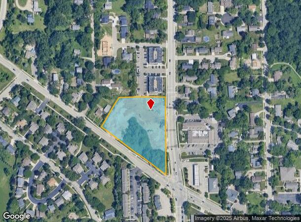
1635 N Maple Rd
Ann Arbor, MI
COM AT NE COR SEC 24, T2S, R5E; TH N86?56'20W 33.00 FT ALNG N LINE OF SEC 24; TH S02?48?22?W 1
08-24-107-025
Washtenaw
Commercialacreage
Michigan
2025
2.53 AC
2025
West Ann Arbor
403300
Detroit
2,256 SF
DEMOGRAPHICS near 1635 N Maple Rd
1 Mile
3 Mile
5 Mile
2024 Total Population
7,371
69,021
135,470
2029 Population
7,266
68,268
134,322
Pop Growth 2024-2029
(1.42%)
(1.09%)
(0.85%)
Average Age
41
35
37
2024 Total Households
3,146
27,888
55,099
HH Growth 2024-2029
(1.56%)
(0.95%)
(0.80%)
Median Household Inc
$113,529
$76,304
$86,087
Avg Household Size
2.30
2.20
2.20
2024 Avg HH Vehicles
2.00
2.00
2.00
Median Home Value
$406,222
$433,779
$438,080
Median Year Built
1963
1968
1976
Nearby Places
Map Layers
Map Styles
 Street
 Aerial
- Restaurants
- Banks
- Shops
- Fitness
- Groceries
PUBLIC TRANSPORTATION
COMMUTER RAIL
Ann Arbor Amtrak Station (Wolverine - Amtrak)
DRIVE
WALK
Distance
Ann Arbor Amtrak Station (Wolverine - Amtrak)
6 min
2.5 mi
AIRPORT
Detroit Metro Wayne County
DRIVE
WALK
Distance
Detroit Metro Wayne County
37 min
29.3 mi
Freight Ports
Port of Toledo
DRIVE
WALK
Distance
Port of Toledo
80 min
62.6 mi
Nearby Properties
Address
Land Use
TOTAL SIZE
Lot Size
Zoning
Address
Land Use
TOTAL SIZE
Lot Size
Zoning
235,070 SF
0.80 AC
D1
Address
Land Use
TOTAL SIZE
Lot Size
Zoning
212,047 SF
1.15 AC
D2
Address
Land Use
TOTAL SIZE
Lot Size
Zoning
268,612 SF
0.74 AC
D1
Address
Land Use
TOTAL SIZE
Lot Size
Zoning
186,029 SF
2.06 AC
D2
Address
Land Use
TOTAL SIZE
Lot Size
Zoning
211,670 SF
0.54 AC
D1
Address
Land Use
TOTAL SIZE
Lot Size
Zoning
222,126 SF
0.52 AC
D1
Address
Land Use
TOTAL SIZE
Lot Size
Zoning
401,491 SF
3.12 AC
C1A/R
Address
Land Use
TOTAL SIZE
Lot Size
Zoning
189,221 SF
0.58 AC
D1
Address
Land Use
TOTAL SIZE
Lot Size
Zoning
173,885 SF
0.45 AC
D1
Address
Land Use
TOTAL SIZE
Lot Size
Zoning
323,630 SF
21.55 AC
UNKNOWN
Address
Land Use
TOTAL SIZE
Lot Size
Zoning
140,840 SF
0.50 AC
D1
Address
Land Use
TOTAL SIZE
Lot Size
Zoning
140,670 SF
1.63 AC
C2B
Address
Land Use
TOTAL SIZE
Lot Size
Zoning
133,830 SF
0.59 AC
D1
Address
Land Use
TOTAL SIZE
Lot Size
Zoning
249,612 SF
1.87 AC
C1A/R
Address
Land Use
TOTAL SIZE
Lot Size
Zoning
177,763 SF
0.91 AC
D2
Address
Land Use
TOTAL SIZE
Lot Size
Zoning
303,524 SF
19.40 AC
R4B
Address
Land Use
TOTAL SIZE
Lot Size
Zoning
99,982 SF
0.35 AC
D1
Address
Land Use
TOTAL SIZE
Lot Size
Zoning
333,275 SF
0.65 AC
D1
Address
Land Use
TOTAL SIZE
Lot Size
Zoning
125,073 SF
0.26 AC
D1
Address
Land Use
TOTAL SIZE
Lot Size
Zoning
137,874 SF
0.55 AC
PUD
Address
Land Use
TOTAL SIZE
Lot Size
Zoning
359,701 SF
37.70 AC
R4A
Address
Land Use
TOTAL SIZE
Lot Size
Zoning
1.19 AC
R4C
Address
Land Use
TOTAL SIZE
Lot Size
Zoning
116,650 SF
0.32 AC
D1
Address
Land Use
TOTAL SIZE
Lot Size
Zoning
231,262 SF
25.82 AC
C3
Address
Land Use
TOTAL SIZE
Lot Size
Zoning
143,619 SF
0.20 AC
PUD
Address
Land Use
TOTAL SIZE
Lot Size
Zoning
179,981 SF
14.55 AC
R4A
Address
Land Use
TOTAL SIZE
Lot Size
Zoning
3,840 SF
1.55 AC
R4D
Address
Land Use
TOTAL SIZE
Lot Size
Zoning
55,700 SF
1.21 AC
R4C
Address
Land Use
TOTAL SIZE
Lot Size
Zoning
182,625 SF
15.89 AC
C3
Address
Land Use
TOTAL SIZE
Lot Size
Zoning
13.77 AC
MR-3
The World's #1 Commercial Real Estate Marketplace
Connect with us
© 2025 CoStar Group
The information above has been obtained from sources believed reliable. While we do not doubt its accuracy we have not verified it and make no guarantee, warranty or representation about it. It is your responsibility to independently confirm its accuracy and completeness. Any projections, opinions, assumptions, or estimates used are for example only and do not represent the current or future performance of the property. The value of this transaction to you depends on tax and other factors which should be evaluated by your tax, financial, and legal advisors. You and your advisors should conduct a careful, independent investigation of the property to determine to your satisfaction the suitability of the property for your needs.