Property Record
1635 Robb Dr, Reno, NV 89523


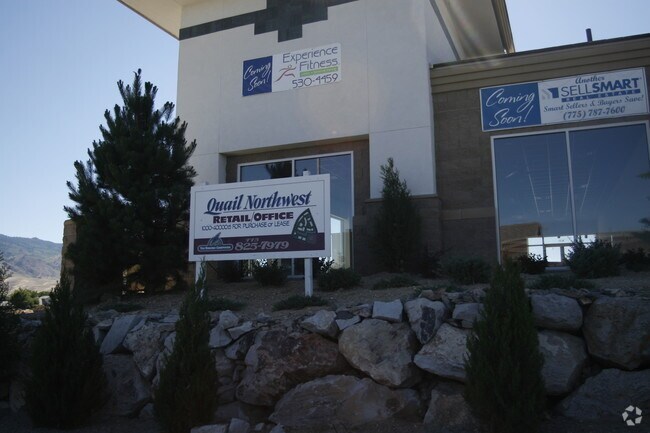

Current Lease Availabilities
Property Detail
1635 Robb Dr
200-590-26
RS 4629 LT 10-A
Commercialnec
Washoe
NC
Nevada
B and X Area of moderate flood hazard, usually the area between the limits of the 100-year and 500-year floods.
10-a
2025
0.12 AC
2026
Northwest Reno
002413
Reno/Sparks
4,757 SF
Reno, NV
NEARBY LISTINGS FOR SALE OR LEASE
DEMOGRAPHICS near 1635 Robb Dr
1 mile
3 mile
5 mile
2025 Total Population
14,158
64,629
147,362
2030 Population
14,612
66,332
150,957
Pop Growth 2025-2030
+ 3.21%
+ 2.64%
+ 2.44%
Average Age
39
41
41
2025 Total Households
5,739
27,044
63,319
HH Growth 2025-2030
+ 3.33%
+ 2.73%
+ 2.51%
Median Household Inc
$92,083
$90,849
$73,620
Avg Household Size
2.40
2.30
2.20
2025 Avg HH Vehicles
2.00
2.00
2.00
Median Home Value
$559,825
$638,067
$637,664
Median Year Built
1995
1992
1986
Nearby Places
Map Layers
Map Styles
 Street
 Aerial
Layers
 Traffic
 Biking
Places
Listings with unknown addresses are not visible on the map
- Restaurants
- Banks
- Shops
- Fitness
- Groceries
PUBLIC TRANSPORTATION
COMMUTER RAIL
Drive
Walk
Distance
10 min
5.1 mi
AIRPORT
Reno/Tahoe International
Drive
Walk
Distance
Reno/Tahoe International
31 min
11.6 mi
Nearby Properties
Address
Land Use
TOTAL SIZE
Lot Size
Zoning
Address
Land Use
TOTAL SIZE
Lot Size
Zoning
55,187 SF
116.12 AC
GC
Address
Land Use
TOTAL SIZE
Lot Size
Zoning
378,145 SF
27.36 AC
PD
Address
Land Use
TOTAL SIZE
Lot Size
Zoning
477,926 SF
54.37 AC
MF14
Address
Land Use
TOTAL SIZE
Lot Size
Zoning
396,810 SF
16.21 AC
PD
Address
Land Use
TOTAL SIZE
Lot Size
Zoning
306,626 SF
17.61 AC
MF14 44% /
Address
Land Use
TOTAL SIZE
Lot Size
Zoning
331,462 SF
20.10 AC
PD
Address
Land Use
TOTAL SIZE
Lot Size
Zoning
304,344 SF
10.24 AC
GC
Address
Land Use
TOTAL SIZE
Lot Size
Zoning
317,507 SF
19.43 AC
MF14
Address
Land Use
TOTAL SIZE
Lot Size
Zoning
305,060 SF
23.90 AC
SPD
Address
Land Use
TOTAL SIZE
Lot Size
Zoning
272,580 SF
18.90 AC
MF21
Address
Land Use
TOTAL SIZE
Lot Size
Zoning
260,382 SF
18.77 AC
PD
Address
Land Use
TOTAL SIZE
Lot Size
Zoning
303,512 SF
20.60 AC
MF30
Address
Land Use
TOTAL SIZE
Lot Size
Zoning
293,364 SF
21.87 AC
MF14
Address
Land Use
TOTAL SIZE
Lot Size
Zoning
182,838 SF
8.02 AC
MS
Address
Land Use
TOTAL SIZE
Lot Size
Zoning
254,180 SF
15.99 AC
MF14
Address
Land Use
TOTAL SIZE
Lot Size
Zoning
259,461 SF
16.24 AC
MF30
Address
Land Use
TOTAL SIZE
Lot Size
Zoning
213,835 SF
12.53 AC
MF21
Address
Land Use
TOTAL SIZE
Lot Size
Zoning
342,672 SF
18.39 AC
MS
Address
Land Use
TOTAL SIZE
Lot Size
Zoning
92,930 SF
2.68 AC
MF21
Address
Land Use
TOTAL SIZE
Lot Size
Zoning
205,916 SF
22.44 AC
GC
Address
Land Use
TOTAL SIZE
Lot Size
Zoning
247,315 SF
20.74 AC
MF14
Address
Land Use
TOTAL SIZE
Lot Size
Zoning
77,545 SF
4.82 AC
PF
Address
Land Use
TOTAL SIZE
Lot Size
Zoning
170,791 SF
9.37 AC
MF30
Address
Land Use
TOTAL SIZE
Lot Size
Zoning
62,792 SF
3.98 AC
MF21
Address
Land Use
TOTAL SIZE
Lot Size
Zoning
263,136 SF
43.49 AC
PF
Address
Land Use
TOTAL SIZE
Lot Size
Zoning
116,495 SF
4.99 AC
MF30
Address
Land Use
TOTAL SIZE
Lot Size
Zoning
27.54 AC
PSP
Address
Land Use
TOTAL SIZE
Lot Size
Zoning
55,994 SF
3.09 AC
MF14
Address
Land Use
TOTAL SIZE
Lot Size
Zoning
200,840 SF
40.35 AC
LLR1
Address
Land Use
TOTAL SIZE
Lot Size
Zoning
159,063 SF
8.39 AC
SPD
The World's #1 Commercial Real Estate Marketplace
Connect with us
© 2026 CoStar Group
The information above has been obtained from sources believed reliable. While we do not doubt its accuracy we have not verified it and make no guarantee, warranty or representation about it. It is your responsibility to independently confirm its accuracy and completeness. Any projections, opinions, assumptions, or estimates used are for example only and do not represent the current or future performance of the property. The value of this transaction to you depends on tax and other factors which should be evaluated by your tax, financial, and legal advisors. You and your advisors should conduct a careful, independent investigation of the property to determine to your satisfaction the suitability of the property for your needs.