Property Record
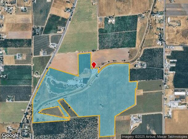
16360 N Highway 88, Lodi, CA 95240
NEARBY LISTINGS FOR SALE OR LEASE
Property Detail
16360 N Highway 88
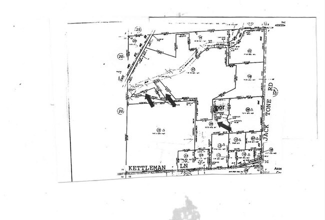
051-260-33
99-FM PT OF 26-29/PT TO 30-32 98064565-98064567-9
Orchard
San Joaquin
AE
California
06077C0195F
179.07 AC
2025
Lodi
2025
Stockton/Modesto
004704
Stockton-Lodi, CA
DEMOGRAPHICS near 16360 N Highway 88
1 Mile
3 Mile
5 Mile
2024 Total Population
327
5,001
8,031
2029 Population
332
5,117
8,196
Pop Growth 2024-2029
+ 1.53%
+ 2.32%
+ 2.05%
Average Age
44
42
42
2024 Total Households
113
1,758
2,817
HH Growth 2024-2029
+ 1.77%
+ 2.50%
+ 2.13%
Median Household Inc
$85,869
$91,566
$94,308
Avg Household Size
2.60
2.70
2.70
2024 Avg HH Vehicles
2.00
2.00
3.00
Median Home Value
$761,111
$516,386
$626,826
Median Year Built
1972
1979
1978
Nearby Places
Map Layers
Map Styles
 Street
 Aerial
- Restaurants
- Banks
- Shops
- Fitness
- Groceries
PUBLIC TRANSPORTATION
COMMUTER RAIL
Lodi Amtrak Station (San Joaquins - Amtrak)
DRIVE
WALK
Distance
Lodi Amtrak Station (San Joaquins - Amtrak)
14 min
7.5 mi
AIRPORT
Stockton Metro
DRIVE
WALK
Distance
Stockton Metro
32 min
20.8 mi
Freight Ports
Port of Stockton
DRIVE
WALK
Distance
Port of Stockton
31 min
19.3 mi
SALE & LEASE HISTORY
LISTING DATE
SALE/LEASE

Sep 24, 2016
For Sale
Nearby Properties
Address
Land Use
TOTAL SIZE
Lot Size
Zoning
Address
Land Use
TOTAL SIZE
Lot Size
Zoning
12.15 AC
IL
Address
Land Use
TOTAL SIZE
Lot Size
Zoning
13,832 SF
23.61 AC
IG
Address
Land Use
TOTAL SIZE
Lot Size
Zoning
49,680 SF
19.93 AC
IG
Address
Land Use
TOTAL SIZE
Lot Size
Zoning
124.73 AC
RL
Address
Land Use
TOTAL SIZE
Lot Size
Zoning
58,032 SF
23.90 AC
IG
Address
Land Use
TOTAL SIZE
Lot Size
Zoning
4.85 AC
RL
Address
Land Use
TOTAL SIZE
Lot Size
Zoning
4.42 AC
CG
Address
Land Use
TOTAL SIZE
Lot Size
Zoning
999 SF
299.02 AC
AG40
Address
Land Use
TOTAL SIZE
Lot Size
Zoning
3.37 AC
Address
Land Use
TOTAL SIZE
Lot Size
Zoning
1,115 SF
91.51 AC
AG40
Address
Land Use
TOTAL SIZE
Lot Size
Zoning
1,975 SF
1.88 AC
CC
Address
Land Use
TOTAL SIZE
Lot Size
Zoning
6,576 SF
0.71 AC
CC
Address
Land Use
TOTAL SIZE
Lot Size
Zoning
6,802 SF
45.42 AC
AG40
Address
Land Use
TOTAL SIZE
Lot Size
Zoning
37,326 SF
7 AC
CC
Address
Land Use
TOTAL SIZE
Lot Size
Zoning
100,000 SF
20 AC
IG
Address
Land Use
TOTAL SIZE
Lot Size
Zoning
116.26 AC
AG40
Address
Land Use
TOTAL SIZE
Lot Size
Zoning
1.98 AC
CG
Address
Land Use
TOTAL SIZE
Lot Size
Zoning
3,493 SF
18.68 AC
AG40
Address
Land Use
TOTAL SIZE
Lot Size
Zoning
4,359 SF
44.92 AC
AG40
Address
Land Use
TOTAL SIZE
Lot Size
Zoning
108.72 AC
AG40
Address
Land Use
TOTAL SIZE
Lot Size
Zoning
3,348 SF
15.68 AC
AG40
Address
Land Use
TOTAL SIZE
Lot Size
Zoning
9,015 SF
0.91 AC
Address
Land Use
TOTAL SIZE
Lot Size
Zoning
13,832 SF
23.61 AC
IG
Address
Land Use
TOTAL SIZE
Lot Size
Zoning
18,796 SF
5.20 AC
CG
Address
Land Use
TOTAL SIZE
Lot Size
Zoning
2,041 SF
0.59 AC
CC
Address
Land Use
TOTAL SIZE
Lot Size
Zoning
2,820 SF
0.76 AC
CC
Address
Land Use
TOTAL SIZE
Lot Size
Zoning
98.86 AC
AG40
Address
Land Use
TOTAL SIZE
Lot Size
Zoning
4,965 SF
17.25 AC
AG40
Address
Land Use
TOTAL SIZE
Lot Size
Zoning
4.98 AC
AG40
The World's #1 Commercial Real Estate Marketplace
Connect with us
© 2025 CoStar Group
The information above has been obtained from sources believed reliable. While we do not doubt its accuracy we have not verified it and make no guarantee, warranty or representation about it. It is your responsibility to independently confirm its accuracy and completeness. Any projections, opinions, assumptions, or estimates used are for example only and do not represent the current or future performance of the property. The value of this transaction to you depends on tax and other factors which should be evaluated by your tax, financial, and legal advisors. You and your advisors should conduct a careful, independent investigation of the property to determine to your satisfaction the suitability of the property for your needs.