Property Record
1637 N Us Highway 1, Ormond Beach, FL 32174
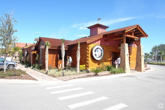

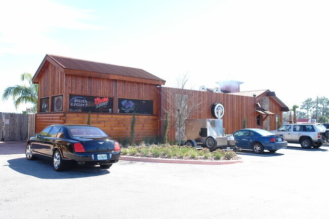
Property Detail
1637 N Us Highway 1
3125-04-00-0030
LOT 3 DESTINATION DAYTONA MB 53 PG 81 PER OR 5937 PG 3654 PER OR 5937 PGS 3644-3645 PER OR 5937 PGS 3636-3637 INC PER OR 5937 PGS 3650-3651 EXC DESTINATION DAYTONA BLDG 2 CONDO PER OR 5908 PG 2376 & EXC DESTINATION DAYTONA BLDG 1 CONDO PER OR 6011 PG
Vehiclerentalsvehiclesales
VOLUSIA
BPUD
Florida
A Areas with a 1% annual chance of flooding and a 26% chance of flooding over the life of a 30-year mortgage.
3
2025
12.44 AC
2026
Ormond Beach
080102
Deltona/Daytona Beach
196,932 SF
Deltona-Daytona Beach-Ormond Beach, FL
NEARBY LISTINGS FOR SALE OR LEASE
DEMOGRAPHICS near 1637 N Us Highway 1
1 mile
3 mile
5 mile
2025 Total Population
785
8,246
39,685
2030 Population
859
8,890
43,170
Pop Growth 2025-2030
+ 9.43%
+ 7.81%
+ 8.78%
Average Age
53
54
52
2025 Total Households
355
3,795
18,534
HH Growth 2025-2030
+ 9.58%
+ 7.75%
+ 8.95%
Median Household Inc
$64,132
$79,762
$75,359
Avg Household Size
2.10
2.10
2.10
2025 Avg HH Vehicles
2.00
2.00
2.00
Median Home Value
$404,794
$426,737
$414,316
Median Year Built
1994
2000
1987
Nearby Places
Map Layers
Map Styles
 Street
 Aerial
Layers
 Traffic
 Biking
Places
Listings with unknown addresses are not visible on the map
- Restaurants
- Banks
- Shops
- Fitness
- Groceries
PUBLIC TRANSPORTATION
AIRPORT
Daytona Beach International
Drive
Walk
Distance
Daytona Beach International
22 min
14.9 mi
Freight Ports
Port Canaveral
Drive
Walk
Distance
Port Canaveral
95 min
82.2 mi
Nearby Properties
Address
Land Use
TOTAL SIZE
Lot Size
Zoning
Address
Land Use
TOTAL SIZE
Lot Size
Zoning
13,846 SF
126.83 AC
13T1
Address
Land Use
TOTAL SIZE
Lot Size
Zoning
137,934 SF
48.30 AC
Address
Land Use
TOTAL SIZE
Lot Size
Zoning
5,350 SF
36.42 AC
13T1
Address
Land Use
TOTAL SIZE
Lot Size
Zoning
161,123 SF
13.56 AC
I1
Address
Land Use
TOTAL SIZE
Lot Size
Zoning
209,984 SF
24.14 AC
I1
Address
Land Use
TOTAL SIZE
Lot Size
Zoning
106,488 SF
27.60 AC
MPUD
Address
Land Use
TOTAL SIZE
Lot Size
Zoning
127,463 SF
5.50 AC
01B2
Address
Land Use
TOTAL SIZE
Lot Size
Zoning
180,677 SF
12.31 AC
13I1
Address
Land Use
TOTAL SIZE
Lot Size
Zoning
13,724 SF
219.03 AC
RPUD
Address
Land Use
TOTAL SIZE
Lot Size
Zoning
17,631 SF
5.47 AC
A2
Address
Land Use
TOTAL SIZE
Lot Size
Zoning
16,887 SF
9.09 AC
01I1
Address
Land Use
TOTAL SIZE
Lot Size
Zoning
31,277 SF
5.45 AC
BPUD
Address
Land Use
TOTAL SIZE
Lot Size
Zoning
102,465 SF
12.50 AC
13I1
Address
Land Use
TOTAL SIZE
Lot Size
Zoning
57,230 SF
6.85 AC
01B6
Address
Land Use
TOTAL SIZE
Lot Size
Zoning
147,329 SF
11.50 AC
13I1
Address
Land Use
TOTAL SIZE
Lot Size
Zoning
41,746 SF
3.28 AC
Address
Land Use
TOTAL SIZE
Lot Size
Zoning
151,185 SF
28.90 AC
01I1
Address
Land Use
TOTAL SIZE
Lot Size
Zoning
44,428 SF
4.51 AC
01I1
Address
Land Use
TOTAL SIZE
Lot Size
Zoning
48,646 SF
3.05 AC
B6
Address
Land Use
TOTAL SIZE
Lot Size
Zoning
130.59 AC
RPUD
Address
Land Use
TOTAL SIZE
Lot Size
Zoning
18,255 SF
14 AC
01I1
Address
Land Use
TOTAL SIZE
Lot Size
Zoning
28,686 SF
3.24 AC
BPUD
Address
Land Use
TOTAL SIZE
Lot Size
Zoning
68,280 SF
4.02 AC
Address
Land Use
TOTAL SIZE
Lot Size
Zoning
70.59 AC
R4
Address
Land Use
TOTAL SIZE
Lot Size
Zoning
45,364 SF
4.34 AC
13I1
Address
Land Use
TOTAL SIZE
Lot Size
Zoning
8,936 SF
9.07 AC
BPUD
Address
Land Use
TOTAL SIZE
Lot Size
Zoning
18,286 SF
2.69 AC
B4
Address
Land Use
TOTAL SIZE
Lot Size
Zoning
21,423 SF
4.46 AC
01B6
Address
Land Use
TOTAL SIZE
Lot Size
Zoning
36,754 SF
7.81 AC
01I2
The World's #1 Commercial Real Estate Marketplace
Connect with us
© 2026 CoStar Group
The information above has been obtained from sources believed reliable. While we do not doubt its accuracy we have not verified it and make no guarantee, warranty or representation about it. It is your responsibility to independently confirm its accuracy and completeness. Any projections, opinions, assumptions, or estimates used are for example only and do not represent the current or future performance of the property. The value of this transaction to you depends on tax and other factors which should be evaluated by your tax, financial, and legal advisors. You and your advisors should conduct a careful, independent investigation of the property to determine to your satisfaction the suitability of the property for your needs.