Property Record
16375 N Tracks Rd, Gardendale, TX 79758
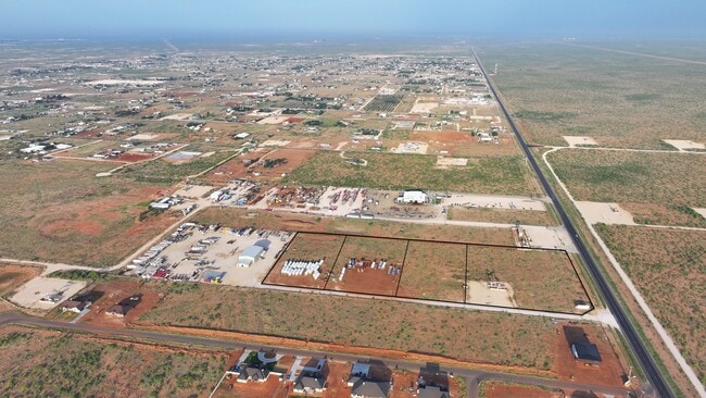


This Property Is For Sale
Property Detail
16375 N Tracks Rd
Odessa, TX
GARDENDALE INDUSTRIAL BLOCK 1 LOT 1
111300001000000
ECTOR
Vacantlandnec
Texas
EG1
1
B and X Area of moderate flood hazard, usually the area between the limits of the 100-year and 500-year floods.
4.52 AC
2025
Midland & Odessa
2025
Other Market Areas
003001
NEARBY LISTINGS FOR SALE OR LEASE
DEMOGRAPHICS near 16375 N Tracks Rd
1 mile
3 mile
5 mile
2025 Total Population
222
2,097
3,112
2030 Population
231
2,174
3,303
Pop Growth 2025-2030
+ 4.05%
+ 3.67%
+ 6.14%
Average Age
39
38
37
2025 Total Households
83
834
1,185
HH Growth 2025-2030
+ 4.82%
+ 4.80%
+ 7.00%
Median Household Inc
$88,888
$90,108
$94,291
Avg Household Size
2.60
2.50
2.60
2025 Avg HH Vehicles
3.00
3.00
3.00
Median Home Value
$380,768
$408,621
$394,193
Median Year Built
1999
1995
1996
Nearby Places
Map Layers
Map Styles
 Street
 Aerial
Layers
 Traffic
 Biking
Places
Listings with unknown addresses are not visible on the map
- Restaurants
- Banks
- Shops
- Fitness
- Groceries
PUBLIC TRANSPORTATION
AIRPORT
Midland International Air And Space Port
Drive
Walk
Distance
Midland International Air And Space Port
22 min
14.9 mi
Nearby Properties
Address
Land Use
TOTAL SIZE
Lot Size
Zoning
Address
Land Use
TOTAL SIZE
Lot Size
Zoning
8,158 SF
16.27 AC
EG1
Address
Land Use
TOTAL SIZE
Lot Size
Zoning
14,616 SF
1 AC
EG1
Address
Land Use
TOTAL SIZE
Lot Size
Zoning
11,200 SF
5.56 AC
EG1
Address
Land Use
TOTAL SIZE
Lot Size
Zoning
11,400 SF
4.95 AC
EG1
Address
Land Use
TOTAL SIZE
Lot Size
Zoning
19,000 SF
0.97 AC
EG1
Address
Land Use
TOTAL SIZE
Lot Size
Zoning
131.51 AC
EG1
Address
Land Use
TOTAL SIZE
Lot Size
Zoning
1,752 SF
39.52 AC
EG1
Address
Land Use
TOTAL SIZE
Lot Size
Zoning
9,800 SF
1.97 AC
EG1
Address
Land Use
TOTAL SIZE
Lot Size
Zoning
625 SF
9.14 AC
EG1
Address
Land Use
TOTAL SIZE
Lot Size
Zoning
900 SF
2.03 AC
EG1
Address
Land Use
TOTAL SIZE
Lot Size
Zoning
77,036 SF
59.04 AC
EG1
Address
Land Use
TOTAL SIZE
Lot Size
Zoning
15,350 SF
4 AC
EG1
Address
Land Use
TOTAL SIZE
Lot Size
Zoning
82.38 AC
EG1
Address
Land Use
TOTAL SIZE
Lot Size
Zoning
2,760 SF
8.36 AC
EG1
Address
Land Use
TOTAL SIZE
Lot Size
Zoning
1,200 SF
11.43 AC
EG1
Address
Land Use
TOTAL SIZE
Lot Size
Zoning
14,500 SF
5 AC
EG1
Address
Land Use
TOTAL SIZE
Lot Size
Zoning
6,600 SF
7.24 AC
EG1
Address
Land Use
TOTAL SIZE
Lot Size
Zoning
6,000 SF
6.47 AC
EG1
Address
Land Use
TOTAL SIZE
Lot Size
Zoning
3,200 SF
0.43 AC
EG1
Address
Land Use
TOTAL SIZE
Lot Size
Zoning
3,918 SF
1.09 AC
EG1
Address
Land Use
TOTAL SIZE
Lot Size
Zoning
1,600 SF
2.47 AC
EG1
Address
Land Use
TOTAL SIZE
Lot Size
Zoning
22,736 SF
1.88 AC
EG1
Address
Land Use
TOTAL SIZE
Lot Size
Zoning
48.79 AC
EG1
Address
Land Use
TOTAL SIZE
Lot Size
Zoning
21,112 SF
1.88 AC
EG1
Address
Land Use
TOTAL SIZE
Lot Size
Zoning
2,400 SF
5.54 AC
EG1
Address
Land Use
TOTAL SIZE
Lot Size
Zoning
6,000 SF
2.53 AC
EG1
Address
Land Use
TOTAL SIZE
Lot Size
Zoning
1,500 SF
14.49 AC
EG1
Address
Land Use
TOTAL SIZE
Lot Size
Zoning
8,200 SF
1 AC
EG1
Address
Land Use
TOTAL SIZE
Lot Size
Zoning
744 SF
2 AC
EG1
Address
Land Use
TOTAL SIZE
Lot Size
Zoning
6,000 SF
3.64 AC
EG1
The World's #1 Commercial Real Estate Marketplace
Connect with us
© 2026 CoStar Group
The information above has been obtained from sources believed reliable. While we do not doubt its accuracy we have not verified it and make no guarantee, warranty or representation about it. It is your responsibility to independently confirm its accuracy and completeness. Any projections, opinions, assumptions, or estimates used are for example only and do not represent the current or future performance of the property. The value of this transaction to you depends on tax and other factors which should be evaluated by your tax, financial, and legal advisors. You and your advisors should conduct a careful, independent investigation of the property to determine to your satisfaction the suitability of the property for your needs.