Property Record
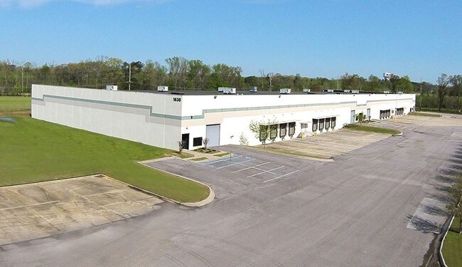
1638 Thompson Rd, Hartselle, AL 35640


NEARBY LISTINGS FOR SALE OR LEASE
Property Detail
1638 Thompson Rd
15-06-24-0-000-029.000
COM AT NW COR OF SE1/4 OF SE1/4 SEC 24 T7S R4W TH E 250'S TO POB; TH CONT E 547.10' TO W R /WTABERNACLE RD; TH SW ALONG NW 70
Publicstorage
Morgan
X
Alabama
01103C0217F
19.30 AC
2025
Alabama North Area
2024
Other Market Areas
005304
Decatur, AL
120,000 SF
DEMOGRAPHICS near 1638 Thompson Rd
1 Mile
3 Mile
5 Mile
2024 Total Population
270
9,943
22,083
2029 Population
274
10,037
22,247
Pop Growth 2024-2029
+ 1.48%
+ 0.95%
+ 0.74%
Average Age
41
40
41
2024 Total Households
103
3,904
8,665
HH Growth 2024-2029
+ 1.94%
+ 0.97%
+ 0.76%
Median Household Inc
$58,333
$59,652
$66,055
Avg Household Size
2.50
2.50
2.50
2024 Avg HH Vehicles
2.00
2.00
2.00
Median Home Value
$168,518
$193,504
$179,670
Median Year Built
1986
1985
1983
Nearby Places
Map Layers
Map Styles
 Street
 Aerial
- Restaurants
- Banks
- Shops
- Fitness
- Groceries
PUBLIC TRANSPORTATION
AIRPORT
Huntsville International-Carl T Jones Field
DRIVE
WALK
Distance
Huntsville International-Carl T Jones Field
35 min
26.0 mi
SALE & LEASE HISTORY
LISTING DATE
SALE/LEASE

Sep 25, 2016
For Lease
Sep 24, 2016
For Sale
Sep 23, 2016
For Sale
Mar 03, 2017
For Sale
Jan 18, 2017
For Lease
Nearby Properties
Address
Land Use
TOTAL SIZE
Lot Size
Zoning
Address
Land Use
TOTAL SIZE
Lot Size
Zoning
79,148 SF
2.34 AC
Address
Land Use
TOTAL SIZE
Lot Size
Zoning
135,937 SF
27 AC
Address
Land Use
TOTAL SIZE
Lot Size
Zoning
12,057 SF
2 AC
Address
Land Use
TOTAL SIZE
Lot Size
Zoning
12,973 SF
1.05 AC
Address
Land Use
TOTAL SIZE
Lot Size
Zoning
99,416 SF
11 AC
Address
Land Use
TOTAL SIZE
Lot Size
Zoning
70,400 SF
7.60 AC
Address
Land Use
TOTAL SIZE
Lot Size
Zoning
5,074 SF
11 AC
Address
Land Use
TOTAL SIZE
Lot Size
Zoning
282,610 SF
44 AC
Address
Land Use
TOTAL SIZE
Lot Size
Zoning
36,240 SF
10 AC
Address
Land Use
TOTAL SIZE
Lot Size
Zoning
16,204 SF
1.58 AC
Address
Land Use
TOTAL SIZE
Lot Size
Zoning
3,690 SF
5 AC
Address
Land Use
TOTAL SIZE
Lot Size
Zoning
73,090 SF
5.45 AC
Address
Land Use
TOTAL SIZE
Lot Size
Zoning
16,650 SF
0.92 AC
Address
Land Use
TOTAL SIZE
Lot Size
Zoning
875 SF
2 AC
Address
Land Use
TOTAL SIZE
Lot Size
Zoning
32,987 SF
1.20 AC
Address
Land Use
TOTAL SIZE
Lot Size
Zoning
7,037 SF
2.77 AC
Address
Land Use
TOTAL SIZE
Lot Size
Zoning
7,500 SF
60 AC
Address
Land Use
TOTAL SIZE
Lot Size
Zoning
1,200 SF
3.50 AC
Address
Land Use
TOTAL SIZE
Lot Size
Zoning
5,360 SF
0.60 AC
Address
Land Use
TOTAL SIZE
Lot Size
Zoning
14,814 SF
3.05 AC
Address
Land Use
TOTAL SIZE
Lot Size
Zoning
2,350 SF
10.50 AC
Address
Land Use
TOTAL SIZE
Lot Size
Zoning
5,780 SF
4.40 AC
Address
Land Use
TOTAL SIZE
Lot Size
Zoning
26,053 SF
1.94 AC
Address
Land Use
TOTAL SIZE
Lot Size
Zoning
Address
Land Use
TOTAL SIZE
Lot Size
Zoning
14,016 SF
0.86 AC
Address
Land Use
TOTAL SIZE
Lot Size
Zoning
14,771 SF
2.70 AC
Address
Land Use
TOTAL SIZE
Lot Size
Zoning
12,062 SF
1.03 AC
Address
Land Use
TOTAL SIZE
Lot Size
Zoning
44,392 SF
5.40 AC
Address
Land Use
TOTAL SIZE
Lot Size
Zoning
2,800 SF
6.50 AC
The World's #1 Commercial Real Estate Marketplace
Connect with us
© 2026 CoStar Group
The information above has been obtained from sources believed reliable. While we do not doubt its accuracy we have not verified it and make no guarantee, warranty or representation about it. It is your responsibility to independently confirm its accuracy and completeness. Any projections, opinions, assumptions, or estimates used are for example only and do not represent the current or future performance of the property. The value of this transaction to you depends on tax and other factors which should be evaluated by your tax, financial, and legal advisors. You and your advisors should conduct a careful, independent investigation of the property to determine to your satisfaction the suitability of the property for your needs.