No Photo
Property Record
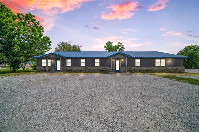
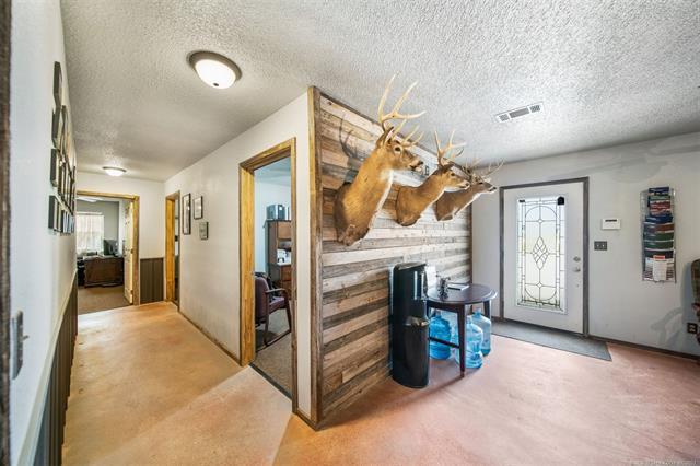
16382 E Highway 20, Claremore, OK 74019

Property Detail
16382 E Highway 20
660016883
E 165' OF N 330' NW NE NW LESS TR BEG 659.98' W NE/C NW, TH S 01-25-30 E 110.05', N 84-32- 36 W 85.27', TH WLY ON CUR TO L (R
Officebuilding
Rogers
B and X Area of moderate flood hazard, usually the area between the limits of the 100-year and 500-year floods.
Oklahoma
2025
0.86 AC
2025
Rogers County
050604
Tulsa
3,200 SF
Tulsa, OK
NEARBY LISTINGS FOR SALE OR LEASE
-
-
View all Claremore listings for lease on LoopNet.com
DEMOGRAPHICS near 16382 E Highway 20
1 mile
3 mile
5 mile
2025 Total Population
324
4,184
21,015
2030 Population
340
4,442
22,214
Pop Growth 2025-2030
+ 4.94%
+ 6.17%
+ 5.71%
Average Age
43
43
41
2025 Total Households
117
1,556
8,272
HH Growth 2025-2030
+ 4.27%
+ 6.23%
+ 5.75%
Median Household Inc
$73,635
$79,464
$60,232
Avg Household Size
2.60
2.60
2.40
2025 Avg HH Vehicles
3.00
3.00
2.00
Median Home Value
$248,717
$249,275
$205,695
Median Year Built
1991
1995
1983
Nearby Places
Map Layers
Map Styles
 Street
 Aerial
Layers
 Traffic
 Biking
Places
Listings with unknown addresses are not visible on the map
- Restaurants
- Banks
- Shops
- Fitness
- Groceries
PUBLIC TRANSPORTATION
AIRPORT
Tulsa International
Drive
Walk
Distance
Tulsa International
32 min
24.5 mi
Freight Ports
Tulsa Port Of Catoosa
Drive
Walk
Distance
Tulsa Port Of Catoosa
21 min
16.7 mi
SALE & LEASE HISTORY
LISTING DATE
SALE/LEASE

Jul 31, 2023
For Sale
Jul 23, 2025
For Lease
Jul 22, 2025
For Lease
Nearby Properties
Address
Land Use
TOTAL SIZE
Lot Size
Zoning
Address
Land Use
TOTAL SIZE
Lot Size
Zoning
18,400 SF
235.53 AC
Address
Land Use
TOTAL SIZE
Lot Size
Zoning
3,200 SF
0.72 AC
Address
Land Use
TOTAL SIZE
Lot Size
Zoning
3,360 SF
16.44 AC
Address
Land Use
TOTAL SIZE
Lot Size
Zoning
11.54 AC
Address
Land Use
TOTAL SIZE
Lot Size
Zoning
3,360 SF
12.37 AC
Address
Land Use
TOTAL SIZE
Lot Size
Zoning
4,000 SF
3.79 AC
Address
Land Use
TOTAL SIZE
Lot Size
Zoning
4,500 SF
6.76 AC
Address
Land Use
TOTAL SIZE
Lot Size
Zoning
3,600 SF
0.52 AC
Address
Land Use
TOTAL SIZE
Lot Size
Zoning
2,880 SF
2.20 AC
Address
Land Use
TOTAL SIZE
Lot Size
Zoning
4,802 SF
5.44 AC
Address
Land Use
TOTAL SIZE
Lot Size
Zoning
5,000 SF
0.82 AC
Address
Land Use
TOTAL SIZE
Lot Size
Zoning
19,252 SF
1.25 AC
Address
Land Use
TOTAL SIZE
Lot Size
Zoning
4,500 SF
9.91 AC
Address
Land Use
TOTAL SIZE
Lot Size
Zoning
2,653 SF
0.42 AC
Address
Land Use
TOTAL SIZE
Lot Size
Zoning
1,606 SF
1.13 AC
Address
Land Use
TOTAL SIZE
Lot Size
Zoning
12.88 AC
Address
Land Use
TOTAL SIZE
Lot Size
Zoning
2,100 SF
1.71 AC
Address
Land Use
TOTAL SIZE
Lot Size
Zoning
3,250 SF
9.12 AC
Address
Land Use
TOTAL SIZE
Lot Size
Zoning
Address
Land Use
TOTAL SIZE
Lot Size
Zoning
18.49 AC
Address
Land Use
TOTAL SIZE
Lot Size
Zoning
675 SF
1.02 AC
Address
Land Use
TOTAL SIZE
Lot Size
Zoning
5,000 SF
10 AC
Address
Land Use
TOTAL SIZE
Lot Size
Zoning
1,280 SF
5.97 AC
Address
Land Use
TOTAL SIZE
Lot Size
Zoning
1,500 SF
4.22 AC
Address
Land Use
TOTAL SIZE
Lot Size
Zoning
5.21 AC
Address
Land Use
TOTAL SIZE
Lot Size
Zoning
10.26 AC
Address
Land Use
TOTAL SIZE
Lot Size
Zoning
Address
Land Use
TOTAL SIZE
Lot Size
Zoning
1,296 SF
13.35 AC
Address
Land Use
TOTAL SIZE
Lot Size
Zoning
7,776 SF
5 AC
The World's #1 Commercial Real Estate Marketplace
Connect with us
© 2026 CoStar Group
The information above has been obtained from sources believed reliable. While we do not doubt its accuracy we have not verified it and make no guarantee, warranty or representation about it. It is your responsibility to independently confirm its accuracy and completeness. Any projections, opinions, assumptions, or estimates used are for example only and do not represent the current or future performance of the property. The value of this transaction to you depends on tax and other factors which should be evaluated by your tax, financial, and legal advisors. You and your advisors should conduct a careful, independent investigation of the property to determine to your satisfaction the suitability of the property for your needs.