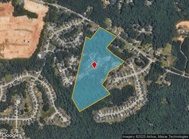
Property Record
1639 Stephenson Rd, Lithonia, GA 30058

NEARBY LISTINGS FOR SALE OR LEASE
Property Detail
1639 Stephenson Rd
16-162-01-008
373 X 310 X 210 X 350 X 245 X 589 X 210 X 600 64.22 2-18-92 402 X 310 X 210 X 350 X 235 X 599 X 210 X 389 X 210 X 210 125 X
Vacantlandnec
DeKalb
AE
Georgia
13089C0114K
8
2025
23.17 AC
2025
I-20 East/Conyers
023313
Atlanta
2,855 SF
Atlanta-Sandy Springs-Roswell, GA
DEMOGRAPHICS near 1639 Stephenson Rd
1 Mile
3 Mile
5 Mile
2024 Total Population
7,751
43,585
134,140
2029 Population
7,658
43,695
135,431
Pop Growth 2024-2029
(1.20%)
+ 0.25%
+ 0.96%
Average Age
38
39
38
2024 Total Households
2,627
14,413
46,183
HH Growth 2024-2029
(1.26%)
+ 0.17%
+ 0.84%
Median Household Inc
$74,009
$77,140
$69,032
Avg Household Size
2.90
3.00
2.80
2024 Avg HH Vehicles
2.00
2.00
2.00
Median Home Value
$229,273
$235,312
$225,781
Median Year Built
1997
1994
1990
Nearby Places
Map Layers
Map Styles
 Street
 Aerial
- Restaurants
- Banks
- Shops
- Fitness
- Groceries
PUBLIC TRANSPORTATION
AIRPORT
Hartsfield - Jackson Atlanta International
DRIVE
WALK
Distance
Hartsfield - Jackson Atlanta International
42 min
27.1 mi
Freight Ports
Georgia Ports - Savannah
DRIVE
WALK
Distance
Georgia Ports - Savannah
290 min
247.5 mi
Nearby Properties
Address
Land Use
TOTAL SIZE
Lot Size
Zoning
Address
Land Use
TOTAL SIZE
Lot Size
Zoning
614,505 SF
97.30 AC
Address
Land Use
TOTAL SIZE
Lot Size
Zoning
240,744 SF
23.93 AC
RM100
Address
Land Use
TOTAL SIZE
Lot Size
Zoning
3,500 SF
391.26 AC
R100
Address
Land Use
TOTAL SIZE
Lot Size
Zoning
129,843 SF
30.97 AC
R100
Address
Land Use
TOTAL SIZE
Lot Size
Zoning
7,384 SF
15.80 AC
M
Address
Land Use
TOTAL SIZE
Lot Size
Zoning
215,422 SF
33.84 AC
M
Address
Land Use
TOTAL SIZE
Lot Size
Zoning
227,648 SF
14.56 AC
X
Address
Land Use
TOTAL SIZE
Lot Size
Zoning
492 SF
208.14 AC
R100
Address
Land Use
TOTAL SIZE
Lot Size
Zoning
18,099 SF
1,412.45 AC
M2
Address
Land Use
TOTAL SIZE
Lot Size
Zoning
207,446 SF
12.21 AC
M
Address
Land Use
TOTAL SIZE
Lot Size
Zoning
54.06 AC
R100
Address
Land Use
TOTAL SIZE
Lot Size
Zoning
253,861 SF
19.28 AC
X
Address
Land Use
TOTAL SIZE
Lot Size
Zoning
142,160 SF
9.50 AC
M
Address
Land Use
TOTAL SIZE
Lot Size
Zoning
150,000 SF
13.24 AC
M
Address
Land Use
TOTAL SIZE
Lot Size
Zoning
21.53 AC
M
Address
Land Use
TOTAL SIZE
Lot Size
Zoning
94,581 SF
5.58 AC
M
Address
Land Use
TOTAL SIZE
Lot Size
Zoning
47,628 SF
10.69 AC
X
Address
Land Use
TOTAL SIZE
Lot Size
Zoning
98,676 SF
17.75 AC
C1
Address
Land Use
TOTAL SIZE
Lot Size
Zoning
99,876 SF
11.81 AC
M2
Address
Land Use
TOTAL SIZE
Lot Size
Zoning
104,000 SF
5.11 AC
M
Address
Land Use
TOTAL SIZE
Lot Size
Zoning
67,445 SF
12 AC
X
Address
Land Use
TOTAL SIZE
Lot Size
Zoning
188.98 AC
M2
Address
Land Use
TOTAL SIZE
Lot Size
Zoning
1,336 SF
8.27 AC
M
Address
Land Use
TOTAL SIZE
Lot Size
Zoning
78,575 SF
4.73 AC
M
Address
Land Use
TOTAL SIZE
Lot Size
Zoning
30,139 SF
4.57 AC
RCD
Address
Land Use
TOTAL SIZE
Lot Size
Zoning
11.05 AC
X
Address
Land Use
TOTAL SIZE
Lot Size
Zoning
53,480 SF
5.40 AC
M
Address
Land Use
TOTAL SIZE
Lot Size
Zoning
60,030 SF
3.90 AC
M
Address
Land Use
TOTAL SIZE
Lot Size
Zoning
40,100 SF
26.81 AC
X
Address
Land Use
TOTAL SIZE
Lot Size
Zoning
30,342 SF
9.68 AC
R100
The World's #1 Commercial Real Estate Marketplace
Connect with us
© 2025 CoStar Group
The information above has been obtained from sources believed reliable. While we do not doubt its accuracy we have not verified it and make no guarantee, warranty or representation about it. It is your responsibility to independently confirm its accuracy and completeness. Any projections, opinions, assumptions, or estimates used are for example only and do not represent the current or future performance of the property. The value of this transaction to you depends on tax and other factors which should be evaluated by your tax, financial, and legal advisors. You and your advisors should conduct a careful, independent investigation of the property to determine to your satisfaction the suitability of the property for your needs.