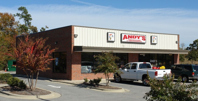
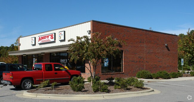
Property Record
152 Bratton Dr, Garner, NC 27529

Property Detail
152 Bratton Dr
06D01015P
LOT 2 RIVER OAKS 59/4701637
Commercialnec
Johnston
COM
North Carolina
B and X Area of moderate flood hazard, usually the area between the limits of the 100-year and 500-year floods.
2
2025
0.83 AC
2025
Johnston County
041111
Raleigh/Durham
2,500 SF
Raleigh-Cary, NC
NEARBY LISTINGS FOR SALE OR LEASE
DEMOGRAPHICS near 152 Bratton Dr
1 mile
3 mile
5 mile
2024 Total Population
5,044
23,895
64,973
2029 Population
5,614
26,372
71,845
Pop Growth 2024-2029
+ 11.30%
+ 10.37%
+ 10.58%
Average Age
38
39
39
2024 Total Households
1,878
8,573
23,611
HH Growth 2024-2029
+ 11.34%
+ 10.46%
+ 10.74%
Median Household Inc
$93,518
$101,724
$101,167
Avg Household Size
2.60
2.70
2.70
2024 Avg HH Vehicles
2.00
2.00
2.00
Median Home Value
$375,604
$382,539
$380,833
Median Year Built
2010
2005
2004
Nearby Places
Map Layers
Map Styles
 Street
 Aerial
Transit
 Traffic
 Biking
Places
Listings with unknown addresses are not visible on the map
- Restaurants
- Banks
- Shops
- Fitness
- Groceries
PUBLIC TRANSPORTATION
AIRPORT
Raleigh-Durham International
Drive
Walk
Distance
Raleigh-Durham International
39 min
30.0 mi
Freight Ports
Port of Wilmington
Drive
Walk
Distance
Port of Wilmington
136 min
118.7 mi
Nearby Properties
Address
Land Use
TOTAL SIZE
Lot Size
Zoning
Address
Land Use
TOTAL SIZE
Lot Size
Zoning
6,769 SF
13.68 AC
COM
Address
Land Use
TOTAL SIZE
Lot Size
Zoning
24,684 SF
11.64 AC
COM
Address
Land Use
TOTAL SIZE
Lot Size
Zoning
15,231 SF
12.07 AC
COM
Address
Land Use
TOTAL SIZE
Lot Size
Zoning
65,000 SF
22.17 AC
IND
Address
Land Use
TOTAL SIZE
Lot Size
Zoning
5,640 SF
601.30 AC
RA
Address
Land Use
TOTAL SIZE
Lot Size
Zoning
196,425 SF
40.89 AC
COP
Address
Land Use
TOTAL SIZE
Lot Size
Zoning
15,500 SF
34.65 AC
RAG
Address
Land Use
TOTAL SIZE
Lot Size
Zoning
105,459 SF
27.47 AC
RAG
Address
Land Use
TOTAL SIZE
Lot Size
Zoning
23,040 SF
33.08 AC
RAG
Address
Land Use
TOTAL SIZE
Lot Size
Zoning
25,000 SF
14.37 AC
COM
Address
Land Use
TOTAL SIZE
Lot Size
Zoning
56,411 SF
9.29 AC
COP
Address
Land Use
TOTAL SIZE
Lot Size
Zoning
134,927 SF
24.97 AC
COM
Address
Land Use
TOTAL SIZE
Lot Size
Zoning
50,400 SF
5.24 AC
COM
Address
Land Use
TOTAL SIZE
Lot Size
Zoning
1,856 SF
3.52 AC
COM
Address
Land Use
TOTAL SIZE
Lot Size
Zoning
30.80 AC
COM
Address
Land Use
TOTAL SIZE
Lot Size
Zoning
42,662 SF
3.48 AC
COM
Address
Land Use
TOTAL SIZE
Lot Size
Zoning
70,792 SF
10.02 AC
COM
Address
Land Use
TOTAL SIZE
Lot Size
Zoning
56,083 SF
6.50 AC
COM
Address
Land Use
TOTAL SIZE
Lot Size
Zoning
34,770 SF
5.20 AC
COM
Address
Land Use
TOTAL SIZE
Lot Size
Zoning
36,971 SF
3.08 AC
RES
Address
Land Use
TOTAL SIZE
Lot Size
Zoning
37,086 SF
6.50 AC
COM
Address
Land Use
TOTAL SIZE
Lot Size
Zoning
50,752 SF
2.11 AC
COM
Address
Land Use
TOTAL SIZE
Lot Size
Zoning
30,368 SF
3.83 AC
RAG
Address
Land Use
TOTAL SIZE
Lot Size
Zoning
18,504 SF
7.38 AC
COM
Address
Land Use
TOTAL SIZE
Lot Size
Zoning
750 SF
7.91 AC
COM
Address
Land Use
TOTAL SIZE
Lot Size
Zoning
35,710 SF
1.84 AC
COM
Address
Land Use
TOTAL SIZE
Lot Size
Zoning
36,456 SF
2.06 AC
COM
Address
Land Use
TOTAL SIZE
Lot Size
Zoning
20,240 SF
10.13 AC
RES
Address
Land Use
TOTAL SIZE
Lot Size
Zoning
2,620 SF
138 AC
R8
Address
Land Use
TOTAL SIZE
Lot Size
Zoning
28,940 SF
8.83 AC
COP
The World's #1 Commercial Real Estate Marketplace
Connect with us
© 2026 CoStar Group
The information above has been obtained from sources believed reliable. While we do not doubt its accuracy we have not verified it and make no guarantee, warranty or representation about it. It is your responsibility to independently confirm its accuracy and completeness. Any projections, opinions, assumptions, or estimates used are for example only and do not represent the current or future performance of the property. The value of this transaction to you depends on tax and other factors which should be evaluated by your tax, financial, and legal advisors. You and your advisors should conduct a careful, independent investigation of the property to determine to your satisfaction the suitability of the property for your needs.