Property Record
1641 Gentry Memorial Hwy, Easley, SC 29640
NEARBY LISTINGS FOR SALE OR LEASE
-
-
View all Easley listings for sale on LoopNet.com
Property Detail
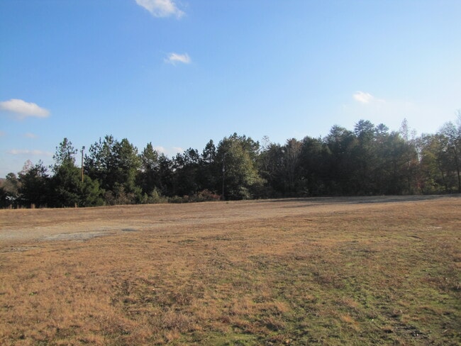
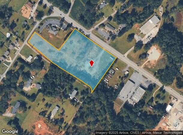
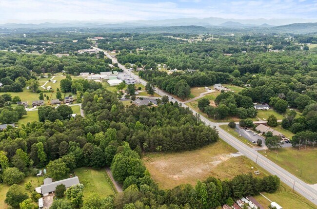
1641 Gentry Memorial Hwy
5100-17-02-9068
S/SIDE HWY 8 E/SIDE ROPER RD PLAT 60/595 P/O. SEE GIS NOTES
Vacantlandnec
Pickens
X
South Carolina
45007C0025E
6.23 AC
2025
Outlying Pickens County
2024
Greenville/Spartanburg
010700
Greenville-Anderson-Mauldin, SC
DEMOGRAPHICS near 1641 Gentry Memorial Hwy
1 Mile
3 Mile
5 Mile
2024 Total Population
1,718
12,395
40,149
2029 Population
1,787
12,961
42,155
Pop Growth 2024-2029
+ 4.02%
+ 4.57%
+ 5.00%
Average Age
43
41
41
2024 Total Households
711
4,820
16,175
HH Growth 2024-2029
+ 4.22%
+ 4.69%
+ 5.13%
Median Household Inc
$61,755
$46,293
$44,416
Avg Household Size
2.40
2.50
2.40
2024 Avg HH Vehicles
2.00
2.00
2.00
Median Home Value
$198,046
$148,211
$156,512
Median Year Built
1989
1983
1982
Nearby Places
Map Layers
Map Styles
 Street
 Aerial
- Restaurants
- Banks
- Shops
- Fitness
- Groceries
PUBLIC TRANSPORTATION
AIRPORT
Greenville Spartanburg International
DRIVE
WALK
Distance
Greenville Spartanburg International
51 min
32.3 mi
Freight Ports
North Charleston Terminal
DRIVE
WALK
Distance
North Charleston Terminal
254 min
218.7 mi
SALE & LEASE HISTORY
LISTING DATE
SALE/LEASE

Jun 10, 2023
For Sale
Jan 14, 2020
For Sale
Nearby Properties
Address
Land Use
TOTAL SIZE
Lot Size
Zoning
Address
Land Use
TOTAL SIZE
Lot Size
Zoning
56,599 SF
8.02 AC
RM16
Address
Land Use
TOTAL SIZE
Lot Size
Zoning
44,601 SF
3 AC
Address
Land Use
TOTAL SIZE
Lot Size
Zoning
13,376 SF
12.36 AC
Address
Land Use
TOTAL SIZE
Lot Size
Zoning
5,356 SF
17.33 AC
Address
Land Use
TOTAL SIZE
Lot Size
Zoning
30,000 SF
3.30 AC
Address
Land Use
TOTAL SIZE
Lot Size
Zoning
27,700 SF
12.91 AC
Address
Land Use
TOTAL SIZE
Lot Size
Zoning
39,480 SF
3.26 AC
Address
Land Use
TOTAL SIZE
Lot Size
Zoning
4,829 SF
2 AC
Address
Land Use
TOTAL SIZE
Lot Size
Zoning
180.03 AC
Address
Land Use
TOTAL SIZE
Lot Size
Zoning
5,645 SF
0.67 AC
Address
Land Use
TOTAL SIZE
Lot Size
Zoning
2,679 SF
0.58 AC
Address
Land Use
TOTAL SIZE
Lot Size
Zoning
19.43 AC
Address
Land Use
TOTAL SIZE
Lot Size
Zoning
19,852 SF
47.45 AC
GBD
Address
Land Use
TOTAL SIZE
Lot Size
Zoning
5,508 SF
4.78 AC
Address
Land Use
TOTAL SIZE
Lot Size
Zoning
1,436 SF
1.62 AC
OC OFFICE
Address
Land Use
TOTAL SIZE
Lot Size
Zoning
114.97 AC
Address
Land Use
TOTAL SIZE
Lot Size
Zoning
91,940 SF
15.07 AC
GBD
Address
Land Use
TOTAL SIZE
Lot Size
Zoning
20,652 SF
3.89 AC
Address
Land Use
TOTAL SIZE
Lot Size
Zoning
2,434 SF
6.19 AC
Address
Land Use
TOTAL SIZE
Lot Size
Zoning
1,296 SF
11.05 AC
Address
Land Use
TOTAL SIZE
Lot Size
Zoning
5,400 SF
2.20 AC
GBD
Address
Land Use
TOTAL SIZE
Lot Size
Zoning
2,997 SF
1.50 AC
GBD
Address
Land Use
TOTAL SIZE
Lot Size
Zoning
1,716 SF
1.01 AC
GBD
Address
Land Use
TOTAL SIZE
Lot Size
Zoning
1,514 SF
0.34 AC
Address
Land Use
TOTAL SIZE
Lot Size
Zoning
12.41 AC
Address
Land Use
TOTAL SIZE
Lot Size
Zoning
30.89 AC
Address
Land Use
TOTAL SIZE
Lot Size
Zoning
9,775 SF
2.09 AC
R 6 ONE FA
Address
Land Use
TOTAL SIZE
Lot Size
Zoning
37,388 SF
4.29 AC
RM16
Address
Land Use
TOTAL SIZE
Lot Size
Zoning
19.53 AC
Address
Land Use
TOTAL SIZE
Lot Size
Zoning
63,529 SF
7.11 AC
GBD
The World's #1 Commercial Real Estate Marketplace
Connect with us
© 2025 CoStar Group
The information above has been obtained from sources believed reliable. While we do not doubt its accuracy we have not verified it and make no guarantee, warranty or representation about it. It is your responsibility to independently confirm its accuracy and completeness. Any projections, opinions, assumptions, or estimates used are for example only and do not represent the current or future performance of the property. The value of this transaction to you depends on tax and other factors which should be evaluated by your tax, financial, and legal advisors. You and your advisors should conduct a careful, independent investigation of the property to determine to your satisfaction the suitability of the property for your needs.