Property Record
16417 Whittier Blvd, Whittier, CA 90603


This Property Is For Sale
NEARBY LISTINGS FOR SALE OR LEASE
Property Detail
16417 Whittier Blvd
Los Angeles-Long Beach-Glendale, CA
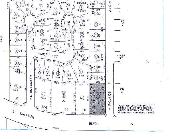
The Lowell Tract
8233-009-009
BLK A OF THE LOWELL TRACT LOT COM AT SE COR OF LOT 19 TR # 18583 TH W ON S LINE OF SD LOT TO SW COR OF SD LOT TH S TO N LINE OF WHITTIER BLVD TH E ON SD N LINE AND N ON W LINE OF POUNDS AVE TO BEG PART OF LOT 19
Storesoffices
Los Angeles
X
California
06059C0028J
19
2024
0.52 AC
2025
Southeast Los Angeles
500203
Los Angeles
4,409 SF
DEMOGRAPHICS near 16417 Whittier Blvd
1 Mile
3 Mile
5 Mile
2024 Total Population
20,163
152,813
389,479
2029 Population
19,534
148,861
379,029
Pop Growth 2024-2029
(3.12%)
(2.59%)
(2.68%)
Average Age
41
41
41
2024 Total Households
6,581
48,806
122,775
HH Growth 2024-2029
(3.36%)
(2.80%)
(2.86%)
Median Household Inc
$107,869
$98,451
$95,684
Avg Household Size
3.00
3.00
3.10
2024 Avg HH Vehicles
2.00
2.00
2.00
Median Home Value
$747,553
$754,109
$750,155
Median Year Built
1957
1962
1964
Nearby Places
Map Layers
Map Styles
 Street
 Aerial
- Restaurants
- Banks
- Shops
- Fitness
- Groceries
PUBLIC TRANSPORTATION
COMMUTER RAIL
Norwalk/Santa Fe Springs (91 Line - Southern California Regional Rail Authority (Metrolink), Orange County Line - Southern California Regional Rail Authority (Metrolink))
DRIVE
WALK
Distance
Norwalk/Santa Fe Springs (91 Line - Southern California Regional Rail Authority (Metrolink), Orange County Line - Southern California Regional Rail Authority (Metrolink))
11 min
5.5 mi
Buena Park (91 Line - Southern California Regional Rail Authority (Metrolink), Orange County Line - Southern California Regional Rail Authority (Metrolink))
DRIVE
WALK
Distance
Buena Park (91 Line - Southern California Regional Rail Authority (Metrolink), Orange County Line - Southern California Regional Rail Authority (Metrolink))
11 min
6.0 mi
AIRPORT
Long Beach (Daugherty Field)
DRIVE
WALK
Distance
Long Beach (Daugherty Field)
33 min
20.3 mi
John Wayne/Orange County
DRIVE
WALK
Distance
John Wayne/Orange County
33 min
24.9 mi
Los Angeles International
DRIVE
WALK
Distance
Los Angeles International
40 min
27.6 mi
Nearby Properties
Address
Land Use
TOTAL SIZE
Lot Size
Zoning
Address
Land Use
TOTAL SIZE
Lot Size
Zoning
10.49 AC
Address
Land Use
TOTAL SIZE
Lot Size
Zoning
35.82 AC
Address
Land Use
TOTAL SIZE
Lot Size
Zoning
10.49 AC
Address
Land Use
TOTAL SIZE
Lot Size
Zoning
178,140 SF
10.88 AC
Address
Land Use
TOTAL SIZE
Lot Size
Zoning
15.11 AC
Address
Land Use
TOTAL SIZE
Lot Size
Zoning
85,245 SF
7.44 AC
WHT*
Address
Land Use
TOTAL SIZE
Lot Size
Zoning
60,710 SF
8.77 AC
LCA1*
Address
Land Use
TOTAL SIZE
Lot Size
Zoning
Address
Land Use
TOTAL SIZE
Lot Size
Zoning
31.82 AC
Address
Land Use
TOTAL SIZE
Lot Size
Zoning
18.96 AC
Address
Land Use
TOTAL SIZE
Lot Size
Zoning
96,802 SF
4.93 AC
Address
Land Use
TOTAL SIZE
Lot Size
Zoning
41,430 SF
5.85 AC
Address
Land Use
TOTAL SIZE
Lot Size
Zoning
14.86 AC
Address
Land Use
TOTAL SIZE
Lot Size
Zoning
13.60 AC
Address
Land Use
TOTAL SIZE
Lot Size
Zoning
192,740 SF
10.18 AC
Address
Land Use
TOTAL SIZE
Lot Size
Zoning
97,952 SF
4.18 AC
WHR3*
Address
Land Use
TOTAL SIZE
Lot Size
Zoning
408,784 SF
9.29 AC
Address
Land Use
TOTAL SIZE
Lot Size
Zoning
61,934 SF
2.37 AC
LCA1YY
Address
Land Use
TOTAL SIZE
Lot Size
Zoning
7.07 AC
Address
Land Use
TOTAL SIZE
Lot Size
Zoning
144,914 SF
1.88 AC
WHC2*
Address
Land Use
TOTAL SIZE
Lot Size
Zoning
142,430 SF
11.24 AC
Address
Land Use
TOTAL SIZE
Lot Size
Zoning
242,099 SF
3.64 AC
LMR1*
Address
Land Use
TOTAL SIZE
Lot Size
Zoning
82,769 SF
4.25 AC
LMR3*
Address
Land Use
TOTAL SIZE
Lot Size
Zoning
37.56 AC
Address
Land Use
TOTAL SIZE
Lot Size
Zoning
54,070 SF
2.51 AC
LCR330U*
Address
Land Use
TOTAL SIZE
Lot Size
Zoning
61,988 SF
1.29 AC
WHC2*
Address
Land Use
TOTAL SIZE
Lot Size
Zoning
59,060 SF
6.05 AC
LMPUD*
Address
Land Use
TOTAL SIZE
Lot Size
Zoning
103,962 SF
4.65 AC
LMR110000*
Address
Land Use
TOTAL SIZE
Lot Size
Zoning
14.32 AC
Address
Land Use
TOTAL SIZE
Lot Size
Zoning
82,778 SF
5.74 AC
The World's #1 Commercial Real Estate Marketplace
Connect with us
© 2026 CoStar Group
The information above has been obtained from sources believed reliable. While we do not doubt its accuracy we have not verified it and make no guarantee, warranty or representation about it. It is your responsibility to independently confirm its accuracy and completeness. Any projections, opinions, assumptions, or estimates used are for example only and do not represent the current or future performance of the property. The value of this transaction to you depends on tax and other factors which should be evaluated by your tax, financial, and legal advisors. You and your advisors should conduct a careful, independent investigation of the property to determine to your satisfaction the suitability of the property for your needs.