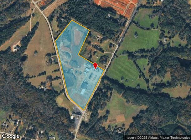
Property Record
1642 Neely Ferry Rd, Simpsonville, SC 29680
NEARBY LISTINGS FOR SALE OR LEASE
Property Detail
1642 Neely Ferry Rd
0567.01-01-023.00
NEELY FERRY RD ACRE
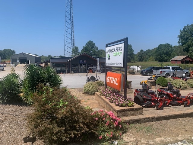
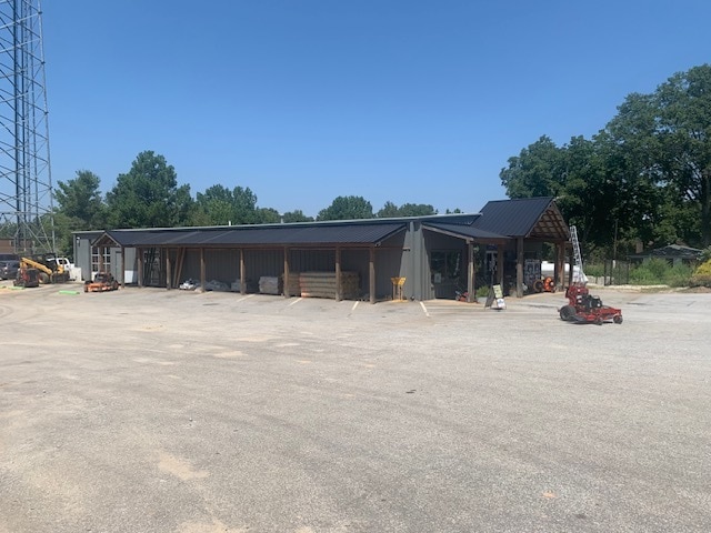
Warehouse
Greenville
X
South Carolina
45045C0492E
023.00
2025
22.82 AC
2024
Greenville Cy/I-385 W
003016
Greenville/Spartanburg
1,084 SF
Greenville-Anderson-Greer, SC
DEMOGRAPHICS near 1642 Neely Ferry Rd
1 Mile
3 Mile
5 Mile
2024 Total Population
3,035
26,285
72,732
2029 Population
3,337
28,920
80,033
Pop Growth 2024-2029
+ 9.95%
+ 10.02%
+ 10.04%
Average Age
39
39
40
2024 Total Households
1,101
9,726
27,371
HH Growth 2024-2029
+ 9.99%
+ 9.98%
+ 10.05%
Median Household Inc
$106,855
$91,168
$83,376
Avg Household Size
2.70
2.70
2.60
2024 Avg HH Vehicles
2.00
2.00
2.00
Median Home Value
$290,425
$263,109
$251,135
Median Year Built
2008
1999
1999
Nearby Places
Map Layers
Map Styles
 Street
 Aerial
- Restaurants
- Banks
- Shops
- Fitness
- Groceries
PUBLIC TRANSPORTATION
AIRPORT
Greenville Spartanburg International
DRIVE
WALK
Distance
Greenville Spartanburg International
28 min
19.4 mi
Nearby Properties
Address
Land Use
TOTAL SIZE
Lot Size
Zoning
Address
Land Use
TOTAL SIZE
Lot Size
Zoning
40.61 AC
I1
Address
Land Use
TOTAL SIZE
Lot Size
Zoning
Address
Land Use
TOTAL SIZE
Lot Size
Zoning
21.78 AC
I1
Address
Land Use
TOTAL SIZE
Lot Size
Zoning
25.87 AC
I1
Address
Land Use
TOTAL SIZE
Lot Size
Zoning
15.05 AC
I1
Address
Land Use
TOTAL SIZE
Lot Size
Zoning
12.05 AC
RS
Address
Land Use
TOTAL SIZE
Lot Size
Zoning
63.14 AC
I1
Address
Land Use
TOTAL SIZE
Lot Size
Zoning
47.12 AC
RRROW
Address
Land Use
TOTAL SIZE
Lot Size
Zoning
31.37 AC
I1
Address
Land Use
TOTAL SIZE
Lot Size
Zoning
12.73 AC
I1
Address
Land Use
TOTAL SIZE
Lot Size
Zoning
1,158 SF
5.11 AC
I1
Address
Land Use
TOTAL SIZE
Lot Size
Zoning
76.20 AC
R20
Address
Land Use
TOTAL SIZE
Lot Size
Zoning
10.04 AC
BG
Address
Land Use
TOTAL SIZE
Lot Size
Zoning
22.60 AC
R12
Address
Land Use
TOTAL SIZE
Lot Size
Zoning
7.03 AC
I1
Address
Land Use
TOTAL SIZE
Lot Size
Zoning
14.60 AC
I1
Address
Land Use
TOTAL SIZE
Lot Size
Zoning
191 SF
98.20 AC
I1
Address
Land Use
TOTAL SIZE
Lot Size
Zoning
29.96 AC
I1
Address
Land Use
TOTAL SIZE
Lot Size
Zoning
10.50 AC
RRROW
Address
Land Use
TOTAL SIZE
Lot Size
Zoning
101.18 AC
Address
Land Use
TOTAL SIZE
Lot Size
Zoning
9.89 AC
C2
Address
Land Use
TOTAL SIZE
Lot Size
Zoning
12.11 AC
BG
Address
Land Use
TOTAL SIZE
Lot Size
Zoning
820 SF
6.75 AC
S1
Address
Land Use
TOTAL SIZE
Lot Size
Zoning
1,528 SF
22.81 AC
RM14
Address
Land Use
TOTAL SIZE
Lot Size
Zoning
Address
Land Use
TOTAL SIZE
Lot Size
Zoning
12.22 AC
I1
Address
Land Use
TOTAL SIZE
Lot Size
Zoning
3.80 AC
I1
Address
Land Use
TOTAL SIZE
Lot Size
Zoning
17.02 AC
BG
Address
Land Use
TOTAL SIZE
Lot Size
Zoning
16.32 AC
ROI
The World's #1 Commercial Real Estate Marketplace
Connect with us
© 2026 CoStar Group
The information above has been obtained from sources believed reliable. While we do not doubt its accuracy we have not verified it and make no guarantee, warranty or representation about it. It is your responsibility to independently confirm its accuracy and completeness. Any projections, opinions, assumptions, or estimates used are for example only and do not represent the current or future performance of the property. The value of this transaction to you depends on tax and other factors which should be evaluated by your tax, financial, and legal advisors. You and your advisors should conduct a careful, independent investigation of the property to determine to your satisfaction the suitability of the property for your needs.