No Photo
Property Record
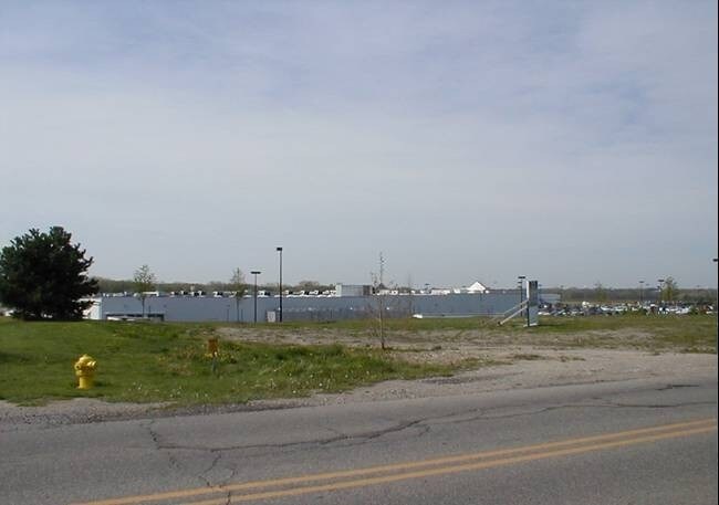
1642 Packard Hwy, Charlotte, MI 48813

NEARBY LISTINGS FOR SALE OR LEASE
Property Detail
1642 Packard Hwy
200-008-200-012-01
COM N 1/4 COR SEC.8, S89 24'43"E 300 FT TO POB, S89 24'43"E 216.32 FT, S00 35'17"W 233 FT, 62.83 FT SWLY ALONG THE ARC OF A CURVE TO THE RIGHT,SAID CURVE HAVING A RAD OF 40 FT, A DELTA ANGLE OF 90 & A CHORD BEARING S45 35'17"W N89 24'34"W 175.14 FT,
Restaurantbuilding
Eaton
X
Michigan
26045C0325E
1.20 AC
2024
Outlying Eaton County
2025
West Michigan
021001
Lansing-East Lansing, MI
4,112 SF
DEMOGRAPHICS near 1642 Packard Hwy
1 Mile
3 Mile
5 Mile
2024 Total Population
1,374
12,223
19,180
2029 Population
1,374
12,205
19,132
Pop Growth 2024-2029
0.00%
(0.15%)
(0.25%)
Average Age
44
42
41
2024 Total Households
537
4,925
7,594
HH Growth 2024-2029
0.00%
(0.14%)
(0.24%)
Median Household Inc
$70,138
$62,880
$64,705
Avg Household Size
2.40
2.30
2.40
2024 Avg HH Vehicles
2.00
2.00
2.00
Median Home Value
$253,124
$158,495
$165,766
Median Year Built
1993
1969
1973
Nearby Places
Map Layers
Map Styles
 Street
 Aerial
- Restaurants
- Banks
- Shops
- Fitness
- Groceries
PUBLIC TRANSPORTATION
AIRPORT
Capital Region International
DRIVE
WALK
Distance
Capital Region International
27 min
24.1 mi
Freight Ports
Port of Baltimore
DRIVE
WALK
Distance
Port of Baltimore
1 min
485.7 mi
SALE & LEASE HISTORY
LISTING DATE
SALE/LEASE

Sep 24, 2016
For Sale
Nearby Properties
Address
Land Use
TOTAL SIZE
Lot Size
Zoning
Address
Land Use
TOTAL SIZE
Lot Size
Zoning
593,008 SF
101.57 AC
N/A
Address
Land Use
TOTAL SIZE
Lot Size
Zoning
38,722 SF
4.23 AC
N/A
Address
Land Use
TOTAL SIZE
Lot Size
Zoning
159,186 SF
28.10 AC
N/A
Address
Land Use
TOTAL SIZE
Lot Size
Zoning
126,110 SF
9.92 AC
N/A
Address
Land Use
TOTAL SIZE
Lot Size
Zoning
193,657 SF
18.37 AC
N/A
Address
Land Use
TOTAL SIZE
Lot Size
Zoning
45,729 SF
6.46 AC
N/A
Address
Land Use
TOTAL SIZE
Lot Size
Zoning
146,685 SF
10.86 AC
N/A
Address
Land Use
TOTAL SIZE
Lot Size
Zoning
110,000 SF
13.86 AC
N/A
Address
Land Use
TOTAL SIZE
Lot Size
Zoning
6,636 SF
22.48 AC
I
Address
Land Use
TOTAL SIZE
Lot Size
Zoning
60,513 SF
11 AC
N/A
Address
Land Use
TOTAL SIZE
Lot Size
Zoning
38,646 SF
6.53 AC
N/A
Address
Land Use
TOTAL SIZE
Lot Size
Zoning
28,275 SF
3.27 AC
Address
Land Use
TOTAL SIZE
Lot Size
Zoning
84,552 SF
13.86 AC
N/A
Address
Land Use
TOTAL SIZE
Lot Size
Zoning
48,384 SF
3.70 AC
N/A
Address
Land Use
TOTAL SIZE
Lot Size
Zoning
10,449 SF
3.15 AC
N/A
Address
Land Use
TOTAL SIZE
Lot Size
Zoning
4.33 AC
N/A
Address
Land Use
TOTAL SIZE
Lot Size
Zoning
65,731 SF
12.60 AC
N/A
Address
Land Use
TOTAL SIZE
Lot Size
Zoning
97,600 SF
11.52 AC
N/A
Address
Land Use
TOTAL SIZE
Lot Size
Zoning
48,092 SF
5.16 AC
N/A
Address
Land Use
TOTAL SIZE
Lot Size
Zoning
40,484 SF
2.28 AC
N/A
Address
Land Use
TOTAL SIZE
Lot Size
Zoning
14,440 SF
0.94 AC
N/A
Address
Land Use
TOTAL SIZE
Lot Size
Zoning
4,608 SF
1.90 AC
N/A
Address
Land Use
TOTAL SIZE
Lot Size
Zoning
104,305 SF
7.36 AC
N/A
Address
Land Use
TOTAL SIZE
Lot Size
Zoning
41,605 SF
17 AC
N/A
Address
Land Use
TOTAL SIZE
Lot Size
Zoning
22,661 SF
173.47 AC
N/A
Address
Land Use
TOTAL SIZE
Lot Size
Zoning
1,088 SF
28.66 AC
N/A
Address
Land Use
TOTAL SIZE
Lot Size
Zoning
44,294 SF
3.95 AC
N/A
Address
Land Use
TOTAL SIZE
Lot Size
Zoning
94,900 SF
7.82 AC
N/A
Address
Land Use
TOTAL SIZE
Lot Size
Zoning
86,950 SF
11.71 AC
N/A
Address
Land Use
TOTAL SIZE
Lot Size
Zoning
The World's #1 Commercial Real Estate Marketplace
Connect with us
© 2025 CoStar Group
The information above has been obtained from sources believed reliable. While we do not doubt its accuracy we have not verified it and make no guarantee, warranty or representation about it. It is your responsibility to independently confirm its accuracy and completeness. Any projections, opinions, assumptions, or estimates used are for example only and do not represent the current or future performance of the property. The value of this transaction to you depends on tax and other factors which should be evaluated by your tax, financial, and legal advisors. You and your advisors should conduct a careful, independent investigation of the property to determine to your satisfaction the suitability of the property for your needs.