Property Record
16422 National Pike, Hagerstown, MD 21740


Current Lease Availabilities
NEARBY LISTINGS FOR SALE OR LEASE
Property Detail
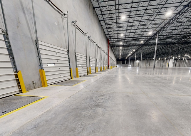
16422 National Pike
23-008092
Preliminary Final Reallotoemnt Plat For
Warehouse
87.6211 ACRES 12520 GREENCASTLE PIKE ( 12524 GREENCASTLE PIKE
A
Washington
24043C0120D
Maryland
2024
87.62 AC
2025
Washington County
000900
Washington, DC
730,880 SF
Hagerstown-Martinsburg, MD-WV
DEMOGRAPHICS near 16422 National Pike
1 Mile
3 Mile
5 Mile
2024 Total Population
990
8,780
64,278
2029 Population
996
8,876
65,241
Pop Growth 2024-2029
+ 0.61%
+ 1.09%
+ 1.50%
Average Age
42
41
40
2024 Total Households
381
3,204
25,830
HH Growth 2024-2029
+ 0.79%
+ 1.09%
+ 1.55%
Median Household Inc
$55,000
$61,959
$52,618
Avg Household Size
2.60
2.70
2.40
2024 Avg HH Vehicles
2.00
2.00
2.00
Median Home Value
$172,825
$195,533
$192,004
Median Year Built
1987
1984
1966
Nearby Places
Map Layers
Map Styles
 Street
 Aerial
- Restaurants
- Banks
- Shops
- Fitness
- Groceries
PUBLIC TRANSPORTATION
AIRPORT
Hagerstown Regional/Richard A Henson Field
DRIVE
WALK
Distance
Hagerstown Regional/Richard A Henson Field
13 min
7.8 mi
Freight Ports
Port of Baltimore
DRIVE
WALK
Distance
Port of Baltimore
96 min
80.5 mi
Nearby Properties
Address
Land Use
TOTAL SIZE
Lot Size
Zoning
Address
Land Use
TOTAL SIZE
Lot Size
Zoning
1,006,880 SF
132.50 AC
PI
Address
Land Use
TOTAL SIZE
Lot Size
Zoning
617,025 SF
142.67 AC
IG
Address
Land Use
TOTAL SIZE
Lot Size
Zoning
825,620 SF
53.74 AC
IG
Address
Land Use
TOTAL SIZE
Lot Size
Zoning
737,000 SF
59.57 AC
PB
Address
Land Use
TOTAL SIZE
Lot Size
Zoning
157,680 SF
69.83 AC
HI
Address
Land Use
TOTAL SIZE
Lot Size
Zoning
591,555 SF
114.50 AC
HI
Address
Land Use
TOTAL SIZE
Lot Size
Zoning
1,021,162 SF
117.63 AC
HI
Address
Land Use
TOTAL SIZE
Lot Size
Zoning
824,298 SF
70.25 AC
HI
Address
Land Use
TOTAL SIZE
Lot Size
Zoning
162,850 SF
65.81 AC
IG
Address
Land Use
TOTAL SIZE
Lot Size
Zoning
294,240 SF
43.79 AC
HI
Address
Land Use
TOTAL SIZE
Lot Size
Zoning
506,003 SF
40 AC
HI
Address
Land Use
TOTAL SIZE
Lot Size
Zoning
113,466 SF
10.62 AC
IG
Address
Land Use
TOTAL SIZE
Lot Size
Zoning
91,026 SF
20.28 AC
A
Address
Land Use
TOTAL SIZE
Lot Size
Zoning
622,245 SF
52.90 AC
U
Address
Land Use
TOTAL SIZE
Lot Size
Zoning
117,096 SF
28.13 AC
CR
Address
Land Use
TOTAL SIZE
Lot Size
Zoning
65,433 SF
16.52 AC
PUD
Address
Land Use
TOTAL SIZE
Lot Size
Zoning
486,861 SF
35.40 AC
HI
Address
Land Use
TOTAL SIZE
Lot Size
Zoning
3,984 SF
18.32 AC
CR
Address
Land Use
TOTAL SIZE
Lot Size
Zoning
5,000 SF
22.41 AC
IG
Address
Land Use
TOTAL SIZE
Lot Size
Zoning
88,042 SF
9.98 AC
RT
Address
Land Use
TOTAL SIZE
Lot Size
Zoning
9,918 SF
17 AC
IG
Address
Land Use
TOTAL SIZE
Lot Size
Zoning
5,427 SF
20.49 AC
BG
Address
Land Use
TOTAL SIZE
Lot Size
Zoning
21,306 SF
4.64 AC
IMU
Address
Land Use
TOTAL SIZE
Lot Size
Zoning
924 SF
67.86 AC
RU
Address
Land Use
TOTAL SIZE
Lot Size
Zoning
65,634 SF
10.23 AC
CR
Address
Land Use
TOTAL SIZE
Lot Size
Zoning
193,280 SF
30.55 AC
IG
Address
Land Use
TOTAL SIZE
Lot Size
Zoning
7,943 SF
26.33 AC
HI
Address
Land Use
TOTAL SIZE
Lot Size
Zoning
110,387 SF
10.51 AC
PB
Address
Land Use
TOTAL SIZE
Lot Size
Zoning
110,000 SF
27.85 AC
IG
The World's #1 Commercial Real Estate Marketplace
Connect with us
© 2025 CoStar Group
The information above has been obtained from sources believed reliable. While we do not doubt its accuracy we have not verified it and make no guarantee, warranty or representation about it. It is your responsibility to independently confirm its accuracy and completeness. Any projections, opinions, assumptions, or estimates used are for example only and do not represent the current or future performance of the property. The value of this transaction to you depends on tax and other factors which should be evaluated by your tax, financial, and legal advisors. You and your advisors should conduct a careful, independent investigation of the property to determine to your satisfaction the suitability of the property for your needs.