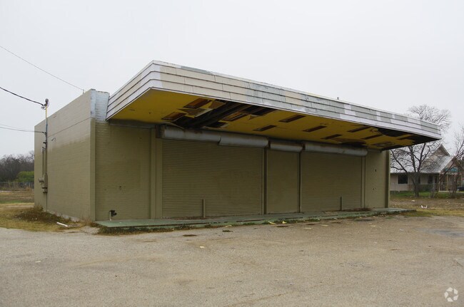
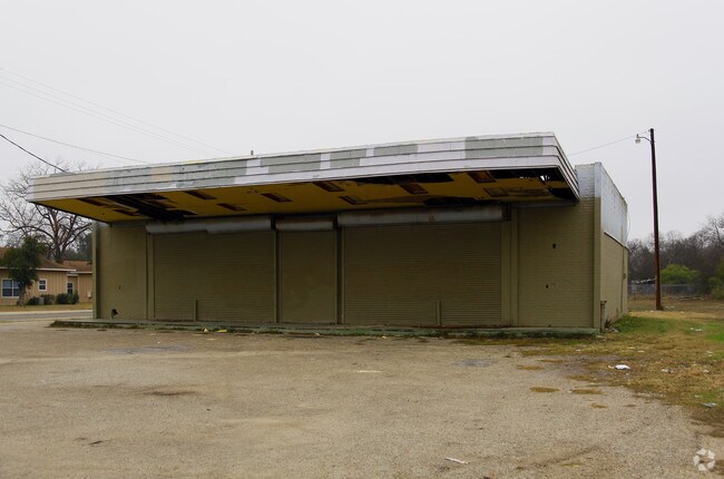
Property Record
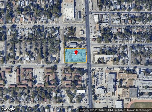
1643 Pleasanton Rd, San Antonio, TX 78221
NEARBY LISTINGS FOR SALE OR LEASE
Property Detail
1643 Pleasanton Rd
San Antonio-New Braunfels, TX
Mcdonalds # 42-2735 Subd
07860-000-0510
NCB 7860 BLK LOT 51 (MCDONALDS # 42-2735 SUBD) 2013-MERGE PER PLAT 9639/44-50 FILED 3/9/2012
Restaurantdrivein
Bexar
X
Texas
48029C0560F
532
2024
1.30 AC
2025
South
151000
San Antonio
4,963 SF
DEMOGRAPHICS near 1643 Pleasanton Rd
1 Mile
3 Mile
5 Mile
2024 Total Population
16,713
119,383
288,767
2029 Population
17,582
126,657
307,992
Pop Growth 2024-2029
+ 5.20%
+ 6.09%
+ 6.66%
Average Age
39
38
37
2024 Total Households
5,675
40,931
99,698
HH Growth 2024-2029
+ 5.32%
+ 6.36%
+ 7.01%
Median Household Inc
$41,000
$41,035
$39,884
Avg Household Size
2.80
2.80
2.70
2024 Avg HH Vehicles
2.00
2.00
2.00
Median Home Value
$117,316
$117,348
$121,621
Median Year Built
1954
1957
1962
Nearby Places
Map Layers
Map Styles
 Street
 Aerial
- Restaurants
- Banks
- Shops
- Fitness
- Groceries
PUBLIC TRANSPORTATION
COMMUTER RAIL
San Antonio Amtrak Station (Sunset Limited - Amtrak, Texas Eagle - Amtrak)
DRIVE
WALK
Distance
San Antonio Amtrak Station (Sunset Limited - Amtrak, Texas Eagle - Amtrak)
10 min
5.5 mi
AIRPORT
San Antonio International
DRIVE
WALK
Distance
San Antonio International
19 min
12.9 mi
Freight Ports
Calhoun Port
DRIVE
WALK
Distance
Calhoun Port
183 min
148.4 mi
Nearby Properties
Address
Land Use
TOTAL SIZE
Lot Size
Zoning
Address
Land Use
TOTAL SIZE
Lot Size
Zoning
548,048 SF
27.53 AC
Address
Land Use
TOTAL SIZE
Lot Size
Zoning
14,492 SF
6.62 AC
Address
Land Use
TOTAL SIZE
Lot Size
Zoning
291,374 SF
13.49 AC
Address
Land Use
TOTAL SIZE
Lot Size
Zoning
197,115 SF
2.29 AC
Address
Land Use
TOTAL SIZE
Lot Size
Zoning
242,297 SF
7.45 AC
Address
Land Use
TOTAL SIZE
Lot Size
Zoning
447,169 SF
46.74 AC
Address
Land Use
TOTAL SIZE
Lot Size
Zoning
163.70 AC
Address
Land Use
TOTAL SIZE
Lot Size
Zoning
63,850 SF
33.42 AC
Address
Land Use
TOTAL SIZE
Lot Size
Zoning
145,389 SF
18.70 AC
Address
Land Use
TOTAL SIZE
Lot Size
Zoning
306,922 SF
32.07 AC
Address
Land Use
TOTAL SIZE
Lot Size
Zoning
71,607 SF
10.46 AC
Address
Land Use
TOTAL SIZE
Lot Size
Zoning
218,003 SF
12.33 AC
Address
Land Use
TOTAL SIZE
Lot Size
Zoning
251,400 SF
10.62 AC
Address
Land Use
TOTAL SIZE
Lot Size
Zoning
87,686 SF
32.01 AC
Address
Land Use
TOTAL SIZE
Lot Size
Zoning
11,553 SF
67.15 AC
Address
Land Use
TOTAL SIZE
Lot Size
Zoning
144,692 SF
10.83 AC
Address
Land Use
TOTAL SIZE
Lot Size
Zoning
231,592 SF
47.96 AC
Address
Land Use
TOTAL SIZE
Lot Size
Zoning
20.58 AC
Address
Land Use
TOTAL SIZE
Lot Size
Zoning
45,363 SF
4.29 AC
Address
Land Use
TOTAL SIZE
Lot Size
Zoning
143,067 SF
11.69 AC
Address
Land Use
TOTAL SIZE
Lot Size
Zoning
56,875 SF
10.04 AC
Address
Land Use
TOTAL SIZE
Lot Size
Zoning
166,270 SF
13.95 AC
Address
Land Use
TOTAL SIZE
Lot Size
Zoning
141,606 SF
13.74 AC
Address
Land Use
TOTAL SIZE
Lot Size
Zoning
203,232 SF
24.20 AC
Address
Land Use
TOTAL SIZE
Lot Size
Zoning
360,000 SF
0.01 AC
Address
Land Use
TOTAL SIZE
Lot Size
Zoning
109,591 SF
5.65 AC
Address
Land Use
TOTAL SIZE
Lot Size
Zoning
89,949 SF
7.14 AC
Address
Land Use
TOTAL SIZE
Lot Size
Zoning
47.74 AC
Address
Land Use
TOTAL SIZE
Lot Size
Zoning
154,556 SF
7.52 AC
Address
Land Use
TOTAL SIZE
Lot Size
Zoning
144,137 SF
10.44 AC
The World's #1 Commercial Real Estate Marketplace
Connect with us
© 2025 CoStar Group
The information above has been obtained from sources believed reliable. While we do not doubt its accuracy we have not verified it and make no guarantee, warranty or representation about it. It is your responsibility to independently confirm its accuracy and completeness. Any projections, opinions, assumptions, or estimates used are for example only and do not represent the current or future performance of the property. The value of this transaction to you depends on tax and other factors which should be evaluated by your tax, financial, and legal advisors. You and your advisors should conduct a careful, independent investigation of the property to determine to your satisfaction the suitability of the property for your needs.