Property Record
16431 Se Foster Rd, Gresham, OR 97080
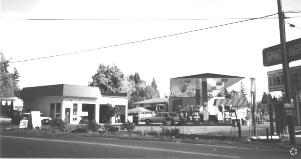

Property Detail
16431 Se Foster Rd
R340674
SECTION 19 1S 3E, TL 500 0.49 ACRES
Commercialnec
MULTNOMAH
CE
Oregon
B and X Area of moderate flood hazard, usually the area between the limits of the 100-year and 500-year floods.
0.49 AC
2025
Mall 205
2025
Portland
009903
Portland-Vancouver-Hillsboro, OR-WA
1,288 SF
NEARBY LISTINGS FOR SALE OR LEASE
DEMOGRAPHICS near 16431 Se Foster Rd
1 mile
3 mile
5 mile
2024 Total Population
3,527
100,370
324,514
2029 Population
3,514
99,332
321,425
Pop Growth 2024-2029
(0.37%)
(1.03%)
(0.95%)
Average Age
41
40
40
2024 Total Households
1,071
33,286
116,151
HH Growth 2024-2029
(0.65%)
(1.37%)
(1.23%)
Median Household Inc
$109,019
$80,773
$74,682
Avg Household Size
3.00
2.80
2.60
2024 Avg HH Vehicles
3.00
2.00
2.00
Median Home Value
$628,512
$473,058
$466,796
Median Year Built
1997
1981
1981
Nearby Places
Map Layers
Map Styles
 Street
 Aerial
Transit
 Traffic
 Biking
Places
Listings with unknown addresses are not visible on the map
- Restaurants
- Banks
- Shops
- Fitness
- Groceries
PUBLIC TRANSPORTATION
AIRPORT
Portland International
Drive
Walk
Distance
Portland International
23 min
13.0 mi
Freight Ports
Port of Portland
Drive
Walk
Distance
Port of Portland
28 min
16.3 mi
Nearby Properties
Address
Land Use
TOTAL SIZE
Lot Size
Zoning
Address
Land Use
TOTAL SIZE
Lot Size
Zoning
109,231 SF
7.87 AC
HI
Address
Land Use
TOTAL SIZE
Lot Size
Zoning
181,493 SF
3.70 AC
CM1
Address
Land Use
TOTAL SIZE
Lot Size
Zoning
123,716 SF
20.03 AC
LDR-5
Address
Land Use
TOTAL SIZE
Lot Size
Zoning
129,462 SF
15.90 AC
R7
Address
Land Use
TOTAL SIZE
Lot Size
Zoning
258,564 SF
20.56 AC
LDR7
Address
Land Use
TOTAL SIZE
Lot Size
Zoning
238,492 SF
13.10 AC
CMF
Address
Land Use
TOTAL SIZE
Lot Size
Zoning
122,558 SF
9.85 AC
CM2
Address
Land Use
TOTAL SIZE
Lot Size
Zoning
64,934 SF
9.89 AC
LDR-7
Address
Land Use
TOTAL SIZE
Lot Size
Zoning
199,805 SF
4.96 AC
MDR-24
Address
Land Use
TOTAL SIZE
Lot Size
Zoning
59,786 SF
4.58 AC
LDR-5
Address
Land Use
TOTAL SIZE
Lot Size
Zoning
259,799 SF
16.16 AC
IG2
Address
Land Use
TOTAL SIZE
Lot Size
Zoning
60,530 SF
19.55 AC
LDR
Address
Land Use
TOTAL SIZE
Lot Size
Zoning
91,523 SF
4.19 AC
RM1
Address
Land Use
TOTAL SIZE
Lot Size
Zoning
Address
Land Use
TOTAL SIZE
Lot Size
Zoning
77,691 SF
2.06 AC
RM2
Address
Land Use
TOTAL SIZE
Lot Size
Zoning
103,090 SF
4.12 AC
CMF
Address
Land Use
TOTAL SIZE
Lot Size
Zoning
86,206 SF
6.66 AC
RM1
Address
Land Use
TOTAL SIZE
Lot Size
Zoning
145,605 SF
Address
Land Use
TOTAL SIZE
Lot Size
Zoning
55,062 SF
2 AC
R5
Address
Land Use
TOTAL SIZE
Lot Size
Zoning
98,045 SF
9.02 AC
CE
Address
Land Use
TOTAL SIZE
Lot Size
Zoning
166,296 SF
8.80 AC
RM1
Address
Land Use
TOTAL SIZE
Lot Size
Zoning
121,428 SF
5.81 AC
CMF
Address
Land Use
TOTAL SIZE
Lot Size
Zoning
45,331 SF
5.25 AC
MDR24
Address
Land Use
TOTAL SIZE
Lot Size
Zoning
97,356 SF
4.13 AC
R2A
Address
Land Use
TOTAL SIZE
Lot Size
Zoning
56,814 SF
0.55 AC
CM2
Address
Land Use
TOTAL SIZE
Lot Size
Zoning
59,435 SF
4.04 AC
TLDR
Address
Land Use
TOTAL SIZE
Lot Size
Zoning
123,420 SF
7.06 AC
CMF
Address
Land Use
TOTAL SIZE
Lot Size
Zoning
57,273 SF
9.89 AC
R7
Address
Land Use
TOTAL SIZE
Lot Size
Zoning
55,855 SF
16.22 AC
RR
Address
Land Use
TOTAL SIZE
Lot Size
Zoning
42,702 SF
1.82 AC
RM1
The World's #1 Commercial Real Estate Marketplace
Connect with us
© 2026 CoStar Group
The information above has been obtained from sources believed reliable. While we do not doubt its accuracy we have not verified it and make no guarantee, warranty or representation about it. It is your responsibility to independently confirm its accuracy and completeness. Any projections, opinions, assumptions, or estimates used are for example only and do not represent the current or future performance of the property. The value of this transaction to you depends on tax and other factors which should be evaluated by your tax, financial, and legal advisors. You and your advisors should conduct a careful, independent investigation of the property to determine to your satisfaction the suitability of the property for your needs.