Property Record
1645 Pushaw Station Rd, Sunderland, MD 20689
NEARBY LISTINGS FOR SALE OR LEASE
Property Detail
1645 Pushaw Station Rd
03-008843
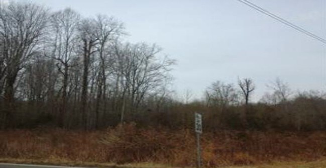
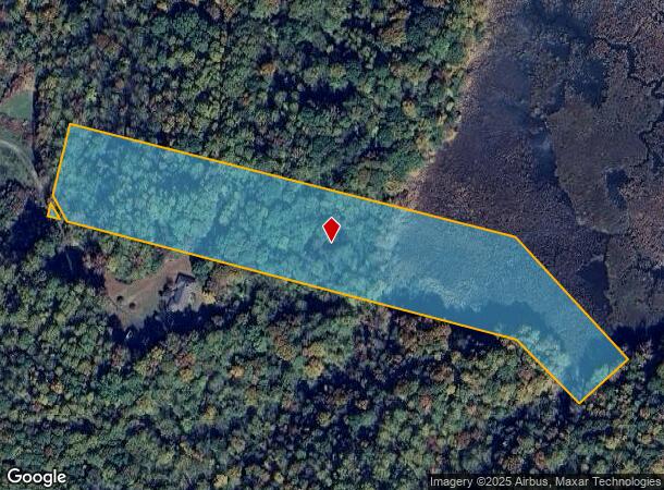
9.15 AC 1645 PUSHAW STATION RD SUNDERLAND
Agriculturalland
Calvert
AE
Maryland
24009C0091G
9.15 AC
2025
Calvert County
2025
Washington, DC
860403
Washington-Arlington-Alexandria, DC-VA-MD-WV
DEMOGRAPHICS near 1645 Pushaw Station Rd
1 Mile
3 Mile
5 Mile
2024 Total Population
1,299
18,235
31,245
2029 Population
1,357
19,074
32,592
Pop Growth 2024-2029
+ 4.46%
+ 4.60%
+ 4.31%
Average Age
36
39
40
2024 Total Households
428
6,696
11,099
HH Growth 2024-2029
+ 4.44%
+ 4.61%
+ 4.34%
Median Household Inc
$147,265
$113,441
$126,642
Avg Household Size
3.00
2.70
2.80
2024 Avg HH Vehicles
2.00
2.00
2.00
Median Home Value
$435,000
$390,540
$426,374
Median Year Built
2000
1987
1987
Nearby Places
Map Layers
Map Styles
 Street
 Aerial
- Restaurants
- Banks
- Shops
- Fitness
- Groceries
PUBLIC TRANSPORTATION
AIRPORT
Ronald Reagan Washington Ntl
DRIVE
WALK
Distance
Ronald Reagan Washington Ntl
62 min
37.4 mi
Freight Ports
Port of Baltimore
DRIVE
WALK
Distance
Port of Baltimore
81 min
52.8 mi
SALE & LEASE HISTORY
LISTING DATE
SALE/LEASE

Feb 20, 2019
For Sale
Nearby Properties
Address
Land Use
TOTAL SIZE
Lot Size
Zoning
Address
Land Use
TOTAL SIZE
Lot Size
Zoning
169.38 AC
RUR
Address
Land Use
TOTAL SIZE
Lot Size
Zoning
65,712 SF
39.22 AC
RUR
Address
Land Use
TOTAL SIZE
Lot Size
Zoning
Address
Land Use
TOTAL SIZE
Lot Size
Zoning
48,653 SF
6.10 AC
Address
Land Use
TOTAL SIZE
Lot Size
Zoning
20,693 SF
4.52 AC
MCR
Address
Land Use
TOTAL SIZE
Lot Size
Zoning
2,348 SF
5.23 AC
C
Address
Land Use
TOTAL SIZE
Lot Size
Zoning
3,859 SF
28.29 AC
RUR
Address
Land Use
TOTAL SIZE
Lot Size
Zoning
2,524 SF
0.76 AC
MCR
Address
Land Use
TOTAL SIZE
Lot Size
Zoning
10,424 SF
0.48 AC
C
Address
Land Use
TOTAL SIZE
Lot Size
Zoning
33,219 SF
3.93 AC
Address
Land Use
TOTAL SIZE
Lot Size
Zoning
55,284 SF
6.37 AC
RC
Address
Land Use
TOTAL SIZE
Lot Size
Zoning
7,120 SF
2.89 AC
MCR
Address
Land Use
TOTAL SIZE
Lot Size
Zoning
44,650 SF
9.36 AC
RUR
Address
Land Use
TOTAL SIZE
Lot Size
Zoning
22,658 SF
2.21 AC
MCR
Address
Land Use
TOTAL SIZE
Lot Size
Zoning
18,720 SF
9.01 AC
I-1
Address
Land Use
TOTAL SIZE
Lot Size
Zoning
31,812 SF
0.83 AC
MCR
Address
Land Use
TOTAL SIZE
Lot Size
Zoning
6,726 SF
3.12 AC
Address
Land Use
TOTAL SIZE
Lot Size
Zoning
3,050 SF
1.78 AC
RC
Address
Land Use
TOTAL SIZE
Lot Size
Zoning
40.63 AC
MCR
Address
Land Use
TOTAL SIZE
Lot Size
Zoning
9,845 SF
0.17 AC
Address
Land Use
TOTAL SIZE
Lot Size
Zoning
1,560 SF
36.79 AC
I-1
Address
Land Use
TOTAL SIZE
Lot Size
Zoning
9,508 SF
3.33 AC
R-2
Address
Land Use
TOTAL SIZE
Lot Size
Zoning
2,600 SF
7.25 AC
HD
Address
Land Use
TOTAL SIZE
Lot Size
Zoning
3,505 SF
1 AC
MCR
Address
Land Use
TOTAL SIZE
Lot Size
Zoning
43,425 SF
0.87 AC
C
Address
Land Use
TOTAL SIZE
Lot Size
Zoning
1.09 AC
R-1
Address
Land Use
TOTAL SIZE
Lot Size
Zoning
7.88 AC
MCR
Address
Land Use
TOTAL SIZE
Lot Size
Zoning
5,520 SF
3.99 AC
I-1
Address
Land Use
TOTAL SIZE
Lot Size
Zoning
9,600 SF
3.19 AC
I-1
Address
Land Use
TOTAL SIZE
Lot Size
Zoning
600 SF
0.80 AC
I-1
The World's #1 Commercial Real Estate Marketplace
Connect with us
© 2025 CoStar Group
The information above has been obtained from sources believed reliable. While we do not doubt its accuracy we have not verified it and make no guarantee, warranty or representation about it. It is your responsibility to independently confirm its accuracy and completeness. Any projections, opinions, assumptions, or estimates used are for example only and do not represent the current or future performance of the property. The value of this transaction to you depends on tax and other factors which should be evaluated by your tax, financial, and legal advisors. You and your advisors should conduct a careful, independent investigation of the property to determine to your satisfaction the suitability of the property for your needs.