Property Record
1645 Saint Stephens Rd, Prichard, AL 36610


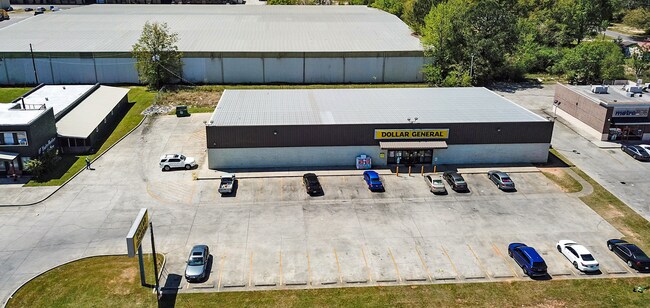
Property Detail
1645 Saint Stephens Rd
29-02-44-0-008-189.007
COMG AT A CAPPED IRON PIN LOCATED ON THE SOUTH LINE OF FIRST CENTERSUBDIVISION AS RECORDED IN MAP BOOK 115 PAGE 32 PROBATE
Storesoffices
MOBILE
B and X Area of moderate flood hazard, usually the area between the limits of the 100-year and 500-year floods.
Alabama
2025
1.27 AC
2025
Prichard/Saraland
003901
Mobile
12,636 SF
Mobile, AL
NEARBY LISTINGS FOR SALE OR LEASE
DEMOGRAPHICS near 1645 Saint Stephens Rd
1 mile
3 mile
5 mile
2024 Total Population
8,613
50,654
109,659
2029 Population
8,883
51,720
110,654
Pop Growth 2024-2029
+ 3.13%
+ 2.10%
+ 0.91%
Average Age
42
41
40
2024 Total Households
3,492
20,031
45,154
HH Growth 2024-2029
+ 3.24%
+ 2.21%
+ 0.90%
Median Household Inc
$32,221
$36,526
$45,354
Avg Household Size
2.30
2.40
2.30
2024 Avg HH Vehicles
2.00
2.00
2.00
Median Home Value
$61,781
$82,101
$140,999
Median Year Built
1965
1966
1966
Nearby Places
Map Layers
Map Styles
 Street
 Aerial
Transit
 Traffic
 Biking
Places
Listings with unknown addresses are not visible on the map
- Restaurants
- Banks
- Shops
- Fitness
- Groceries
PUBLIC TRANSPORTATION
AIRPORT
Mobile International
Drive
Walk
Distance
Mobile International
18 min
7.9 mi
Mobile Regional
Drive
Walk
Distance
Mobile Regional
26 min
13.9 mi
Freight Ports
Port of Mobile
Drive
Walk
Distance
Port of Mobile
9 min
6.8 mi
SALE & LEASE HISTORY
LISTING DATE
SALE/LEASE

Oct 12, 2020
For Sale
Apr 17, 2018
For Sale
Apr 11, 2019
For Sale
Nearby Properties
Address
Land Use
TOTAL SIZE
Lot Size
Zoning
Address
Land Use
TOTAL SIZE
Lot Size
Zoning
171,670 SF
20.19 AC
Address
Land Use
TOTAL SIZE
Lot Size
Zoning
339,141 SF
7.18 AC
Address
Land Use
TOTAL SIZE
Lot Size
Zoning
141,209 SF
10.20 AC
Address
Land Use
TOTAL SIZE
Lot Size
Zoning
30,504 SF
16.45 AC
Address
Land Use
TOTAL SIZE
Lot Size
Zoning
200,370 SF
47.96 AC
Address
Land Use
TOTAL SIZE
Lot Size
Zoning
91,391 SF
14.93 AC
Address
Land Use
TOTAL SIZE
Lot Size
Zoning
12.97 AC
Address
Land Use
TOTAL SIZE
Lot Size
Zoning
103,308 SF
34 AC
Address
Land Use
TOTAL SIZE
Lot Size
Zoning
15,960 SF
11.06 AC
Address
Land Use
TOTAL SIZE
Lot Size
Zoning
5,553 SF
40.77 AC
Address
Land Use
TOTAL SIZE
Lot Size
Zoning
97,443 SF
98.83 AC
Address
Land Use
TOTAL SIZE
Lot Size
Zoning
107,777 SF
8.87 AC
Address
Land Use
TOTAL SIZE
Lot Size
Zoning
99,856 SF
33 AC
Address
Land Use
TOTAL SIZE
Lot Size
Zoning
37,209 SF
8.75 AC
Address
Land Use
TOTAL SIZE
Lot Size
Zoning
40,590 SF
9.30 AC
Address
Land Use
TOTAL SIZE
Lot Size
Zoning
131,516 SF
15 AC
Address
Land Use
TOTAL SIZE
Lot Size
Zoning
53,850 SF
12 AC
Address
Land Use
TOTAL SIZE
Lot Size
Zoning
66,025 SF
9.70 AC
Address
Land Use
TOTAL SIZE
Lot Size
Zoning
94,787 SF
18 AC
Address
Land Use
TOTAL SIZE
Lot Size
Zoning
12,520 SF
5.92 AC
Address
Land Use
TOTAL SIZE
Lot Size
Zoning
77,123 SF
10 AC
Address
Land Use
TOTAL SIZE
Lot Size
Zoning
105,627 SF
7.91 AC
Address
Land Use
TOTAL SIZE
Lot Size
Zoning
69,338 SF
8.23 AC
Address
Land Use
TOTAL SIZE
Lot Size
Zoning
58,452 SF
5.08 AC
Address
Land Use
TOTAL SIZE
Lot Size
Zoning
Address
Land Use
TOTAL SIZE
Lot Size
Zoning
41,928 SF
29.40 AC
Address
Land Use
TOTAL SIZE
Lot Size
Zoning
143,623 SF
11.94 AC
Address
Land Use
TOTAL SIZE
Lot Size
Zoning
101,578 SF
32 AC
Address
Land Use
TOTAL SIZE
Lot Size
Zoning
89,556 SF
18 AC
Address
Land Use
TOTAL SIZE
Lot Size
Zoning
58,789 SF
17 AC
The World's #1 Commercial Real Estate Marketplace
Connect with us
© 2026 CoStar Group
The information above has been obtained from sources believed reliable. While we do not doubt its accuracy we have not verified it and make no guarantee, warranty or representation about it. It is your responsibility to independently confirm its accuracy and completeness. Any projections, opinions, assumptions, or estimates used are for example only and do not represent the current or future performance of the property. The value of this transaction to you depends on tax and other factors which should be evaluated by your tax, financial, and legal advisors. You and your advisors should conduct a careful, independent investigation of the property to determine to your satisfaction the suitability of the property for your needs.