Property Record
1647 Pottstown Pike, Glenmoore, PA 19343
NEARBY LISTINGS FOR SALE OR LEASE
Property Detail
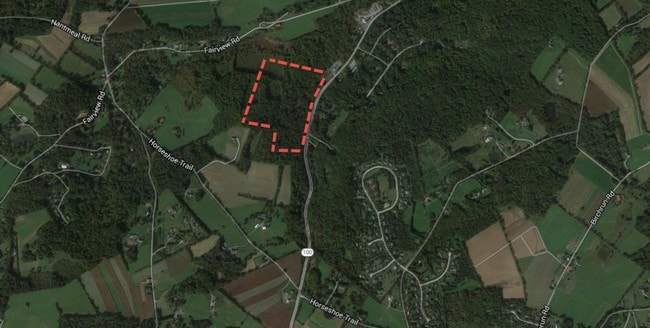
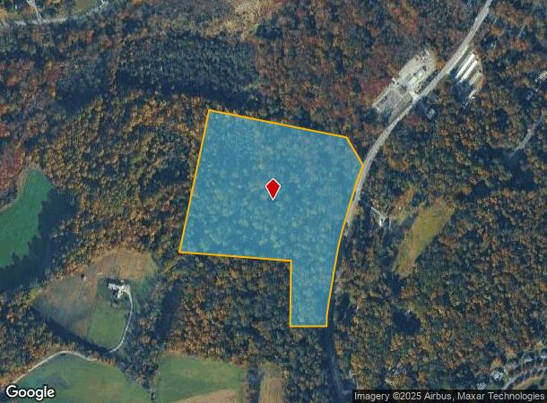
1647 Pottstown Pike
24-005-0098.0000
25.7 AC
Residentialacreage
Chester
X
Pennsylvania
42029C0045G
25.70 AC
2024
Exton/Whitelands
2025
Philadelphia
301700
Philadelphia-Camden-Wilmington, PA-NJ-DE-MD
DEMOGRAPHICS near 1647 Pottstown Pike
1 Mile
3 Mile
5 Mile
2024 Total Population
633
9,645
30,469
2029 Population
644
9,960
31,664
Pop Growth 2024-2029
+ 1.74%
+ 3.27%
+ 3.92%
Average Age
43
41
41
2024 Total Households
216
3,424
10,339
HH Growth 2024-2029
+ 1.39%
+ 3.39%
+ 3.96%
Median Household Inc
$164,189
$137,619
$162,303
Avg Household Size
2.60
2.70
2.90
2024 Avg HH Vehicles
3.00
2.00
2.00
Median Home Value
$684,375
$487,387
$523,342
Median Year Built
1976
1996
1993
Nearby Places
Map Layers
Map Styles
 Street
 Aerial
- Restaurants
- Banks
- Shops
- Fitness
- Groceries
SALE & LEASE HISTORY
LISTING DATE
SALE/LEASE

Oct 06, 2016
For Sale
Jul 30, 2018
For Sale
Aug 02, 2018
For Sale
Nearby Properties
Address
Land Use
TOTAL SIZE
Lot Size
Zoning
Address
Land Use
TOTAL SIZE
Lot Size
Zoning
284,792 SF
20.82 AC
R2
Address
Land Use
TOTAL SIZE
Lot Size
Zoning
105,651 SF
35.64 AC
R3
Address
Land Use
TOTAL SIZE
Lot Size
Zoning
89,359 SF
8 AC
AP
Address
Land Use
TOTAL SIZE
Lot Size
Zoning
108,603 SF
57.30 AC
AP
Address
Land Use
TOTAL SIZE
Lot Size
Zoning
73,614 SF
24.80 AC
MHP
Address
Land Use
TOTAL SIZE
Lot Size
Zoning
24,563 SF
123.20 AC
R1
Address
Land Use
TOTAL SIZE
Lot Size
Zoning
37,045 SF
5.20 AC
R2
Address
Land Use
TOTAL SIZE
Lot Size
Zoning
34,059 SF
24.10 AC
AP
Address
Land Use
TOTAL SIZE
Lot Size
Zoning
25,700 SF
4.90 AC
PC
Address
Land Use
TOTAL SIZE
Lot Size
Zoning
11,198 SF
323.80 AC
CONS
Address
Land Use
TOTAL SIZE
Lot Size
Zoning
423.70 AC
AP
Address
Land Use
TOTAL SIZE
Lot Size
Zoning
30,590 SF
0.88 AC
L1
Address
Land Use
TOTAL SIZE
Lot Size
Zoning
126,036 SF
18.80 AC
IA1
Address
Land Use
TOTAL SIZE
Lot Size
Zoning
38,772 SF
7.18 AC
MHP
Address
Land Use
TOTAL SIZE
Lot Size
Zoning
30,726 SF
8.80 AC
R1
Address
Land Use
TOTAL SIZE
Lot Size
Zoning
8,838 SF
43.40 AC
R1
Address
Land Use
TOTAL SIZE
Lot Size
Zoning
15,840 SF
33.50 AC
R3
Address
Land Use
TOTAL SIZE
Lot Size
Zoning
13,716 SF
63.20 AC
LI
Address
Land Use
TOTAL SIZE
Lot Size
Zoning
4,016 SF
199.30 AC
INS
Address
Land Use
TOTAL SIZE
Lot Size
Zoning
11,750 SF
21.92 AC
R1
Address
Land Use
TOTAL SIZE
Lot Size
Zoning
14,812 SF
7.97 AC
R2
Address
Land Use
TOTAL SIZE
Lot Size
Zoning
18,625 SF
161.80 AC
AP
Address
Land Use
TOTAL SIZE
Lot Size
Zoning
31,304 SF
6.52 AC
L1
Address
Land Use
TOTAL SIZE
Lot Size
Zoning
7,740 SF
43.24 AC
AP
Address
Land Use
TOTAL SIZE
Lot Size
Zoning
9,678 SF
19.30 AC
RC
Address
Land Use
TOTAL SIZE
Lot Size
Zoning
9,324 SF
1.20 AC
L1
Address
Land Use
TOTAL SIZE
Lot Size
Zoning
12,412 SF
51.70 AC
AP
Address
Land Use
TOTAL SIZE
Lot Size
Zoning
28,454 SF
8.37 AC
B1
Address
Land Use
TOTAL SIZE
Lot Size
Zoning
14,996 SF
51.13 AC
RA
Address
Land Use
TOTAL SIZE
Lot Size
Zoning
6,319 SF
62.57 AC
AP
The World's #1 Commercial Real Estate Marketplace
Connect with us
© 2025 CoStar Group
The information above has been obtained from sources believed reliable. While we do not doubt its accuracy we have not verified it and make no guarantee, warranty or representation about it. It is your responsibility to independently confirm its accuracy and completeness. Any projections, opinions, assumptions, or estimates used are for example only and do not represent the current or future performance of the property. The value of this transaction to you depends on tax and other factors which should be evaluated by your tax, financial, and legal advisors. You and your advisors should conduct a careful, independent investigation of the property to determine to your satisfaction the suitability of the property for your needs.