Property Record
16481 Multiview Dr, Perris, CA 92570


Save to a Folder
{{folder.Name}}
{{folder.ListingIds.length}} Properties
{{folder.ListingIds.length}} Property
Create a New Folder
Property Detail
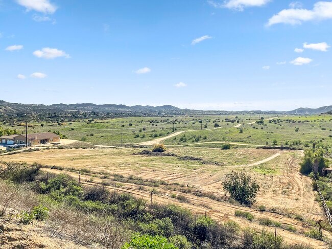
16481 Multiview Dr
287-140-024
9.64 ACRES M/L IN POR SW 1/4 OF SEC 14 T4S R5W FOR TOTAL DESCRIPTION SEE ASSESSORS MAPS
Agriculturalland
RIVERSIDE
RA212
California
B and X Area of moderate flood hazard, usually the area between the limits of the 100-year and 500-year floods.
9.64 AC
2024
South Riverside
2025
Inland Empire (California)
042007
Riverside-San Bernardino-Ontario, CA
NEARBY LISTINGS FOR SALE OR LEASE
DEMOGRAPHICS near 16481 Multiview Dr
1 mile
3 mile
5 mile
2025 Total Population
930
6,300
31,884
2030 Population
937
6,443
32,823
Pop Growth 2025-2030
+ 0.75%
+ 2.27%
+ 2.95%
Average Age
42
42
39
2025 Total Households
324
2,031
8,759
HH Growth 2025-2030
0.00%
+ 1.67%
+ 2.63%
Median Household Inc
$130,288
$115,306
$114,428
Avg Household Size
2.90
3.00
3.40
2025 Avg HH Vehicles
3.00
3.00
3.00
Median Home Value
$771,802
$761,746
$727,327
Median Year Built
1984
1987
1988
Nearby Places
Map Layers
Map Styles
 Street
 Aerial
Layers
 Traffic
 Biking
Places
Listings with unknown addresses are not visible on the map
- Restaurants
- Banks
- Shops
- Fitness
- Groceries
PUBLIC TRANSPORTATION
AIRPORT
Ontario International
Drive
Walk
Distance
Ontario International
44 min
25.2 mi
Freight Ports
Port of Long Beach
Drive
Walk
Distance
Port of Long Beach
82 min
59.7 mi
SALE & LEASE HISTORY
LISTING DATE
SALE/LEASE

Jun 23, 2023
For Sale
Nearby Properties
Address
Land Use
TOTAL SIZE
Lot Size
Zoning
Address
Land Use
TOTAL SIZE
Lot Size
Zoning
8,201 SF
6.87 AC
Address
Land Use
TOTAL SIZE
Lot Size
Zoning
84.24 AC
Address
Land Use
TOTAL SIZE
Lot Size
Zoning
57.73 AC
RA12
Address
Land Use
TOTAL SIZE
Lot Size
Zoning
1,300 SF
22.33 AC
RA12
Address
Land Use
TOTAL SIZE
Lot Size
Zoning
65 AC
RA1
Address
Land Use
TOTAL SIZE
Lot Size
Zoning
6,807 SF
20.83 AC
RA2
Address
Land Use
TOTAL SIZE
Lot Size
Zoning
33.92 AC
RA212
Address
Land Use
TOTAL SIZE
Lot Size
Zoning
2,529 SF
15.15 AC
AP
Address
Land Use
TOTAL SIZE
Lot Size
Zoning
5,467 SF
4.29 AC
Address
Land Use
TOTAL SIZE
Lot Size
Zoning
5,880 SF
1.38 AC
Address
Land Use
TOTAL SIZE
Lot Size
Zoning
2,310 SF
80 AC
CBOOK
Address
Land Use
TOTAL SIZE
Lot Size
Zoning
6,143 SF
1.74 AC
CPS
Address
Land Use
TOTAL SIZE
Lot Size
Zoning
3,822 SF
10 AC
RT
Address
Land Use
TOTAL SIZE
Lot Size
Zoning
8.23 AC
RA212
Address
Land Use
TOTAL SIZE
Lot Size
Zoning
31.14 AC
A15
Address
Land Use
TOTAL SIZE
Lot Size
Zoning
25 SF
10 AC
RA1
Address
Land Use
TOTAL SIZE
Lot Size
Zoning
45.28 AC
MIX
Address
Land Use
TOTAL SIZE
Lot Size
Zoning
29.51 AC
RA1
Address
Land Use
TOTAL SIZE
Lot Size
Zoning
4,415 SF
27 AC
RA212
Address
Land Use
TOTAL SIZE
Lot Size
Zoning
3,164 SF
77.20 AC
SPZONE
Address
Land Use
TOTAL SIZE
Lot Size
Zoning
1,976 SF
18.22 AC
RA2
Address
Land Use
TOTAL SIZE
Lot Size
Zoning
161.91 AC
SPZONE
The World's #1 Commercial Real Estate Marketplace
Connect with us
© 2026 CoStar Group
The information above has been obtained from sources believed reliable. While we do not doubt its accuracy we have not verified it and make no guarantee, warranty or representation about it. It is your responsibility to independently confirm its accuracy and completeness. Any projections, opinions, assumptions, or estimates used are for example only and do not represent the current or future performance of the property. The value of this transaction to you depends on tax and other factors which should be evaluated by your tax, financial, and legal advisors. You and your advisors should conduct a careful, independent investigation of the property to determine to your satisfaction the suitability of the property for your needs.