Property Record
1649 Candia Rd, Manchester, NH 03109


NEARBY LISTINGS FOR SALE OR LEASE
Property Detail
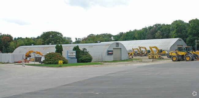
1649 Candia Rd
MNCH-000882-000000-000001
Hillsborough
Autorepair
New Hampshire
X
1
33011C0382D
6.30 AC
2024
Hillsborough
2024
Boston
001000
Manchester-Nashua, NH
36,820 SF
DEMOGRAPHICS near 1649 Candia Rd
1 Mile
3 Mile
5 Mile
2024 Total Population
4,559
55,414
125,638
2029 Population
4,648
56,154
128,002
Pop Growth 2024-2029
+ 1.95%
+ 1.34%
+ 1.88%
Average Age
42
40
40
2024 Total Households
1,899
22,627
52,424
HH Growth 2024-2029
+ 2.05%
+ 1.31%
+ 1.88%
Median Household Inc
$89,616
$75,328
$74,666
Avg Household Size
2.30
2.30
2.30
2024 Avg HH Vehicles
2.00
2.00
2.00
Median Home Value
$320,540
$315,265
$325,234
Median Year Built
1983
1961
1967
Nearby Places
Map Layers
Map Styles
 Street
 Aerial
- Restaurants
- Banks
- Shops
- Fitness
- Groceries
PUBLIC TRANSPORTATION
AIRPORT
Manchester Boston Regional
DRIVE
WALK
Distance
Manchester Boston Regional
18 min
7.9 mi
Portsmouth International at Pease
DRIVE
WALK
Distance
Portsmouth International at Pease
57 min
38.5 mi
Freight Ports
Port of Boston
DRIVE
WALK
Distance
Port of Boston
81 min
53.3 mi
Nearby Properties
Address
Land Use
TOTAL SIZE
Lot Size
Zoning
Address
Land Use
TOTAL SIZE
Lot Size
Zoning
446,957 SF
24.16 AC
Address
Land Use
TOTAL SIZE
Lot Size
Zoning
6,830 SF
17.24 AC
Address
Land Use
TOTAL SIZE
Lot Size
Zoning
135,686 SF
30.23 AC
Address
Land Use
TOTAL SIZE
Lot Size
Zoning
217,697 SF
43.25 AC
Address
Land Use
TOTAL SIZE
Lot Size
Zoning
49,788 SF
34.73 AC
Address
Land Use
TOTAL SIZE
Lot Size
Zoning
237,634 SF
5.39 AC
Address
Land Use
TOTAL SIZE
Lot Size
Zoning
24,064 SF
19.44 AC
Address
Land Use
TOTAL SIZE
Lot Size
Zoning
211,525 SF
93.01 AC
Address
Land Use
TOTAL SIZE
Lot Size
Zoning
2,218 SF
17.11 AC
Address
Land Use
TOTAL SIZE
Lot Size
Zoning
109,034 SF
14.30 AC
RESIDE
Address
Land Use
TOTAL SIZE
Lot Size
Zoning
38,506 SF
9.88 AC
Address
Land Use
TOTAL SIZE
Lot Size
Zoning
123,966 SF
13 AC
Address
Land Use
TOTAL SIZE
Lot Size
Zoning
92,492 SF
85 AC
Address
Land Use
TOTAL SIZE
Lot Size
Zoning
131,003 SF
49.31 AC
Address
Land Use
TOTAL SIZE
Lot Size
Zoning
28,888 SF
5.50 AC
Address
Land Use
TOTAL SIZE
Lot Size
Zoning
16,000 SF
20.69 AC
Address
Land Use
TOTAL SIZE
Lot Size
Zoning
3,803 SF
13.83 AC
Address
Land Use
TOTAL SIZE
Lot Size
Zoning
106,338 SF
18 AC
Address
Land Use
TOTAL SIZE
Lot Size
Zoning
5,150 SF
13.50 AC
Address
Land Use
TOTAL SIZE
Lot Size
Zoning
56,033 SF
4.91 AC
Address
Land Use
TOTAL SIZE
Lot Size
Zoning
38,040 SF
1.24 AC
Address
Land Use
TOTAL SIZE
Lot Size
Zoning
76,084 SF
12.17 AC
Address
Land Use
TOTAL SIZE
Lot Size
Zoning
69,076 SF
1.89 AC
Address
Land Use
TOTAL SIZE
Lot Size
Zoning
156,000 SF
19.19 AC
Address
Land Use
TOTAL SIZE
Lot Size
Zoning
40,718 SF
3.42 AC
Address
Land Use
TOTAL SIZE
Lot Size
Zoning
Address
Land Use
TOTAL SIZE
Lot Size
Zoning
26,555 SF
6.55 AC
Address
Land Use
TOTAL SIZE
Lot Size
Zoning
3,608 SF
133.83 AC
Address
Land Use
TOTAL SIZE
Lot Size
Zoning
71,748 SF
1.52 AC
Address
Land Use
TOTAL SIZE
Lot Size
Zoning
1,976 SF
40.02 AC
The World's #1 Commercial Real Estate Marketplace
Connect with us
© 2026 CoStar Group
The information above has been obtained from sources believed reliable. While we do not doubt its accuracy we have not verified it and make no guarantee, warranty or representation about it. It is your responsibility to independently confirm its accuracy and completeness. Any projections, opinions, assumptions, or estimates used are for example only and do not represent the current or future performance of the property. The value of this transaction to you depends on tax and other factors which should be evaluated by your tax, financial, and legal advisors. You and your advisors should conduct a careful, independent investigation of the property to determine to your satisfaction the suitability of the property for your needs.