No Photo
Property Record
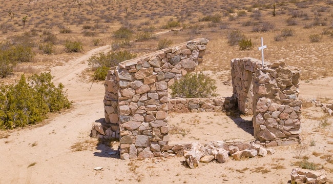
165 E Avenue I, Lancaster, CA 93535

Property Detail
165 E Avenue I
Los Angeles-Long Beach-Glendale, CA
LOT COM AT INTERSECTION OF W LINE OF SEC15 T 7N R 9W WITH N LINE OF S 1/2 OF NW 1/4 OF SD SEC TH E TO W LINE OF 175TH STE TH S TO S LINE OF SD S 1/2 OF NW 1/4 SEE ASSESSOR MAPBOOK FOR MISSING PORTIONTO BEG PART OF SEC 15 T 7N R 9W
3358-014-007
LOS ANGELES
Desertorbarrenland
California
LCA11*
15
B and X Area of moderate flood hazard, usually the area between the limits of the 100-year and 500-year floods.
39.08 AC
2024
NE LA County Outlying
2025
Los Angeles
900508
NEARBY LISTINGS FOR SALE OR LEASE
-
-
No Photo
-
View all Lancaster listings for sale on LoopNet.com
DEMOGRAPHICS near 165 E Avenue I
1 mile
3 mile
5 mile
2025 Total Population
14
313
3,202
2030 Population
14
327
3,199
Pop Growth 2025-2030
0.00%
+ 4.47%
(0.09%)
Average Age
40
43
38
2025 Total Households
5
116
930
HH Growth 2025-2030
0.00%
+ 4.31%
0.00%
Median Household Inc
$47,500
$44,999
$58,999
Avg Household Size
1.80
2.60
3.20
2025 Avg HH Vehicles
2.00
2.00
2.00
Median Home Value
$150,000
$231,818
$268,076
Median Year Built
1964
1964
1979
Nearby Places
Map Layers
Map Styles
 Street
 Aerial
Transit
 Traffic
 Biking
Places
Listings with unknown addresses are not visible on the map
- Restaurants
- Banks
- Shops
- Fitness
- Groceries
SALE & LEASE HISTORY
LISTING DATE
SALE/LEASE

Jul 15, 2019
For Sale
Nearby Properties
Address
Land Use
TOTAL SIZE
Lot Size
Zoning
Address
Land Use
TOTAL SIZE
Lot Size
Zoning
1,500 SF
2.47 AC
LCC4-A11*
Address
Land Use
TOTAL SIZE
Lot Size
Zoning
315.50 AC
LCA11*
Address
Land Use
TOTAL SIZE
Lot Size
Zoning
10.20 AC
LCA11*
Address
Land Use
TOTAL SIZE
Lot Size
Zoning
82.22 AC
LCA11*
Address
Land Use
TOTAL SIZE
Lot Size
Zoning
81.88 AC
LCA11*
Address
Land Use
TOTAL SIZE
Lot Size
Zoning
80.10 AC
LCA11*
Address
Land Use
TOTAL SIZE
Lot Size
Zoning
80.07 AC
LCA11*
Address
Land Use
TOTAL SIZE
Lot Size
Zoning
159.31 AC
LCA21*
Address
Land Use
TOTAL SIZE
Lot Size
Zoning
40.74 AC
LCA11*
Address
Land Use
TOTAL SIZE
Lot Size
Zoning
161.19 AC
LCA11*
Address
Land Use
TOTAL SIZE
Lot Size
Zoning
41.43 AC
LCA21-A11*
Address
Land Use
TOTAL SIZE
Lot Size
Zoning
76.97 AC
LCA21*
Address
Land Use
TOTAL SIZE
Lot Size
Zoning
152.64 AC
LCA11*
Address
Land Use
TOTAL SIZE
Lot Size
Zoning
39.85 AC
LCA11*
Address
Land Use
TOTAL SIZE
Lot Size
Zoning
528 SF
82.45 AC
LCA11*
Address
Land Use
TOTAL SIZE
Lot Size
Zoning
158.33 AC
LCA11-RR1*
Address
Land Use
TOTAL SIZE
Lot Size
Zoning
4.76 AC
LCA21
Address
Land Use
TOTAL SIZE
Lot Size
Zoning
21.26 AC
LCA11*
Address
Land Use
TOTAL SIZE
Lot Size
Zoning
10.01 AC
LCA2
Address
Land Use
TOTAL SIZE
Lot Size
Zoning
10.07 AC
LCA11*
Address
Land Use
TOTAL SIZE
Lot Size
Zoning
79.56 AC
LCA11*
Address
Land Use
TOTAL SIZE
Lot Size
Zoning
40.43 AC
LCA21*
Address
Land Use
TOTAL SIZE
Lot Size
Zoning
20.79 AC
LCA11*
Address
Land Use
TOTAL SIZE
Lot Size
Zoning
39.83 AC
LCA21-A11*
Address
Land Use
TOTAL SIZE
Lot Size
Zoning
20.93 AC
LCA11*
Address
Land Use
TOTAL SIZE
Lot Size
Zoning
20.92 AC
LCA11*
Address
Land Use
TOTAL SIZE
Lot Size
Zoning
20.13 AC
LCA11*
Address
Land Use
TOTAL SIZE
Lot Size
Zoning
2.51 AC
LCA11*
Address
Land Use
TOTAL SIZE
Lot Size
Zoning
2.60 AC
LCA21*
Address
Land Use
TOTAL SIZE
Lot Size
Zoning
41.11 AC
LCA121/2*
The World's #1 Commercial Real Estate Marketplace
Connect with us
© 2026 CoStar Group
The information above has been obtained from sources believed reliable. While we do not doubt its accuracy we have not verified it and make no guarantee, warranty or representation about it. It is your responsibility to independently confirm its accuracy and completeness. Any projections, opinions, assumptions, or estimates used are for example only and do not represent the current or future performance of the property. The value of this transaction to you depends on tax and other factors which should be evaluated by your tax, financial, and legal advisors. You and your advisors should conduct a careful, independent investigation of the property to determine to your satisfaction the suitability of the property for your needs.