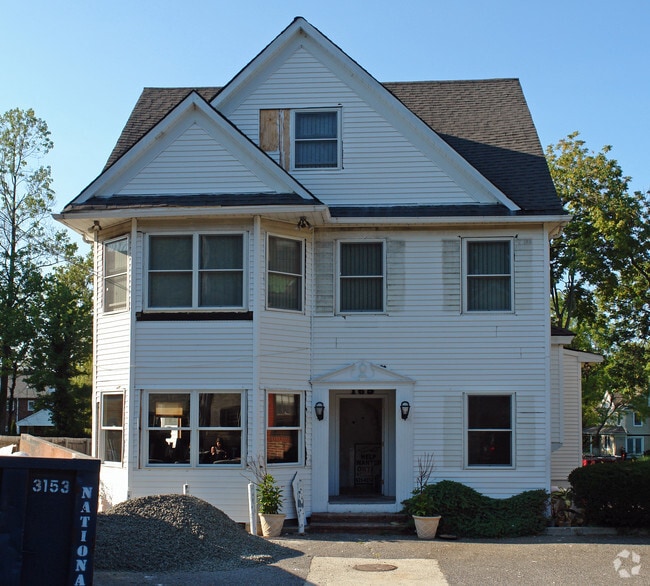
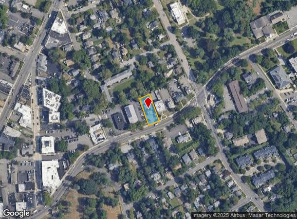
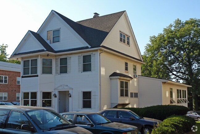
Property Record
165 Main St, Huntington, NY 11743
NEARBY LISTINGS FOR SALE OR LEASE
Property Detail
165 Main St
Nassau County-Suffolk County, NY
49 Lots Of Estates Of Ezra Pr
0400-072-00-03-00-028-000
BLK LOT 27
Commercialnec
Suffolk
X
New York
36103C0610H
28
2024
0.28 AC
2024
Western Suffolk
110300
Long Island (New York)
DEMOGRAPHICS near 165 Main St
1 Mile
3 Mile
5 Mile
2024 Total Population
10,872
63,936
130,836
2029 Population
10,674
62,567
128,193
Pop Growth 2024-2029
(1.82%)
(2.14%)
(2.02%)
Average Age
45
42
42
2024 Total Households
4,633
21,670
44,395
HH Growth 2024-2029
(2.14%)
(2.27%)
(2.21%)
Median Household Inc
$128,084
$137,243
$146,239
Avg Household Size
2.30
2.80
2.80
2024 Avg HH Vehicles
2.00
2.00
2.00
Median Home Value
$730,100
$697,454
$710,806
Median Year Built
1954
1957
1959
Nearby Places
- Restaurants
- Banks
- Shops
- Fitness
- Groceries
PUBLIC TRANSPORTATION
COMMUTER RAIL
Huntington Station (Port Jefferson Branch - Long Island Rail Road)
DRIVE
WALK
Distance
Huntington Station (Port Jefferson Branch - Long Island Rail Road)
5 min
1.8 mi
Cold Spring Harbor Station (Port Jefferson Branch - Long Island Rail Road)
DRIVE
WALK
Distance
Cold Spring Harbor Station (Port Jefferson Branch - Long Island Rail Road)
8 min
4.1 mi
AIRPORT
Long Island MacArthur
DRIVE
WALK
Distance
Long Island MacArthur
36 min
20.2 mi
John F Kennedy International
DRIVE
WALK
Distance
John F Kennedy International
49 min
31.2 mi
Westchester County
DRIVE
WALK
Distance
Westchester County
76 min
48.3 mi
Freight Ports
NY - Red Hook Container Terminal
DRIVE
WALK
Distance
NY - Red Hook Container Terminal
57 min
37.5 mi
Nearby Properties
Address
Land Use
TOTAL SIZE
Lot Size
Zoning
Address
Land Use
TOTAL SIZE
Lot Size
Zoning
42.21 AC
CA
Address
Land Use
TOTAL SIZE
Lot Size
Zoning
0.80 AC
CR60
Address
Land Use
TOTAL SIZE
Lot Size
Zoning
0.06 AC
VILLA
Address
Land Use
TOTAL SIZE
Lot Size
Zoning
0.06 AC
VILLA
Address
Land Use
TOTAL SIZE
Lot Size
Zoning
441,456 SF
47.92 AC
Address
Land Use
TOTAL SIZE
Lot Size
Zoning
0.02 AC
VILLA
Address
Land Use
TOTAL SIZE
Lot Size
Zoning
0.04 AC
VILLA
Address
Land Use
TOTAL SIZE
Lot Size
Zoning
0.05 AC
VILLA
Address
Land Use
TOTAL SIZE
Lot Size
Zoning
0.05 AC
VILLA
Address
Land Use
TOTAL SIZE
Lot Size
Zoning
0.05 AC
VILLA
Address
Land Use
TOTAL SIZE
Lot Size
Zoning
0.05 AC
VILLA
Address
Land Use
TOTAL SIZE
Lot Size
Zoning
0.03 AC
VILLA
Address
Land Use
TOTAL SIZE
Lot Size
Zoning
0.04 AC
VILLA
Address
Land Use
TOTAL SIZE
Lot Size
Zoning
0.04 AC
VILLA
Address
Land Use
TOTAL SIZE
Lot Size
Zoning
0.03 AC
VILLA
Address
Land Use
TOTAL SIZE
Lot Size
Zoning
0.02 AC
VILLA
Address
Land Use
TOTAL SIZE
Lot Size
Zoning
0.04 AC
VILLA
Address
Land Use
TOTAL SIZE
Lot Size
Zoning
0.04 AC
VILLA
Address
Land Use
TOTAL SIZE
Lot Size
Zoning
0.04 AC
VILLA
Address
Land Use
TOTAL SIZE
Lot Size
Zoning
0.04 AC
VILLA
Address
Land Use
TOTAL SIZE
Lot Size
Zoning
1 AC
VILLA
Address
Land Use
TOTAL SIZE
Lot Size
Zoning
1.50 AC
R40
Address
Land Use
TOTAL SIZE
Lot Size
Zoning
11.85 AC
RMS
Address
Land Use
TOTAL SIZE
Lot Size
Zoning
0.04 AC
VILLA
Address
Land Use
TOTAL SIZE
Lot Size
Zoning
2.60 AC
R80
Address
Land Use
TOTAL SIZE
Lot Size
Zoning
0.23 AC
VILLA
Address
Land Use
TOTAL SIZE
Lot Size
Zoning
0.03 AC
VILLA
Address
Land Use
TOTAL SIZE
Lot Size
Zoning
0.03 AC
VILLA
Address
Land Use
TOTAL SIZE
Lot Size
Zoning
0.03 AC
VILLA
Address
Land Use
TOTAL SIZE
Lot Size
Zoning
2,214 SF
0.57 AC
R20
The World's #1 Commercial Real Estate Marketplace
Connect with us
© 2025 CoStar Group
The information above has been obtained from sources believed reliable. While we do not doubt its accuracy we have not verified it and make no guarantee, warranty or representation about it. It is your responsibility to independently confirm its accuracy and completeness. Any projections, opinions, assumptions, or estimates used are for example only and do not represent the current or future performance of the property. The value of this transaction to you depends on tax and other factors which should be evaluated by your tax, financial, and legal advisors. You and your advisors should conduct a careful, independent investigation of the property to determine to your satisfaction the suitability of the property for your needs.